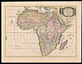
Category:1726 maps of Africa
Jump to navigation
Jump to search
Temperate regions: North America · South America · Africa · Europe · Asia · – Polar regions: – Other regions:
| ← 1720 1721 1722 1723 1725 1726 1727 1728 1729 → |
Subcategories
This category has only the following subcategory.
Media in category "1726 maps of Africa"
The following 9 files are in this category, out of 9 total.
-
 1726 Valentijn Map of the Cape of Good Hope.jpg 7,087 × 5,725; 39.46 MB
-

-

-
 AMH-7272-KB Two maps of the Cape of Good Hope.jpg 2,400 × 1,913; 984 KB
-
 AMH-7276-KB Map of the island of Anjouan.jpg 1,496 × 2,400; 774 KB
-
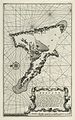
 AMH-7277-KB The river of Maningaar on Madagascar.jpg 2,400 × 1,849; 830 KB
-

-

-
 Nicolas Sanson, Africa Vetus (FL35470161 2497122).jpg 15,024 × 11,710; 236.93 MB


_Les_Forces_de_l%27Europe,_Asie,_Afrique_et_Amerique_Comme_aussi_les_Cartes_des_C%C3%B4tes_de_France_et_d%27Espagne_(seri,_RP-P-OB-83.036-246.jpg)
.jpg)