Category:16th-century maps of Virginia
Jump to navigation
Jump to search
States of the United States: Alaska · California · Florida · Georgia · Massachusetts · New York · North Carolina · South Carolina · Virginia
Puerto Rico
Puerto Rico
Media in category "16th-century maps of Virginia"
The following 11 files are in this category, out of 11 total.
-
 Americae pars Nunc Virginia.jpg 5,120 × 3,712; 3.54 MB
-
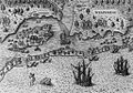
 Towns of the tribe of the Chesapeake.jpg 1,169 × 1,003; 202 KB
-
 Bodleian Libraries, John White, Americae pars, Nunc Virginia dicta.jpg 1,000 × 675; 176 KB
-

-

-

-

-

-
 Map of Virginia, Theodorus de Bry, 1591.jpg 1,878 × 1,379; 1.26 MB
-
 The Carte of all the Coast of Virginia by Theodor de Bry 1585 1586.jpg 1,000 × 739; 247 KB
-
 The Englishmen's arrival in Virginia (1590).jpg 1,017 × 708; 314 KB


_-_autore_Ioanne_With_;_sculptore_Theodore_de_Br%C3%BF_qui_et_excud_LCCN2001696975.jpg)
.jpg)


.jpg)