Category:16th-century maps of Scotland
Jump to navigation
Jump to search
Constituent countries of the United Kingdom: England · Scotland · Wales – British Crown dependencies: Isle of Man
British overseas territories: Bermuda
British overseas territories: Bermuda
Subcategories
This category has the following 3 subcategories, out of 3 total.
1
- 1590s maps of Scotland (6 F)
M
Media in category "16th-century maps of Scotland"
The following 12 files are in this category, out of 12 total.
-
 Scotiae Tabula - btv1b530567745 (1 of 2).jpg 5,912 × 4,616; 5.25 MB
-

-
 Saxton's atlas of England - btv1b55007148q (119 of 131).jpg 7,540 × 5,615; 5.15 MB
-
 Braun & Hogenberg, Edenburgum, Scotiae Metropolis c.1581.jpg 1,018 × 763; 415 KB
-
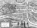 Edinburgh Civitates Orbis Terrarum.jpg 983 × 746; 177 KB
-
 Battle of Pinkie sketch, 1547.jpg 774 × 1,273; 414 KB
-
 Edinburgh Siege 1573.jpg 867 × 941; 240 KB
-
 Map of Scotland from De Origine Moribus, et Rebus Gestis Scotorum 1578.JPG 2,000 × 1,426; 1.06 MB
-
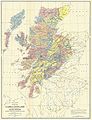 Map of the clans of Scotland (1899, third edition).jpg 3,505 × 4,568; 5.68 MB
-
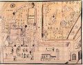
 Sketch showing the site of the future University of Edinburgh Wellcome M0012086.jpg 4,262 × 2,582; 5.27 MB
-
 Stuart-Henry-Kirk-Fields.jpg 708 × 547; 93 KB
-
 UBBasel Map 1570-1590 Kartenslg Mappe 238-45 Hebride Orcade.tiff 4,320 × 1,959, 2 pages; 24.24 MB
.jpg)
.jpg)
.jpg)


.jpg)

