Category:16th-century maps of Istanbul
Jump to navigation
Jump to search
Most populous urban areas of the world: Istanbul [TR] · London [GB] · Mexico City [MX] · Moscow [RU] · Paris [FR]

Subcategories
This category has the following 2 subcategories, out of 2 total.
- 1570s maps of Istanbul (15 F)
1
Media in category "16th-century maps of Istanbul"
The following 15 files are in this category, out of 15 total.
-
 Detail from Map of Constantinople by Piri Reis.jpg 306 × 391; 73 KB
-
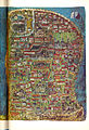
 Istanbul in the 16th century - right.jpg 2,082 × 3,088; 8.98 MB
-
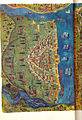
 Istanbul in the 16th century - left.jpg 2,016 × 3,158; 6.7 MB
-
 Turkish-map-of-Constantinople,-1526.png 535 × 648; 56 KB
-
 Istanbul in 1535-a.jpg 2,344 × 3,431; 7.88 MB
-
 Istanbul in 1535-b.jpg 2,395 × 3,508; 7.69 MB
-
 Constantinopolitanae urbis effigies, quam hodie sub Turcae inhabitatione habet.jpg 4,881 × 3,641; 6.38 MB
-
 Constantinopeitanael urbis effigies, quam Hodie sub Turcae inhabitantione habet.jpg 9,530 × 6,747; 19.37 MB
-
 Constantinople.jpg 1,010 × 728; 183 KB
-
 Map of Istanbul, Hunername-I.png 1,870 × 1,438; 5.79 MB
-
 Constantinople (1590).jpg 800 × 600; 165 KB
-
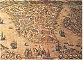
 Constantinopoli - Rosaccio Giuseppe - 1598.jpg 1,500 × 850; 940 KB
-
 16th-century view of Constantinople.png 5,935 × 3,305; 47.03 MB
-
 Anonymous, undated illustration of Constantinople.jpg 2,949 × 2,511; 1.8 MB
-
 Piri Reis - Map of the City of Constantinople - Walters W658370B - Full Page.jpg 1,235 × 1,800; 2.62 MB


.jpg)


