Category:1689 maps
Jump to navigation
Jump to search
| ← · 1680 · 1681 · 1682 · 1683 · 1684 · 1685 · 1686 · 1687 · 1688 · 1689 · → |
Deutsch: Karten mit Bezug zum Jahr 1689
English: Maps related to the year 1689
Español: Mapas relativos al año 1689
Français : Cartes concernant l’an 1689
Русский: Карты 1689 года
Subcategories
This category has the following 5 subcategories, out of 5 total.
Media in category "1689 maps"
The following 32 files are in this category, out of 32 total.
-

-
 A new chart off the Bahama islands and the Windward passage - btv1b5970856q.jpg 6,480 × 5,072; 4.52 MB
-

-
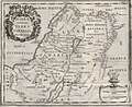 Bernard Lamy, Iudaeae et totius Terrae Israelis Nova descriptio (FL45612489 3958500).jpg 2,819 × 2,305; 1.74 MB
-
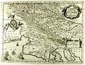
 Carniolia Karstia Histria et Windorum Marchia 1689 (alt).jpg 4,704 × 3,623; 8.39 MB
-
 Carniolia Karstia Histria et Windorum Marchia 1689 II.jpg 2,068 × 1,588; 824 KB
-
 Carniolia Karstia Histria et Windorum Marchia 1689.jpg 4,704 × 3,623; 3.97 MB
-
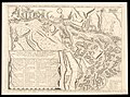
 Chateau du Taureau plan.jpg 312 × 219; 23 KB
-

-

-
 Heilbronn mit Böckingen Feldlagers bey Böckingen 1689.jpg 2,071 × 1,158; 636 KB
-
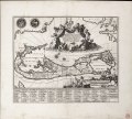
 Joan Blaeu, Persia sive Sophorum Regnum (FL39695810 2518838).jpg 16,114 × 13,874; 291.32 MB
-
 Luxembourg françois 1689.jpg 2,828 × 1,523; 1.75 MB
-
 Mappa Aestivarum Insularum, alias Barmudas dictarum RMG F0405.tiff 6,382 × 5,774; 105.43 MB
-
 Olfert Dapper, De Olyf Bergh en Dal Iosaphat (FL163876615 2370290).jpg 6,308 × 5,416; 36.61 MB
-

-
 Olfert Dapper, Rama (FL147392319 2369758).jpg 3,983 × 3,250; 14.64 MB
-
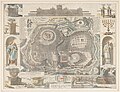
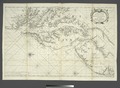
 Quebec 1689 - Villeneuve.jpg 1,968 × 2,456; 931 KB
-
 Richard Blome Ierusalem 1689 colorized.jpg 5,098 × 3,918; 2.96 MB
-
 Richard Blome, Ierusalem (FL6878606 2367962).jpg 2,850 × 2,162; 3.71 MB
-

-

-
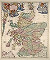 Scotland 1689 map by Nicolaes Visscher II.jpg 5,504 × 6,536; 10.93 MB
-

-

-
 Van Keulen-Nieuwe Pascaert van Oost Indien-1680-1735-2 detail Mascareignes.png 1,095 × 781; 164 KB
-
 Van Keulen-Nieuwe Pascaert van Oost Indien-1680-1735-2.png 4,769 × 4,162; 3.48 MB
-
 Vincenzo Coronelli, Isola Di Malta, olim Melita (FL13730023 2564683).jpg 10,731 × 8,153; 128.66 MB
-
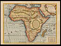 Vincenzo Coronelli, L'Afrique selon les relations les plus nouvelles (FL35470143 2496864).jpg 16,125 × 12,213; 270.61 MB
-
 Vincenzo Coronelli, Territorio di Naiasel, e gran Comora (FL39696863 3705701).jpg 16,088 × 11,928; 263.04 MB
-
 Virginia, Maryland, Pennsilvania, east and west New Jarsey. NYPL484186.tiff 5,120 × 3,754; 55 MB
-
 World Map 1689 (Aquita).JPG 238 × 150; 20 KB

.jpg)
.jpg)
.jpg)


.jpg)
_ei_undique_praetensas_accurate_divisa_(8643653024).jpg)

.jpg)

.jpg)
.jpg)
.jpg)


.jpg)
.jpg)
.jpg)

.jpg)
.jpg)


.jpg)
.jpg)
.jpg)
.JPG)