Category:1680s maps
Jump to navigation
Jump to search
| 17th-century maps: ← 1600s 1610s 1620s 1630s 1640s 1650s 1660s 1670s 1680s 1690s → |
Not to be confused with maps depicting the 1680s.
Subcategories
This category has the following 19 subcategories, out of 19 total.
Media in category "1680s maps"
The following 9 files are in this category, out of 9 total.
-
A new mapp of England Scotland and Ireland (8642553813).jpg 800 × 661; 172 KB
-
Allard, Carel (1648-1709), Afb KOKA00088000001.jpg 7,315 × 6,224; 6.09 MB
-
Allard, Carel (1648-1709), Afb KOKA00091000001.jpg 7,155 × 6,096; 6.63 MB
-
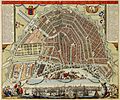
Amsterdam1688.jpg 5,500 × 4,589; 5.94 MB
-
Amsterdam1688.png 5,370 × 4,507; 44.83 MB
-
Ierusalem (FL184620795 2367963).jpg 4,718 × 3,642; 20.49 MB
-
Jakob Koppmayer, Neuhausel (FL167448373 2369950).jpg 8,196 × 5,954; 57.25 MB
-
Polus Antarcticus Terra Australis Incognita (15188866396).jpg 4,961 × 4,268; 2.89 MB
-
Trondheim Cicignons plan 1681.jpg 7,400 × 5,744; 6.46 MB


