Category:1560s maps of the Americas
Jump to navigation
Jump to search
Subcategories
This category has the following 3 subcategories, out of 3 total.
N
S
Media in category "1560s maps of the Americas"
The following 10 files are in this category, out of 10 total.
-
Terra Nova by Girolamo Ruscelli.JPG 775 × 603; 157 KB
-
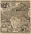
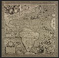
1562 Americæ Gutiérrez.JPG 10,490 × 11,500; 91.89 MB
-
Americae sive qvartae orbis partis nova et exactissima descriptio LOC map49000970.jpg 10,492 × 11,908; 28.32 MB
-
Americae sive qvartae orbis partis nova et exactissima descriptio LOC map49000970.tif 10,492 × 11,908; 357.45 MB
-
French Florida 1562.gif 619 × 900; 62 KB
-
Gutierrez Americas-California.jpg 2,623 × 2,977; 9.2 MB
-
Gutiérrez, the Americas, 1562.jpg 5,246 × 5,148; 16.62 MB
-
Map of America by Ramusio.JPG 1,692 × 1,320; 528 KB
-
Universale della nuovamente parte del mondo ritrovata. LOC 84696978.jpg 4,559 × 3,695; 2.35 MB
-
Universale della nuovamente parte del mondo ritrovata. LOC 84696978.tif 4,559 × 3,695; 48.2 MB


