Category:1560s maps of Germany
Jump to navigation
Jump to search
Federal states of Germany:
Subcategories
This category has the following 12 subcategories, out of 12 total.
- 1560 maps of Germany (1 F)
- 1561 maps of Germany (1 F)
- 1565 maps of Germany (empty)
- 1569 maps of Germany (2 F)
B
- 1560s maps of Bavaria (3 F)
H
- 1560s maps of Hesse (4 F)
M
Media in category "1560s maps of Germany"
The following 7 files are in this category, out of 7 total.
-

-
 Handskizze der Grenze zwischen Schotten und Burkhards.jpg 5,320 × 3,949; 11.86 MB
-
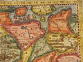 Tavola Nuova di Germania (Germany) northeast.jpg 800 × 600; 160 KB
-
 Tavola Nuova di Germania (Germany) northwest.jpg 800 × 600; 153 KB
-
 Tavola Nuova di Germania (Germany) southeast.jpg 800 × 600; 155 KB
-
 Tavola Nuova di Germania (Germany) southwest.jpg 800 × 600; 151 KB
-
 Tavola Nuova di Germania (Germany).jpg 800 × 600; 147 KB
.jpg)

_northeast.jpg)
_northwest.jpg)
_southeast.jpg)
_southwest.jpg)
.jpg)