Category:1470s maps of Constantinople
Jump to navigation
Jump to search
15th-century maps of Constantinople: ◀ · 1400s · 1410s · 1420s · 1430s · 1440s · 1450s · 1460s · 1470s · 1480s · 1490s · ▶
Media in category "1470s maps of Constantinople"
The following 4 files are in this category, out of 4 total.
-
-

-
 Kastellion, Liber Insularum Archipelag (BNCF).jpg 245 × 390; 66 KB
-
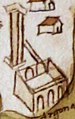
 The Galata Tower in Liber insularum Archipelagi (Florence copy).jpg 177 × 396; 45 KB
_01.jpg)
_02.jpg)
.jpg)
.jpg)