Category:15th-century maps of Constantinople
Jump to navigation
Jump to search
Subcategories
This category has the following 4 subcategories, out of 4 total.
- 1450s maps of Constantinople (1 F)
- 1470s maps of Constantinople (4 F)
- 1480s maps of Constantinople (2 F)
- 1490s maps of Constantinople (5 F)
Media in category "15th-century maps of Constantinople"
The following 13 files are in this category, out of 13 total.
-
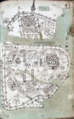 Buondelmonti Bodleian Constantinopolis.png 701 × 1,127; 2.09 MB
-
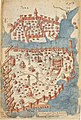
 Constantinople in the 15th century (ver. 1).jpg 1,476 × 1,940; 996 KB
-
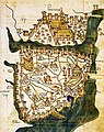
 Constantinople in the 15th century (ver. 2).jpg 1,640 × 2,196; 177 KB
-
 Constantinopolis civitas - Buondelmonti Cristoforo - 1420.jpg 699 × 937; 272 KB
-
 Ensenius Laurenziana Constantinople 1420.jpg 839 × 1,129; 809 KB
-
 Kastellion, Liber Insularum Archipelagi (Bodleian).png 117 × 105; 32 KB
-

-
 Constantinople mediaeval map.jpg 1,054 × 1,562; 792 KB
-
 Kastellion in Liber insularum Archipelagi (420s-1430s).jpg 153 × 137; 11 KB
-
-

-

-
 Bondelmontius Liber insularum constantinople marciana.jpg 561 × 702; 403 KB

.jpg)
.jpg)


.png)

.jpg)
_by_Florentine_cartographer_Cristoforo_Buondelmonte.jpg)


.png)
.jpg)