Wikidata map
Jump to navigation
Jump to search
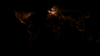
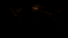
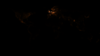
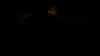
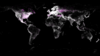
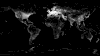
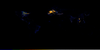
This is a map showing density of Wikidata items.
The Wikidata map has gone through a few generations since it was originally created at the start of Wikidata's life.
You can find the live version here.
This gallery displays the snapshots that have been uploaded to Commons over the years.
Most of the images in this gallery are also in Category:Wikidata_geocoding
Map years
[edit]From the 3rd and current rewrite.
- 100x intensity through the years
-
 2023
2023 -
 2021
2021 -
 2020
2020 -
 2019
2019 -
 2018
2018 -
 2017
2017 -
 2016
2016 -
 2015
2015 -
 2014
2014


- 5x intensity through the years
-
 2023
2023 -
 2021
2021 -
 2020
2020 -
 2019
2019 -
 2018
2018 -
 2017
2017 -
 2016
2016 -
 2015
2015 -
 2014
2014


- 1x intensity through the years
-
 2023
2023 -
 2021
2021 -
 2020
2020 -
 2019
2019 -
 2018
2018 -
 2017
2017 -
 2016
2016 -
 2015
2015 -
 2014
2014


Growth
[edit]Diffs
[edit]- 2021-2023
-
 Intensity 1
 -
 Intensity 5
 -
 Intensity 100


Animations
[edit]- Growth animations
-
 2014-2021 yearly intensity 1
 -
 2014-2021 yearly intensity 5
 -
 2014-2021 yearly intensity 100
 -
 2018-10 to 2019-05
 -
 2013-06 to 2016-10
 -
 2014 to 2017
 -
 2014-10 to 2016-10
 -
 2013-06 to 2013-07


.gif)
.gif)

.gif)
.gif)
Rewrite 2 (2015-2019)
[edit]Date series
[edit]- Huge
-
 September 2019
 -
 May 2019
 -
 October 2018
 -
 March 2018
 -
 November 2017
 -
 July 2017
 -
 October 2016
 -
 April 2016
 -
 October 2016
 -
 June 2015


- Enormous
-
 November 2017
 -
 July 2017
 -
 October 2016
 -
 April 2016
 -
 October 2016
 -
 June 2015


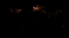
Some other sizes exist in the category.
Comparisons & Highlights
[edit]- Highlights
-
 India October 2018 to May 2019
 -
 Mexico June vs October 2015
 -
 South Burma June vs October 2015
 -
 Bermuda June 2015
 -
 Carpathian Mountains June 2015
 -
 Saint Petersburg & Moscow June 2015


- Date comparisons
-
 October 2018 to May 2019
 -
 March 2018 to October 2018
 -
 November 2017 to March 2018 (faded)
 -
 July 2017 to November 2017
 -
 Oct 2016 to July 2017
 -
 April 2016 to Oct 2016
 -
 Oct 2015 to April 2016


.png)


Markus originals (2015)
[edit]Generated in 2015 showing items with a sitelink from the specified wiki and with a coordinate
- Wiki items
-
 arwiki
 -
 cawiki
 -
 commonswiki
 -
 dewiki
 -
 enwiki
 -
 eswiki
 -
 fawiki
 -
 frwiki
 -
 itwiki
 -
 jawiki
 -
 mswiki
 -
 nlwiki
 -
 plwiki
 -
 ptwiki
 -
 rowiki
 -
 ruwiki
 -
 shwiki
 -
 srwiki
 -
 svwiki
 -
 ukwiki
 -
 viwiki
 -
 vowiki
 -
 warwiki
 -
 zhwiki


Denny original (2013)
[edit]- Maps
-
 2013-12-01
 -

-

-

-

-

-

-

-

-

-

-


.JPG)
.JPG)
.JPG)
.JPG)
.JPG)
.JPG)
.JPG)