User:WikiAnika/Mühlen/SN/BZ GR
< User:WikiAnika | Mühlen
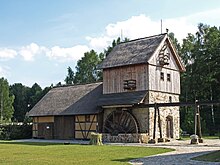
Fehrmann-Mühle Coblenz
[edit]| Object location | | View all coordinates using: OpenStreetMap |
|---|

Coblenz 1a, 02633 Göda
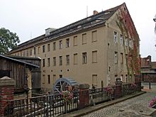
Neumühle Herrnhut-Rennersdorf
[edit]| Object location | | View all coordinates using: OpenStreetMap |
|---|

Am Eichler 3, 02747 Herrnhut, OT Rennersdorf
Handwerk- und Gewerbe Museum (Bret-Mühle) Krauschwitz/Sagar
[edit]| Object location | | View all coordinates using: OpenStreetMap |
|---|

Skerbersdorfer Strasse 68, 02957 Krauschwitz, OT Sagar
Pink-Mühle Großdöbschütz
[edit]| Object location | | View all coordinates using: OpenStreetMap |
|---|

Dorfstr. 5, 02692 Obergurig, OT Großdöbschütz
Krabat-Mühle Schwarzkollm
[edit]| Object location | | View all coordinates using: OpenStreetMap |
|---|

KRABAT-Mühle Schwarzkollm e.V. Koselbruch 22, 02977 Hoyerswerda, OT Schwarzkollm
Sägemühle Grüngräbchen
[edit]| Object location | | View all coordinates using: OpenStreetMap |
|---|
Am Mühlgraben 8, 01936 Schwepnitz, Ortsteil Grüngräbchen
Bachmann-Windmühle Sohland
[edit]| Object location | | View all coordinates using: OpenStreetMap |
|---|

Paulsdorfer-Str. 169, 02894 Sohland a.R.
Schloßmühle Radeberg
[edit]| Object location | | View all coordinates using: OpenStreetMap |
|---|

Schloßstr. 8, 01454 Radeberg
Bockwindmühle Dörgenhausen
[edit]| Object location | | View all coordinates using: OpenStreetMap |
|---|

An der Windmühle 26, 02977 Hoyerswerda, OT Dörgenhausen
Niedermühle Lawalde
[edit]| Object location | | View all coordinates using: OpenStreetMap |
|---|

Mühlweg 6, 02708 Lawalde
Bockwindmühle Kottmarsdorf
[edit]| Object location | | View all coordinates using: OpenStreetMap |
|---|

Obercunnersdorfer Str. 4, 02708 Kottmar, OT Kottmarsdorf
Birkmühle Oberoderwitz
[edit]| Object location | | View all coordinates using: OpenStreetMap |
|---|

Birkmühlstr. 12, 02791 Oderwitz, OT Oberoderwitz
Neumann-Mühle Oberoderwitz
[edit]| Object location | | View all coordinates using: OpenStreetMap |
|---|

Langer Garten 13, 02791 Oderwitz, OT Oberoderwitz
Berthold-Mühle Oberoderwitz
[edit]| Object location | | View all coordinates using: OpenStreetMap |
|---|

Dorfstr. 25, 02791 Oderwitz, OT Oberoderwitz
Kunstmühle Ludwigsdorf
[edit]| Object location | | View all coordinates using: OpenStreetMap |
|---|

Neißetalstr. 33, 02828 Görlitz, OT Ludwigsdorf
