User:Mjrmtg/Georgia Cook County gallery
Jump to navigation
Jump to search

Cook County, Georgia[edit]
-
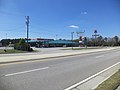
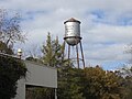
 Adel Water Tower
 -
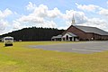
 Antioch United Methodist Church
 -
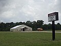
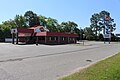
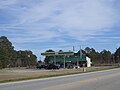
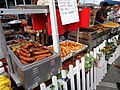
 Catfish House
 -
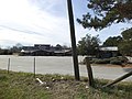
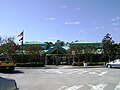
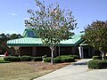
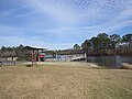
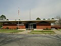
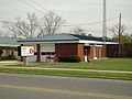
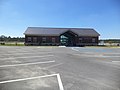
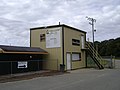
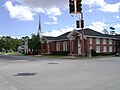
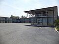
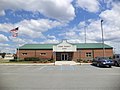 Cook County E-911 Center
 -

-
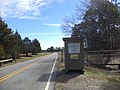
 Cook County limit (with Lowndes County), US41NB
 -
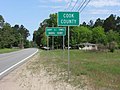
 Cook Co marker (with Lowndes County), US41SB
 -
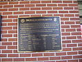
 Cook County Emergency 911 Facility Plaque
 -
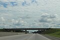
 Cook County Forestry Commission Tower from I75 Exit 37
 -
 Cook County Forestry Commission Tower from MJ Taylor Rd
 -
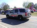
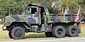
 Cook County Sheriff car
 -
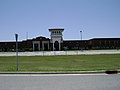 Cook High School
 -
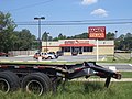
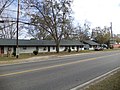
 Economy Inn, Barneyville Rd, Exit 45 area
 -
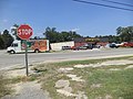
 Fellowship Baptist Church (east of Cecil)
 -
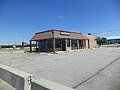
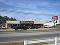
 Former BP gas station, northside of Barneyville Rd, Exit 45 area
 -
 Former gas station, southside of Barneyville Rd, Exit 45 area
 -
 God's Way Baptist Church
 -
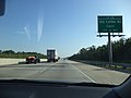
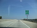
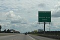
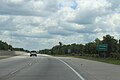
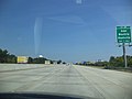
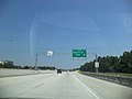
 Georgia I75nb Exit 32
 -
 Georgia I75nb Exit 32 .5 mile
 -
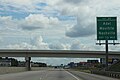
 Georgia I75nb Exit 37 1 mile
 -
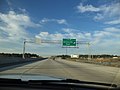
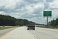
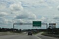
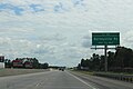
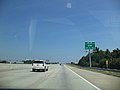
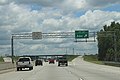
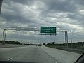
 Georgia I75nb Exit 39
 -
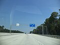
 Georgia I75nb Exit 39 .5 mile
 -
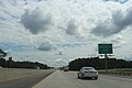
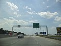
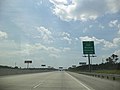
 Georgia I75nb Exit 45
 -
 Georgia I75nb Exit 45 1 mile
 -
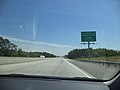
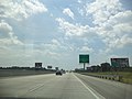
 Georgia I75nb Exit 49 .5 mile
 -
 Georgia I75nb Exit 49 1 mile
 -
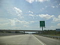
 Georgia I75nb Rest Stop 5 Exit
 -
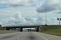 Georgia I75sb 4th St Overpass
 -
 Georgia I75sb Barneyville Rd Overpass
 -
 Georgia I75sb Cook County limit
 -
 Georgia I75sb Darden Rd Overpass
 -
 Georgia I75sb Exit 32 .5 mile
 -
 Georgia I75sb Exit 32 1 mile
 -
 Georgia I75sb exit 39 .5 mile
 -
 Georgia I75sb exit 41
 -
 Georgia I75sb exit 41 .5 mile
 -
 Georgia I75sb exit 41 1 mile
 -
 Georgia I75sb exit 45 .5 mile
 -
 Georgia I75sb Exit 45 .5 mile
 -
 Georgia I75sb exit 45 1 mile
 -
 Georgia I75sb Exit 45
 -
 Georgia I75sb Exit 45
 -
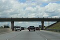
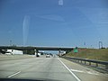
 Georgia I75sb Exit 45 Overpass - Barneyville Rd
 -
 Georgia I75sb Exit 45 1 mile
 -
 Georgia I75sb exit 49
 -
 Georgia I75sb exit 49 .5 mile
 -
 Georgia I75sb Exit 49 .5 mile
 -
 Georgia I75sb exit 49 1 mile
 -
 Georgia I75sb Exit 49 1 mile
 -
 Georgia I75sb Guy Henry Rd Overpass
 -
 Georgia I75Sb Lowndes County line
 -
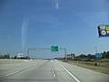
 Georgia I75sb Old Quitman Rd Overpass - Exit 37
 -
 Georgia I75sb Roundtree Bridge Rd Overpass
 -
 Georgia I75sb Rest Stop 6 Exit
 -
 Georgia I75sb Springhill Church Rd Overpass
 -
 Georgia I75sb W Central Ave Overpass
 -
 Horse Creek Winery
 -
 Old Coffee Rd Historical Marker
 -
 I-75 Rest Stop #5
 -
 I-75 Rest Stop #5 Plaque
 -
 Battle of Brushy Creek Historical Marker at Rest Stop #5
 -
 Blue Star Memorial Highway Rest Stop #5
 -
 I-75 Rest Stop #6
 -
 I-75 Rest Stop #6
 -
 Blue Star Memorial Highway Rest Stop #6
 -
 I-75 Rest Stop #6 Memorial Plaque
 -
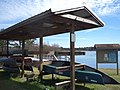
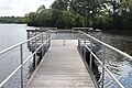
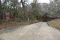
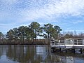
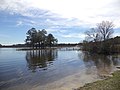
 Little River Boat ramp at SR76 Bridge
 -
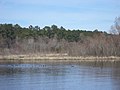
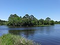
 Little River flowing south from SR76 boat ramp
 -
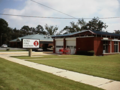
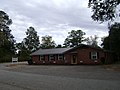
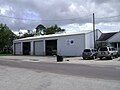
 Pine Valley Volunteer Fire Department
 -
 I-75 Rest Stop #6 Signs
 -
 Salem Methodist Church
 -
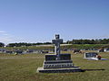
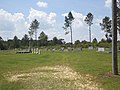 Salem Methodist Church Cemetery (North)
 -
 Salem Methodist Church Cemetery (South)
 -
 Springhead Baptist Church
 -
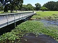
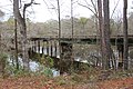
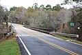
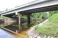 SR76 Bridge over Little River
 -
 SR76 Bridge over Little River
 -
 SR76 Bridge over Little River
 -
 SR76 boat ramp sign
 -
 The Cotton Gin
 -
 The Cotton Gin, Cook County, Rectangular Cotton Bales


,_Cook_County.JPG)
,_Cook_County.JPG)


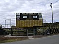
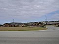
Adel-Cook Sports Complex[edit]
-
 Arch
Arch -
 Drive from GA37
 -
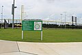 Field 1
 -
 Field 2
 -
 Flagpole
 -
 Parking lot


Cardinal Tract Voluntary Public Access[edit]
-
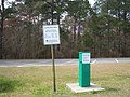
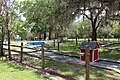
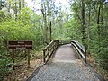
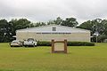
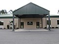
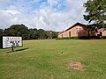
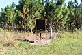 Information Kiosk
 -
 looking east
 -
 looking west


Circlestone Country Club[edit]
-
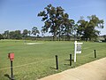
 Driving range
 -
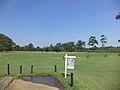
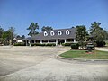
 Entrance
 -
 Golf carts
 -
 Gristmill at Circlestone
 -
 Gristmill restaurant SE corner
 -
 Gristmill restaurant SW corner
 -
 Putting Green at Circlestone Country Club


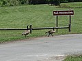
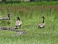
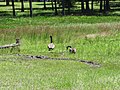
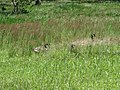
Reed Bingham State Park[edit]
-
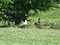
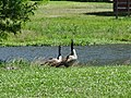
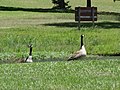
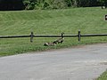 2 Canadian Geese
 -
 2 Canadian Geese
 -
 2 Canadian Geese
 -
 2 Canadian Geese
 -
 2 Canadian Geese
 -
 2 Canadian Geese
 -
 2 Canadian Geese
 -
 2 Canadian Geese
 -
 2 Canadian Geese
 -
 2 Canadian Geese
 -
 2 Canadian Geese
 -
 Azaleas
 -
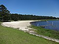 Beach
Beach -
 Beach looking NorthEast
 -
 Beach pavilion
 -
 Beach pavilion and beach
 -
 Beach restrooms
 -
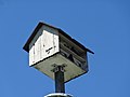 Birdhouse
 -
 Cattails
 -
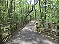
 Cattails and pedestrian bridge to island
 -
 Flowering Bush
 -
 Flowering Bush
 -
 Flowering Bush
 -
 Gopher Tortoise
 -
 Gopher Tortoise
 -
 Gopher Tortoise
 -
 Gopher Tortoise
 -
 Gopher Tortois
 -
 Great Blue Heron
 -
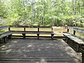
 North side of walk to fishing pier
 -
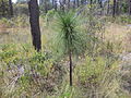 Pinus palustris
 -
 Pinus palustris
 -
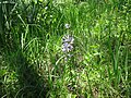 Purple flower
 -
 Purple flowers
 -
 Railroad Trustle
 -
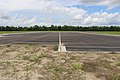
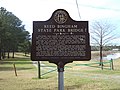
 Reed Bingham marker
 -
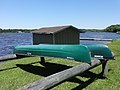
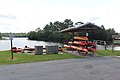
 Reed Bingham State Park canoes
 -
 Reed Bingham State Park Coastal Plains Nature Trail
 -
 Reed Bingham State Park Coastal Plain Natural Trails entrance
 -
 Reed Bingham State Park collection box near beach
 -
 Reed Bingham State Park Colquitt County entrance
 -
 Reed Bingham State Park Colquitt County Toll Gate
 -
 Reed Bingham State Park flagpole near park office
 -
 Reed Bingham State Park gopher tortoise habitat
 -
 Reed Bingham State Park Gopher Tortoise Trail
 -
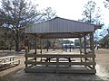
 Reed Bingham State Park group shelter 3
 -
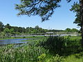
 Reed Bingham Island and bridge
 -
 Reed Bingham State Park kids fishing ponds
 -
 Reed Bingham State Park large shelter
 -
 Reed Bingham State Park miniature golf
 -
 Reed Bingham State Park miniature golf
 -
 Reed Bingham State Park miniature golf
 -
 Reed Bingham State Park miniature golf
 -
 Reed Bingham State Park miniature golf
 -
 Reed Bingham State Park miniature golf
 -
 Reed Bingham State Park miniature golf
 -
 Reed Bingham State Park miniature golf
 -
 Reed Bingham State Park miniature golf
 -
 Reed Bingham State Park miniature golf
 -
 Reed Bingham State Park miniature golf parking area
 -
 Reed Bingham State Park Office
 -
 Reed Bingham State Park palmetto bushes on Gopher Tortoise Trail
 -
 Reed Bingham State Park playground
 -
 Picnic Shelter 2
 -
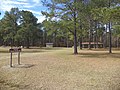 Picnic Shelter 2 from road
 -
 Restrooms north of playground
 -
 Shelter 8 with playground
 -
 South side of walk to fishing pier
 -
 Trail
Trail -
 Two canoes
 -
 Rental Kayaks on west side of Reed Bingham Lake
 -
 Seed pods of wildflowers
 -
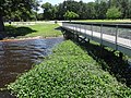
 Water Hyacinth harvester vehicle
 -
 Water lilies
 -
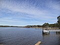
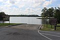 West boat ramp on Reed Bingham Lake
 -
 West Fishing pier on Reed Bingham Lake
 -
 Yellow sweet clover


Little River Trail[edit]
-
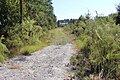
 Little River Trail
 -
 Little River Trail
 -
 Little River Trail
 -
 Little River Trail
 -
 Little River Trail
 -
 Little River Trail
 -
 Little River Trail
 -
 Little River Trail
 -
 Little River Trail
 -
 Little River Trail
 -
 Little River Trail
 -
 Little River Trail snake
 -
 Little River Trail
 -
 Little River Trail
 -
 Little River Trail 16 overlook
 -
 Little River Trail
 -
 Little River Trail
 -
 Little River Trail
 -
 Little River Trail
 -
 Little River Trail
 -
 Little River Trail
 -
 Little River Trail


,_Reed_Bingham_Park.JPG)


Red Roberts Landing[edit]
-
 Coastal Plain Nature Trails
 -
 Collection box and signs
 -
 Entrance to Red Roberts Landing
 -
 Little River boat ramp
 -
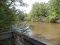
 Little River from Yearling Trail
 -
 Overall view
 -
 Picnic tables
 -
 Red Roberts Loop trail footbridge
 -
 Roundtree bridge over Little River
 -
 Rountree Bridge
 -
 Two trails


Reed Bingham Lake[edit]
-
 beach and lake from parking lot
 -
 beach and lake looking North
 -
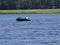 Boat on lake
 -
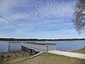
 boat ramp near fishing pier
 -
 Bridge and fishing pier
 -
 bridge to island
 -
 bridge to island
 -
 Bridge and lake
 -
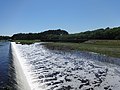
 Dam
Dam -
 East fishing pier
 -
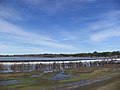
 lake
lake -
 lake
lake -
 lake
lake -
 lake
lake -
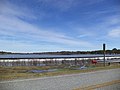
 Lake
Lake -
 Lake
Lake -
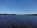 Lake
Lake -
 lake and bridge to island
 -
 lake and fishing pier
 -
 lake and fishing pier
 -
 Lake and island
 -
 Pontoon boat
 -
 fishing pier and canoes
 -
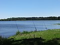 Three fishing poles


Reed Bingham Dam[edit]
-
 dam
dam -
 dam
dam -
 dam
dam -
 dam
dam -
 dam
dam -
Dam
-
 dam and bridge
 -
 Dam and Bridge
 -
 dam marker
 -
 bridge and dam


Reed Bingham State Park Bridge[edit]
-
Bridge and lake
-
Dam and Bridge
-
Dam and Bridge
-
 1973 engraving
 -
 Bridge and Colquitt County border
 -
Bridge and Dam
-
 Bridge Historical Marker
 -
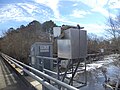 USDA Hydrologic Monitoring Station on bridge


Adel[edit]
-
 4th St, double railroad crossing
 -
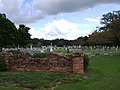
 Adel Cemetery
 -
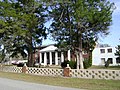
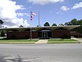 Adel City Hall
 -
 Adel City Hall 2008
 -
 Adel City Hall 2005
 -
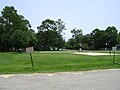
 Adel City Park
 -
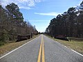
 Adel City Limits, Coxstill Rd WB
 -
 Adel City Limit, GA 37 WB
 -
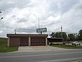
 Adel Fire Station
 -
 Adel Fire Station 2008
 -
 Adel Fire Station 2001
 -
 Adel Fire Station #2
 -
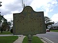 Adel Lime Sink Historical Marker
 -
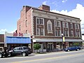
 Adel News Tribune
 -
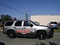
 Adel Police Department
 -
 Adel United Methodist Church
 -
 Adel Welcome Signs, GA 37 WB
 -
 Adel Welcome Sign, GA Hwy 76 from East
 -
 Advance Auto Parts
 -
 BB&T Bank
 -
 Boys & Girls Club, Cook County, Georgia
 -
 Captain D's, Exit 39
 -
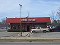 China House
 -
 Circle K
 -
 Citgo, GA 37 E of I-75
 -
 Citgo, GA 37 W of I-75
 -
 Community Christian Academy
 -
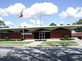
 Cook County Administration Building
 -
 Cook County Airport
 -
 Cook County Board of Education
 -
 Cook County Courthouse 2009
 -
 Cook County Courthouse 2012
 -
 Cook County Courthouse 2001
 -
Cook County E-911 Center
-
Cook County Emergency 911 Facility Plaque
-
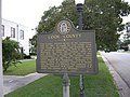 Cook County Historical Marker
 -
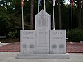
 Veterans Monument at Courthouse
 -
 Veterans Monument Closeup at Courthouse
 -
 Cook County Hornets Baseball-Softball Fields
 -
 Cook County Hornets Baseball Field
 -
 Cook County Hornets Baseball Field Concession Stand
 -
 Cook County Hornets Softball Field
 -
 Cook County Health Department
 -
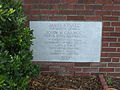
 Cook County Health Department Plaque
 -
 Cook County Library
 -
 Cook County Tax Offices
 -
 Cook Medical Center
 -
 Cook Medical Center
 -
 Christian Fellowship Church
 -
 Dairy Queen
 -
 Dave Godwin Memorial EMS Complex
 -
 Dixie Gas Station
 -
 Delle Beamguard Community Center
 -
 Delle Beamguard Community Center Sign
 -
 Dollar General
 -
 Dollar General, W 4th St.
 -
 El Carrisal
 -
 First Baptist Church
 -
 Former Huddle House, GA 37
 -
 Former Pizza Hut
 -
 Former Pizza Hut (from back)
 -
 Georgia I75nb Exit 37
 -
 Georgia I75nb Exit 37 .5 mile
 -
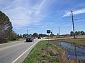
 Georgia I75nb Exit 37 overpass Adel Quitman Rd, Adel city limit
 -
Georgia I75nb Exit 39 .5 mile
-
 Georgia I75nb Exit 39 1 mile
 -
 Georgia I75sb Adel city limit
 -
 Georgia I75sb Exit 37
 -
 Georgia I75sb Exit 37 .5 mile
 -
 Georgia I75sb Exit 37 1 mile
 -
 Georgia I75sb Exit 39 .5 mile
 -
 Georgia I75sb Exit 39
 -
 Georgia I75sb Exit 39 Overpass - GA37
 -
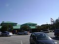
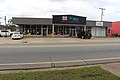
 Harvey's Supermarket
 -
 Remodeled Harvey's Supermarket
 -
 Hayes Express Lube
 -
 Horizon Academy, Cook County
 -
 Horizon Academy, Cook County closeup
 -
 Howard Johnson
 -
 Huddle House
 -
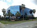 ING Building
 -
 ING Fountain
 -
 Layne's Mexican Grill
 -
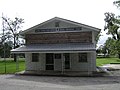
 Masonic Lodge 310.
 -
 McDonald's, GA 37
 -
 Mid Georgia Ambulance
 -
 Norfolk Southern 9853
 -
 One Shop
 -
 O'Reilly Auto Parts
 -
 Piggly Wiggly
 -
 Quick Gas
 -
 Rico's Tacos
 -
 Salem Primitive Baptist Church
 -
 School bus in front of Old Adel Public School
 -
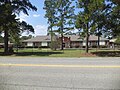
 Southwell Medical Pavilion
 -
 Southwell Medical Hospital
 -
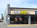 Subway
 -
 Super 8
 -
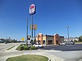 Taco Bell, GA 37
 -
 Telephone Building
 -
 The Citizens Bank
 -
 The Nest Antiques
 -
 USDA Service Center
 -
 UGA Cooperative Extension Side
 -
 USDA Service Center Side
 -
 Waffle House, GA 37
 -
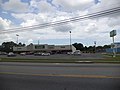
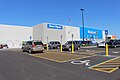
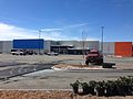
 Adel Wal-Mart (East face)
 -
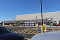
 Adel Wal-Mart (front)
 -
 Adel Wal-Mart garden section
 -
 Wal-mart under construction
 -
 Walgreens Pharmacy
 -
 Wendy's, GA 37
 -
 Western Sizzlin
 -
 Zaxby's


,_Adel.JPG)


.JPG)
.JPG)


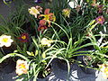
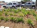
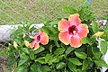
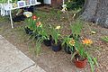
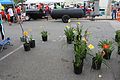
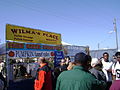
Adel Daylily Festival 2013[edit]
-
 Food Court
 -
 Kids Zone
 -
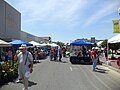 North End
 -
-

-

-
-

-

-
-

-

-

-
-

-

-


Adel Daylily Festival 2016[edit]
-

-

-

-

-

-

-

-

-
-

-
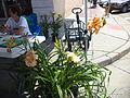
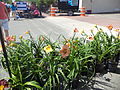
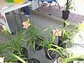
 Daylilies
 -
 Daylilies
 -
 Daylilies
 -
 Kids Zone


Adel Daylily Festival 2022[edit]


SOWEGA Building[edit]
-
 Building Plaque
 -
 East side
 -
 NE corner
 -
 North side
 -
 SE corner


Union Road Veterans' Park[edit]
-
 Union Road Park Veterans Memorial Back
 -
 Union Road Park Veterans Memorial Front
 -
 Union Road Veterans' Park


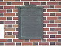
United States Post Office–Adel, Georgia[edit]
-
 Corner stone
 -
 NRHP plaque
 -
 Southeast corner
 -
 Southwest corner


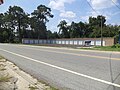
Vietnam traveling memorial wall[edit]


Woodlawn Cemetery[edit]
-
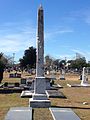 Crosby Obelisk
 -
 Flagpole
 -
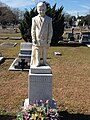 Myron Hinson statue
 -
 Paulk tomb
 -
 sign
sign


Cecil[edit]
-
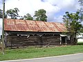 Bray Commissary from east
 -
 Bray Commissary from south
 -
 Former Bray Commissary from east
 -
 Former Bray Commissary from south
 -
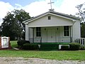 Cecil Baptist Church
 -
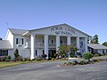
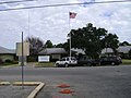
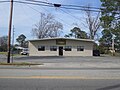
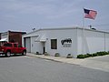
 Cecil City Hall
 -
 Cecil City Hall corner stone
 -
 Cecil City Hall Police Station 2005
 -
 Cecil Fire Department
 -
 Cecil Fire Station 2001
 -
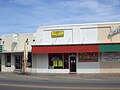
 Cecil Grocery 2014
 -
 Cecil Grocery 2015
 -
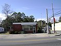
 Cecil Post Office
 -
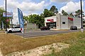
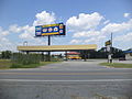
 Chevron Food Store
 -
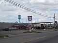
 File:Citgo Blimpie Stuckey's
 -
 Family World Motel
 -
 Family World Motel (West face)
 -
 Family World Motel and Citgo
 -
 Fromer hotel (SE corner)
 -
 Former hotel (SW corner)
 -
 Former King St RR Crossing
 -
 Former truck stop
 -
 Former truck stop closeup
 -
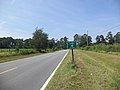
 Georgia I75nb Cecil city limit
 -
 Georgia I75SB Cecil city limit
 -
 Georgia I75sb Exit 32
 -
 Georgia I75sb Old Coffee Rd Overpass - Exit 32


,_Cecil.JPG)

,_Cecil.jpg)
,_Cecil.JPG)


Lenox[edit]
-
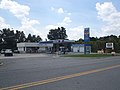
 Dixie Gas station
 -
 Dixie Gas station sign
 -
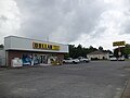
 Dollar General
 -
 Family Dollar Store
 -
 Family Dollar Store with freestanding sign
 -
 Georgia I75nb Exit 49
 -
Georgia I75nb Exit 49 .5 mile
-
 Georgia I75sb Exit 49
 -
 Georgia I75sb Lenox limit
 -
 Knights Inn, Lenox (NW corner)
 -
 Knights Inn, Lenox (West face)
 -
 Lenox Baptist Church
 -
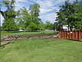
 Lenox Basketball Park
 -
 Lenox Cemetery
 -
 Lenox Church of God
 -
 Lenox City Hall
 -
 Lenox City Hall 2005
 -
 Lenox City Limit, E Central Ave WB
 -
 Lenox Elementary School
 -
 Lenox Fire Department
 -
 Lenox Fire Station 2005
 -
 Lenox Mini Storage Units
 -
 Lenox Park playground
 -
 Lenox Police Department
 -
 Lenox Police Truck
 -
 Lenox Police Truck
 -
 Lenox Post Office
 -
 Lenox Water Tower, Margaret St
 -
 Roby H Robinson Sr Memorial Park
 -
 The Trust Bank, Lenox


.JPG)
.JPG)


Lean-Ox Festival 2012[edit]
-
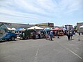
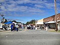
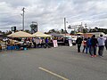
 vendors
 -
 vendors
 -
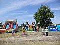
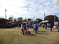
 children's play area
 -
 vendors
 -
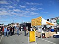
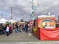
 Information booth
 -
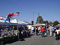 vendors
 -
 vendors
 -
 Clogging at the park
 -
Lenox Police Truc
-
Lenox Police Truck
-
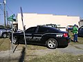 Sparks Police Car


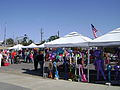
Lean-Ox Festival 2013[edit]
-
 vendors
 -
 singers
 -
 vendors
 -
 children's play area
 -
 vendors
 -
 vendors
 -
 Lean-Ox Festival 2013 Army truck
 -
 Lean-Ox Festival 2013 Army truck (cropped)


.jpg)
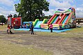
Lean-Ox Festival 2015[edit]
-

-

-
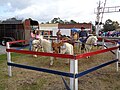 Pony rides
 -
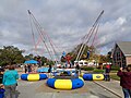 Bungee Trampoline
 -
-
-

-


Sparks[edit]
-
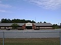
 Cook Elementary School
 -
 Cook Middle School
 -
 Cook County Workforce Development Center (west)
 -
 Cook County Workforce Development Center (south)
 -
 Cornerstone Christian Church
 -
 Former roadside motel on US 41
 -
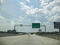
 Georgia I75nb Exit 41
 -
 Georgia I75sb Exit 39 1 mile
 -
 Georgia I75sb Exit 41 Overpass
 -
 Georgia I75sb Exit 41 .5 mile
 -
 Georgia I75sb Exit 41 1 mile
 -
 Georgia I75sb Exit 41
 -
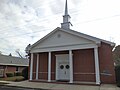 Sparks Baptist Church
 -
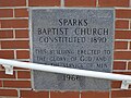 Sparks Baptist Church cornerstone
 -
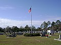 Sparks Cemetery
 -
 Sparks City Hall
 -
 Sparks City Hall 2005
 -
 Sparks City Hall Plaque
 -
 Sparks City Limit Sign
 -
 Sparks Collegiate Institute
 -
 Sparks Collegiate Institute marker
 -
 Sparks Fire Department
 -
 Sparks Fire Department 2005
 -
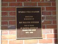 Sparks Fire Station Plaque
 -
Sparks Police Car
-
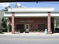
 Sparks Post Office
 -
 Old Sparks Water tower
 -
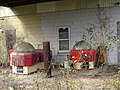 Weathered arcade machines


.JPG)
.JPG)


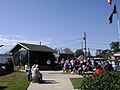
Sparks Cut Off Voluntary Public Access[edit]
-
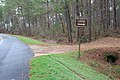
 Information Kiosk
 -
 Looking east
 -
 Looking west


