User:Giftzwerg 88/Fotoprojekt Sulz am Eck
Jump to navigation
Jump to search

| This is a gallery of files created by Giftzwerg 88. |
Dieses ist die Seite von Fotoprojekt Sulz am Eck, einem Teil von Wildbad. Ziel war die Dokumentation des Orts, ein Großteil, aber nicht alle der älteren Gebäude wurden fotografiert.
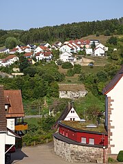
Ortsansicht[edit]
,_Ortsansicht_01.jpg)
,_Ortsansicht_02.jpg)
,_Ortsansicht_03.jpg)
,_Ortsansicht_04.jpg)
,_Ortsansicht_05.jpg)
,_Ortsansicht_06.jpg)
,_Ortsansicht_07.jpg)
,_Ortsansicht_08.jpg)
,_Ortsansicht_09.jpg)
,_Ortsansicht_10.jpg)
,_Ortsansicht_11.jpg)
,_Ortsansicht_12.jpg)
,_Ortsansicht_13.jpg)
,_Ortsansicht_14.jpg)
,_Ortsansicht_15.jpg)
,_Ortsansicht_16.jpg)
,_Ortsansicht_17.jpg)
,_Ortsansicht_18.jpg)
,_Ortsansicht_19.jpg)
,_Ortsansicht_20.jpg)
,_Ortsansicht_21.jpg)
,_Ortsansicht_22.jpg)
,_Ortsansicht_23.jpg)
,_Ortsansicht_24.jpg)
,_Ortsansicht_25.jpg)
,_Ortsansicht_26.jpg)
,_Ortsansicht_27.jpg)
,_Ortsansicht_28.jpg)
,_Ortsansicht_29.jpg)
,_Ortsansicht_30.jpg)
,_Ortsansicht_31.jpg)
,_Ortsansicht_32.jpg)
,_Ortsansicht_33.jpg)
,_Ortsansicht_34.jpg)
,_Ortsansicht_35.jpg)
,_Ortsansicht_36.jpg)
Gebäude[edit]


Gruhe[edit]
| Object location | | View all coordinates using: OpenStreetMap |
|---|


Friedhof[edit]
| Object location | | View all coordinates using: OpenStreetMap |
|---|


Evangelisches Gemeindehaus[edit]
| Object location | | View all coordinates using: OpenStreetMap |
|---|
_01.jpg)
_02.jpg)
_03.jpg)
_04.jpg)
_05.jpg)
_06.jpg)
_07.jpg)
_08.jpg)
_09.jpg)
_10.jpg)
_11.jpg)
_12.jpg)
Kriegsdenkmal[edit]
| Object location | | View all coordinates using: OpenStreetMap |
|---|
,_Kriegsdenkm%C3%A4ler_01.jpg)
,_Kriegsdenkm%C3%A4ler_02.jpg)
,_Kriegsdenkm%C3%A4ler_03.jpg)
,_Kriegsdenkm%C3%A4ler_04.jpg)
,_Kriegsdenkm%C3%A4ler_05.jpg)
,_Kriegsdenkm%C3%A4ler_06.jpg)
,_Kriegsdenkm%C3%A4ler_07.jpg)
,_Kriegsdenkm%C3%A4ler_08.jpg)
,_Kriegsdenkm%C3%A4ler_09.jpg)
,_Kriegsdenkm%C3%A4ler_10.jpg)
,_Kriegsdenkm%C3%A4ler_11.jpg)
,_Kriegsdenkm%C3%A4ler_12.jpg)
,_Kriegsdenkm%C3%A4ler_13.jpg)
,_Kriegsdenkm%C3%A4ler_14.jpg)
Brunnen[edit]


Kirche[edit]
| Object location | | View all coordinates using: OpenStreetMap |
|---|


Sonstiges in Sulz[edit]
-

-
 Tierstein
 -
 Tierstein
 -
 Tierstein
 -
 Tierstein
 -

-

-

-

-

-

-

-

-

-

-

-


Schotterwerk[edit]
| Object location | | View all coordinates using: OpenStreetMap |
|---|


Flugplatz Wächtersberg[edit]
| Object location | | View all coordinates using: OpenStreetMap |
|---|


Ausblick auf Wildberg vom Wächtersberg[edit]
| Camera location | | View all coordinates using: OpenStreetMap |
|---|


Ehemaliges Munitionslager[edit]
| Object location | | View all coordinates using: OpenStreetMap |
|---|


Industriegebiet[edit]
| Object location | | View all coordinates using: OpenStreetMap |
|---|


