From Wikimedia Commons, the free media repository
Jump to navigation
Jump to search
Aufnahmen von der Buchhalde Rommelsbach[edit]
Neckartalviadukt[edit]
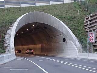
Scheibengipfeltunnel[edit]
Hauptbahnhof Reutlingen[edit]
Postgebäude[edit]
Gebäude und Ansichten[edit]
Rathaus[edit]
Nikolaikirche[edit]
Marienkirche[edit]
Zunftbrunnen[edit]
Gerberbrunnen[edit]
Charlottenstraße[edit]
Gartenstraße[edit]
Matthäus-Beger-Schule[edit]
Stadtgarten[edit]
Echazbahn[edit]
Naturdenkmale[edit]
Kaiserstraße[edit]
Wilhelmstraße[edit]
Aulberstraße[edit]
Burgstraße/Burgplatz[edit]
Landratsamt[edit]
Heimatmuseum und Museumsgarten[edit]
Sonstiges[edit]
St. Wolfgang und St.-Wolfgang-Straße[edit]
Bismarckstraße[edit]
Karlstraße[edit]
Oberamteistraße[edit]
Albstraße[edit]
Arbeitsamt[edit]
Spendhausstraße[edit]
Lederstraße[edit]
Kanzleistraße[edit]
Jos-Weiß-Straße[edit]
Katharinenstraße[edit]
Marktplatz[edit]
Krämerstraße[edit]
Mauerstraße / Zeughausstraße[edit]
Leonhardskirche / Leonhardsplatz[edit]
Finanzamt[edit]
Sankt-Leonhard-Straße[edit]
Urbanstraße[edit]
Metzgerstraße[edit]
Panoramastraße / Sommerhalde[edit]
Seestraße[edit]


