User:Giftzwerg 88/Fotoprojekt Hildrizhausen
Jump to navigation
Jump to search
| This is a gallery of files created by Giftzwerg 88. |
Hölderlinstraße[edit]
Hafner und Wassermädchen[edit]
| Object location | | View all coordinates using: OpenStreetMap |
|---|
Altes Rathaus[edit]
| Object location | | View all coordinates using: OpenStreetMap |
|---|
Gasthaus Krone[edit]
| Object location | | View all coordinates using: OpenStreetMap |
|---|
Pfarrhaus[edit]
| Object location | | View all coordinates using: OpenStreetMap |
|---|
Hölderlinstraße 14[edit]
Hölderlinstraße 17[edit]
Hölderlinstraße 26+28[edit]
Hölderlinstraße 29[edit]
Hölderlinstraße 36[edit]
Hölderlinstraße 39[edit]
Hölderlinstraße 47[edit]
Hölderlinstraße 48[edit]
| Object location | | View all coordinates using: OpenStreetMap |
|---|
Höderlinstraße 50[edit]
Kirchgasse[edit]
Kirchgasse 5[edit]
Kirchgasse 6[edit]
Kirchgasse 7 + 9[edit]
Ehninger Straße[edit]
Ehninger Straße 6[edit]
| Object location | | View all coordinates using: OpenStreetMap |
|---|
Ehninger Straße 14[edit]
Ehninger Straße 15[edit]
| Object location | | View all coordinates using: OpenStreetMap |
|---|
Waaghaus[edit]
| Object location | | View all coordinates using: OpenStreetMap |
|---|
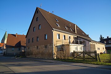
Altes Forsthaus[edit]
| Object location | | View all coordinates using: OpenStreetMap |
|---|
Falkentorstraße 2[edit]
Falkentorstraße 4[edit]
| Object location | | View all coordinates using: OpenStreetMap |
|---|
Falkentorstraße 7[edit]
| Object location | | View all coordinates using: OpenStreetMap |
|---|
Herrenberger Straße[edit]
Rathaus[edit]
| Object location | | View all coordinates using: OpenStreetMap |
|---|
Kreisel[edit]
| Object location | | View all coordinates using: OpenStreetMap |
|---|
Gartenstraße[edit]
Tübinger Straße[edit]
Hundsrückenstraße[edit]
Hundsrückenstraße 14[edit]
Talstraße[edit]
Talstraße 21[edit]
| Object location | | View all coordinates using: OpenStreetMap |
|---|
Haus Jakob Hablizel[edit]
| Object location | | View all coordinates using: OpenStreetMap |
|---|
Obere Mühle II[edit]
| Object location | | View all coordinates using: OpenStreetMap |
|---|
Industriegebiet[edit]
| Object location | | View all coordinates using: OpenStreetMap |
|---|
| Object location | | View all coordinates using: OpenStreetMap |
|---|
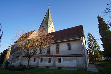
Nikomedeskirche[edit]
| Object location | | View all coordinates using: OpenStreetMap |
|---|
Franziskuskirche[edit]
Neuapostolische Kirche[edit]
Freibad[edit]
| Object location | | View all coordinates using: OpenStreetMap |
|---|
| Object location | | View all coordinates using: OpenStreetMap |
|---|


