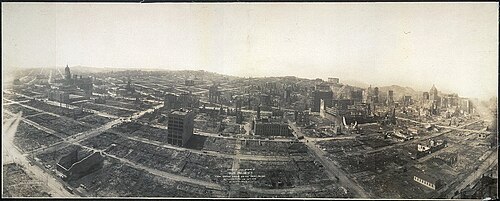
Historic pictures of 1906 San Francisco earthquake
The 1906 San Francisco earthquake was a major earthquake that struck San Francisco and the coast of northern California at 5:12 a.m. on Wednesday, April 18, 1906. The magnitude of the earthquake is estimated by the USGS as a 7.9 moment magnitude (Mw) or 7.7 surface wave magnitude (Ms), or as a 8.3 magnitude on the local (Richter) scale. The main shock epicenter occurred offshore about two miles (three km) from the city. It ruptured along the San Andreas Fault both northward and southward for a total length of 296 miles (477 km). Shaking was felt from Oregon to Los Angeles, and inland as far as central Nevada. The earthquake and resulting fires are remembered as one of the worst natural disasters in the history of the United States.
Documentation[edit]
Additional historic photographs of the aftermath of the earthquake follow.


See also[edit]
- Category:Loma Prieta earthquake for the 1989 earthquake