File:WMM2010 F MERC.pdf
Jump to navigation
Jump to search

Size of this JPG preview of this PDF file: 800 × 533 pixels. Other resolutions: 320 × 213 pixels | 640 × 427 pixels | 1,024 × 683 pixels | 1,280 × 853 pixels | 2,560 × 1,707 pixels | 5,400 × 3,600 pixels.
Original file (5,400 × 3,600 pixels, file size: 866 KB, MIME type: application/pdf)
Captions
Captions
Add a one-line explanation of what this file represents
Summary
[edit]| Description |
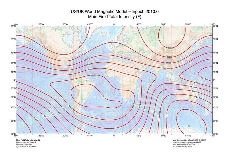
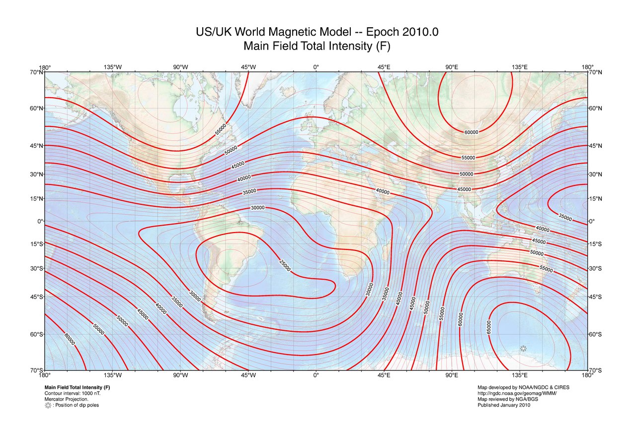
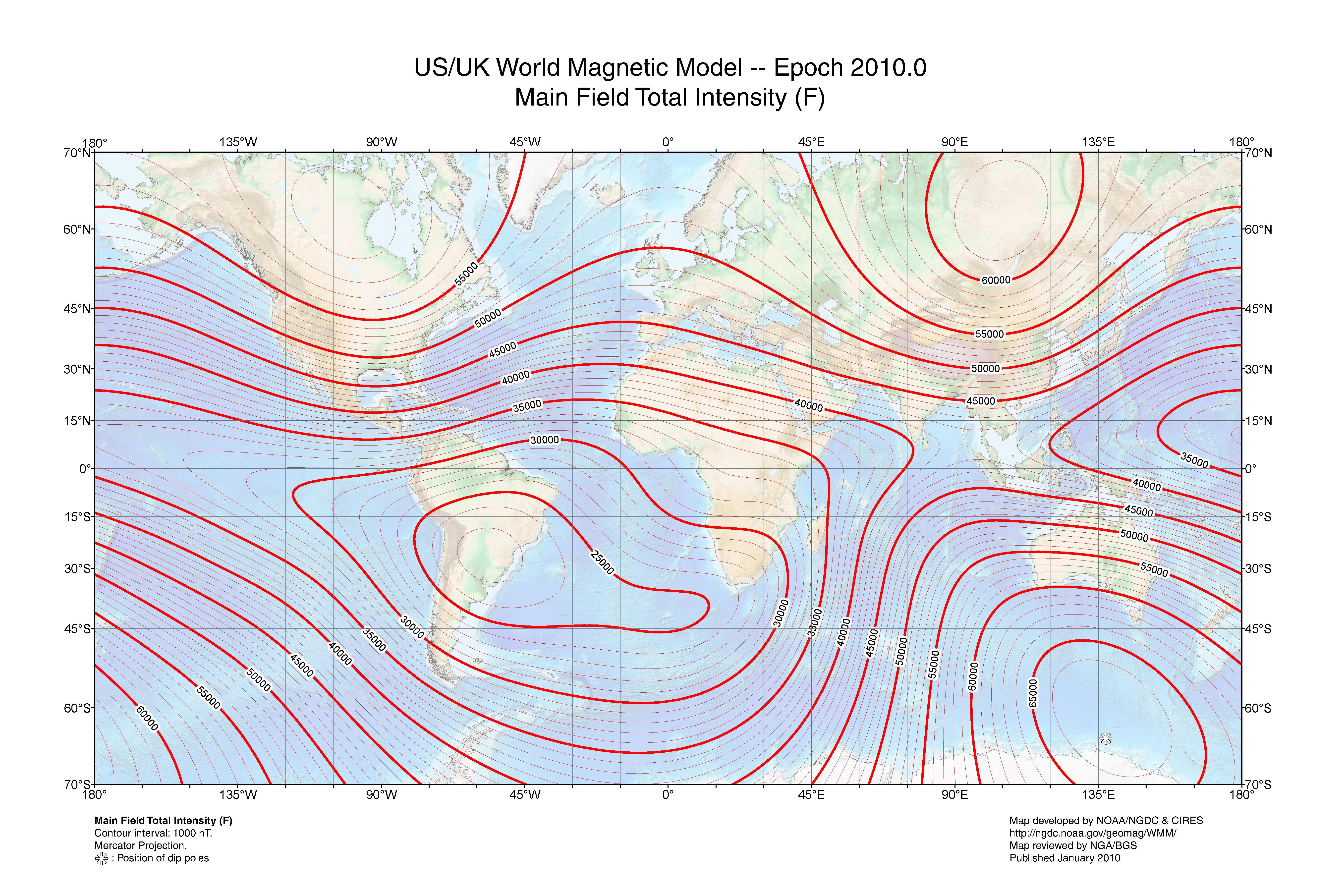
English: This is a world map of main field total intensity created by the National Geophysical Data Center at NOAA. |
| Date | |
| Source | http://www.ngdc.noaa.gov/geomag/WMM/data/WMM2010/WMM2010_F_MERC.pdf |
| Author | NOAA/NGDC & CIRES |
| Other versions | File:WMM2010 F MERC.jpg |
Licensing
[edit]This image is in the public domain because it contains materials that originally came from the U.S. National Oceanic and Atmospheric Administration, taken or made as part of an employee's official duties.
|
File history
Click on a date/time to view the file as it appeared at that time.
| Date/Time | Thumbnail | Dimensions | User | Comment | |
|---|---|---|---|---|---|
| current | 16:29, 5 October 2011 |  | 5,400 × 3,600 (866 KB) | RockMagnetist (talk | contribs) |
You cannot overwrite this file.
File usage on Commons
There are no pages that use this file.
File usage on other wikis
The following other wikis use this file:
- Usage on ast.wikipedia.org
- Usage on en.wikipedia.org
- Usage on es.wikipedia.org
- Usage on uk.wikipedia.org