File:Trolleybus Thun–Beatenbucht.png
Jump to navigation
Jump to search
Size of this preview: 666 × 599 pixels. Other resolutions: 267 × 240 pixels | 533 × 480 pixels | 853 × 768 pixels | 1,138 × 1,024 pixels | 2,271 × 2,044 pixels.
Original file (2,271 × 2,044 pixels, file size: 462 KB, MIME type: image/png)
Captions
Captions
Add a one-line explanation of what this file represents
Summary[edit]
| Description |
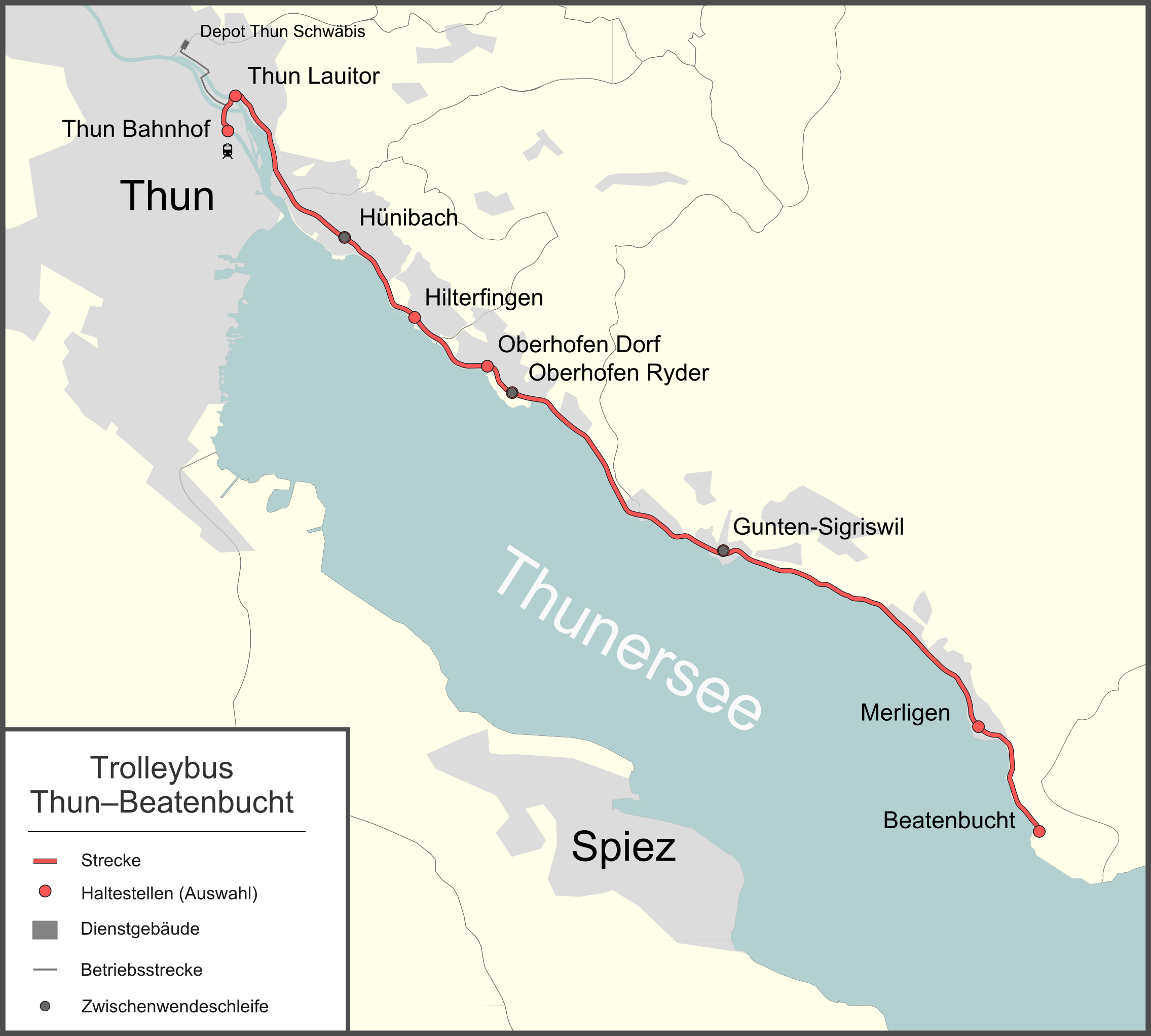
Deutsch: Übersichtskarte Trolleybus Thun–Beatenbucht English: Route map of the Thun–Beatenbucht trolleybus system |
| Date | |
| Source |
Own work Map was created using: |
| Author | Pechristener |
| Permission (Reusing this file) |
Map data (c) OpenStreetMap (and) contributors, CC-BY-SA |
| Camera location | | View this and other nearby images on: OpenStreetMap |
|---|
Licensing[edit]
This file is licensed under the Creative Commons Attribution-Share Alike 2.0 Generic license.
- You are free:
- to share – to copy, distribute and transmit the work
- to remix – to adapt the work
- Under the following conditions:
- attribution – You must give appropriate credit, provide a link to the license, and indicate if changes were made. You may do so in any reasonable manner, but not in any way that suggests the licensor endorses you or your use.
- share alike – If you remix, transform, or build upon the material, you must distribute your contributions under the same or compatible license as the original.
File history
Click on a date/time to view the file as it appeared at that time.
| Date/Time | Thumbnail | Dimensions | User | Comment | |
|---|---|---|---|---|---|
| current | 09:57, 28 February 2012 | | 2,271 × 2,044 (462 KB) | Pechristener (talk | contribs) | besiedelte Gebiete ergänzt / Gemeindegrenzen fixed |
| 00:11, 27 February 2012 |  | 2,271 × 2,044 (423 KB) | Pechristener (talk | contribs) | Reverted to version as of 21:01, 26 February 2012 (error in creation of miniature seems to be fixed) | |
| 00:08, 27 February 2012 |  | 2,271 × 2,044 (423 KB) | Pechristener (talk | contribs) | Fehler bei der Erstellung der Vorschau | |
| 21:01, 26 February 2012 |  | 2,271 × 2,044 (423 KB) | Pechristener (talk | contribs) | Gemeindegrenzen, Diensstrecke, Depot, Massstab hinzu | |
| 18:04, 25 February 2012 |  | 2,271 × 1,796 (203 KB) | Pechristener (talk | contribs) | bessere Auflösung | |
| 17:28, 25 February 2012 |  | 1,344 × 1,063 (112 KB) | Pechristener (talk | contribs) |
You cannot overwrite this file.
File usage on Commons
The following 2 pages use this file:
File usage on other wikis
The following other wikis use this file:
- Usage on de.wikipedia.org
- Usage on nl.wikipedia.org
- Usage on www.wikidata.org