File:The American Atlas WDL9562.pdf
Jump to navigation
Jump to search

Size of this JPG preview of this PDF file: 424 × 600 pixels. Other resolutions: 169 × 240 pixels | 339 × 480 pixels | 543 × 768 pixels | 723 × 1,024 pixels | 1,447 × 2,048 pixels | 2,650 × 3,750 pixels.

Original file (2,650 × 3,750 pixels, file size: 11.16 MB, MIME type: application/pdf, 15 pages)
Captions
Captions
Add a one-line explanation of what this file represents
Summary[edit]
| Author |
Русский: Бурр, Дэвид Г., 1803-1875 гг.
Français : Burr, David H., 1803-1875
English: Burr, David H., 1803-1875
中文:大卫·伯尔,1803-1875 年
Português: Burr, David H., 1803-1875
العربية: ديفيد بور، 1803-1875
Español: Burr, David H., 1803-1875 |
| Title |
Русский: Американский атлас
Français : L'atlas américain
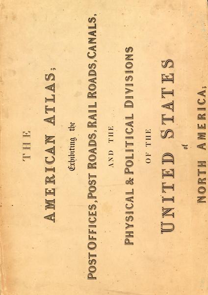
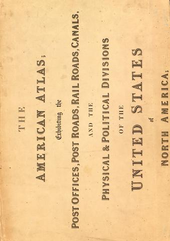
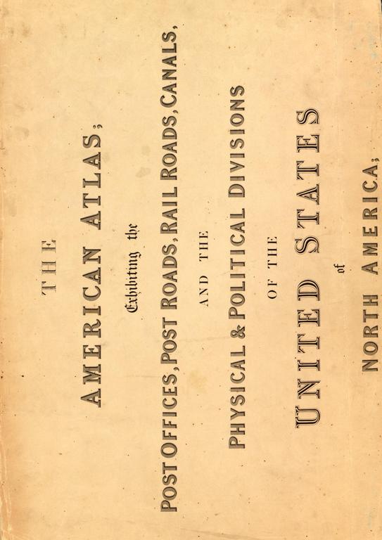
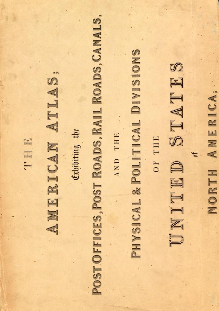
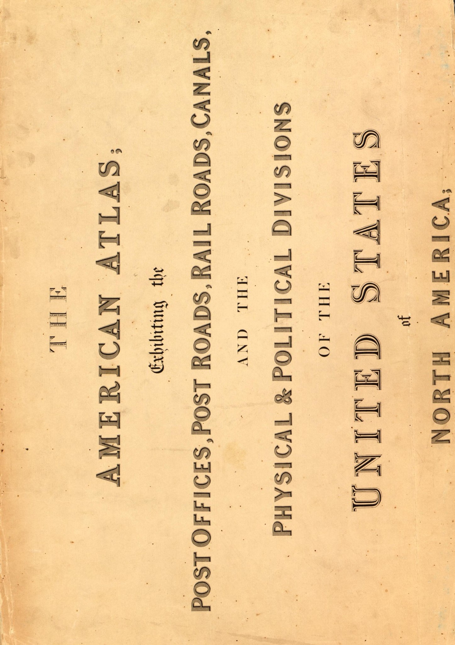
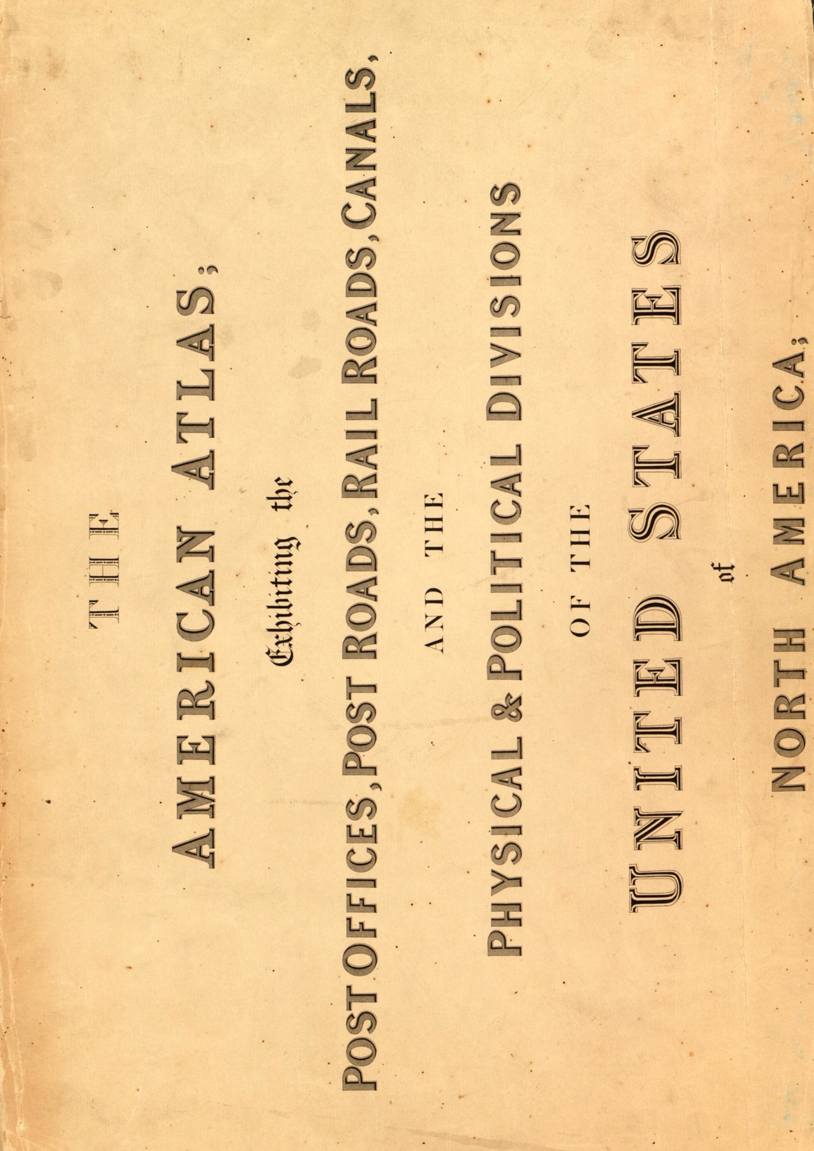
English: The American Atlas
中文:美国地图册
Português: O atlas americano
العربية: الأطلس الأمريكي
Español: El atlas estadounidense |
| Description |
Русский: Дэвид Г. Бурр (1803–1875 гг.), землемер и картограф, служил топографом Почтового департамента США в 1832–1838 гг. и географом Палаты представителей в 1838–1847 гг. Под руководством генерального почтмейстера Бурр собирал от почтмейстеров всей страны информацию о транспортных маршрутах – почтовых трактах, железных дорогах и каналах, а также о расположении почтовых отделений с целью выпуска большого комплекта государственных и региональных карт. Опубликованный в 1839 г. известной лондонской картографической фирмой Джона Эрроусмита, "Американский атлас" Бурра представлял подробную картину заселения и транспортных маршрутов в Соединенных Штатах Америки за несколько десятилетий до Гражданской войны, в период быстрого развития и национальной консолидации. Атлас содержит 13 карт, включая обзорную карту Соединенных Штатов Америки и прилежащих частей Канады, Мексики и Карибского региона и 12 карт, посвященных отдельным штатам и территориям.
Каналы; Почтовые тракты; Почтовая служба; Железные дороги Français : Géomètre et cartographe, David H. Burr (1803-1875) fut topographe au Département des Postes des États-Unis entre 1832 et 1838, puis géographe à la Chambre des représentants entre 1838 et 1847. Sous la direction du Maître des postes général, Burr compila les informations fournies par les maîtres des postes à travers le pays concernant les routes (routes postières, chemins de fer et cours d'eau) et l'emplacement des bureaux de poste afin de réaliser une importante série de cartes des États et des régions. Publié en 1839 par l'éminente société cartographique de John Arrowsmith, L'atlas américain de Burr représente de façon détaillée la répartition du peuplement et du transport aux États-Unis quelques dizaines d'années avant la guerre de Sécession, une période de croissance rapide et de consolidation nationale. L'atlas est composé de 13 cartes dont une carte représentant l'ensemble des États-Unis incluant des régions du Canada, du Mexique et des Caraïbes limitrophes ainsi que 12 cartes consacrées à des États et des territoires précis.
Canaux; Routes postières; Service postal; Chemins de fer English: David H. Burr (1803–75) was a surveyor and cartographer, who served as topographer to the United States Post Office Department in 1832–38 and as geographer to the House of Representatives in 1838–47. Under the direction of the postmaster general, Burr compiled information from postmasters throughout the country about transportation routes—post roads, railroads, and canals—and the location of post offices to produce a large set of state and regional maps. Published in 1839 by the prominent London mapmaking firm of John Arrowsmith, Burr’s The American Atlas offers a detailed picture of settlement and transportation patterns in the United States in the decades before the Civil War, a period of rapid growth and national consolidation. The atlas contains in all 13 maps, including an overview map of the United States and parts of adjacent Canada, Mexico, and the Caribbean region, and 12 maps devoted to particular states and territories.
Canals; Post roads; Postal service; Railroads 中文:大卫·伯尔(David H. Burr,1803-1875 年)是一位测量员和制图员,于 1832—1838 年担任美国邮政署地形学者,1838—1847 年担任众议院地理学家。在邮政署长的指导下,伯尔汇编了全国各地邮政局长提供的有关运输路线(邮路、铁路和运河)以及邮局位置的信息,制作了大量州地图和地区地图。伯尔的《美国地图册》由伦敦著名制图商约翰·阿罗史密斯 (John Arrowsmith) 于 1839 年出版,详细描绘了美国在内战前数十年的聚居和运输模式——美国正是在这一时期取得迅速发展,日渐强大。该地图册共汇编了 13 幅地图,包括一幅美国概览图和邻近的加拿大、墨西哥、加勒比海区域的部分地区,以及 12 幅州地图和地区地图。
运河; 邮路; 邮政服务; 铁路 Português: David H. Burr (1803-1875) foi um agrimensor e cartógrafo, que atuou como topógrafo para o Departamento de Correios dos Estados Unidos entre 1832 e 1838 e como geógrafo para a Câmara dos Representantes entre 1838 e 1847. Sob a direção do reponsável geral dos correios, Burr compilou informações dos responsáveis dos correios em todo o país sobre rotas de transporte—estradas de correios, ferrovias e canais—e o local dos postos de correios para a produção de um grande conjunto de mapas estaduais e regionais. Publicado em 1839 pela proeminente empresa de cartografia londrina de John Arrowsmith, O atlas americano de Burr fornece um quadro detalhado da disposição das colônias e do transporte nos Estados Unidos nas décadas anteriores à Guerra Civil, um período de rápido crescimento e consolidação nacional. O atlas contém todos os 13 mapas, incluindo um mapa geral dos Estados Unidos e partes dos países vizinhos Canadá, México e região do Caribe e 12 mapas dedicados a determinados estados e territórios.
Canais; Estradas do correio; Serviço postal; Ferrovias العربية: كان ديفيد بور (1803-1875) ماسح أراضٍ ورسام خرائط، وقد شغل منصب طبوغرافي تابع لإدارة مكاتب البريد الأمريكية في الفترة ما بين 1832-1838، كما عَمِل جغرافياً تابعاً لمجلس النواب في الفترة ما بين 1838-1847. جمع بور معلومات من مدراء مكاتب البريد الموجودة في جميع أنحاء الدولة حول مسارات النقل— طرق نقل البريد والسكك الحديدية والقنوات— ومواقع مكاتب البريد لتصميم مجموعة كبيرة من خرائط الولايات والأقاليم، وذلك بتوجيه من المدير العام لمكتب البريد. نشرت مؤسسة جون آروسميث البارزة لصنع الخرائط بلندن الأطلس الأمريكي بقلم بور عام 1839، وهو يعرض صورة مفصلة لأنماط الاستيطان والنقل في الولايات المتحدة في العقود السابقة للحرب الأهلية، وهي فترة شهدت نمواً سريعاً وتمدداً قومياً. يحتوي الأطلس على 13 خريطة، بما في ذلك خريطة شاملة للولايات المتحدة الأمريكية وأجزاء من البلدان المجاورة مثل كندا والمكسيك ومنطقة الكاريبي، فضلاً عن 12 خريطة مخصصة لولايات وأقاليم بعينها.
القنوات; طرق نقل البريد; خدمات البريد; السكك الحديدية Español: David H. Burr (1803-1875) era topógrafo y cartógrafo, y se desempeñó como topógrafo en el Departamento de Correos de los Estados Unidos de 1832 a 1838 y como geógrafo para la Cámara de Representantes entre 1838 y 1847. Bajo la dirección del director general de correos, Burr recopiló información de los administradores de correo de todo el país acerca de las rutas de transporte (carreteras, ferrocarriles y canales de rutas de correos) y la ubicación de las oficinas de correos para producir un gran conjunto de mapas estatales y regionales. Publicado en 1839 por la prominente empresa de cartografía londinense de John Arrowsmith, El atlas estadounidense de Burr ofrece un panorama detallado de los patrones de asentamiento y de transporte en los Estados Unidos en las décadas anteriores a la Guerra Civil, un período de rápido crecimiento y de consolidación nacional. El atlas contiene un total de 13 mapas, entre los que se encuentran un mapa general de los Estados Unidos y partes adyacentes de Canadá, México y la región de El Caribe, y 12 mapas dedicados a determinados estados y territorios.
Canales; Rutas de correos; Servicio postal; Ferrocarriles |
| Date | 1839 |
| Medium |
Русский: Карты
Français : Cartes
English: Maps
中文:地图
Português: Mapas
العربية: خرائط
Español: Mapas |
| Dimensions |
English: 1 loose-leaf atlas (13 maps) : hand colored, mounted on cloth ; maps 130 x 130 centimeters or smaller, folded in case 50 x 33 x 7 centimeters |
| Collection |
Русский: Библиотека Конгресса
Français : Bibliothèque du Congrès
English: Library of Congress
中文:国会图书馆
Português: Biblioteca do Congresso
العربية: مكتبة الكونغرس
Español: Biblioteca del Congreso |
| Place of creation |
Русский: Соединенные Штаты Америки
Français : États-Unis d’Amérique
English: United States of America
中文:美利坚合众国
Português: Estados Unidos da América
العربية: الولايات المتحدة الأمريكية
Español: Estados Unidos de América |
| Notes |
Русский: Масштаб прим. 1:4 000 000; масштаб прим. 1:633,600. Изображение рельефа штрихами.
Français : Échelle 1:4 000 000 environ ; échelle 1:633 600 environ. Relief représenté par des hachures.
English: Scale ca. 1:4,000,000; Scale ca. 1:633,600. Relief shown by hachures.
中文:比例尺约为:1:4,000,000;比例尺约为:1:633,600. 地势由晕滃线示出。
Português: Escala ca. 1:4.000.000; escala ca. 1:633,600. Relevo destacado por hachuras.
العربية: المقياس حوالي 1:4,000,000; المقياس حوالي 1:633,600. تظهر التضاريس من خلال التظليل.
Español: Escala ca. 1:4 000 000; escala ca. 1:633 600. Se muestra el relieve por sombreado. |
| References | http://hdl.loc.gov/loc.wdl/dlc.9562 |
| Source/Photographer |
http://dl.wdl.org/9562/service/9562.pdf
|
Licensing[edit]
|
This is a faithful photographic reproduction of a two-dimensional, public domain work of art. The work of art itself is in the public domain for the following reason:
The official position taken by the Wikimedia Foundation is that "faithful reproductions of two-dimensional public domain works of art are public domain".
This photographic reproduction is therefore also considered to be in the public domain in the United States. In other jurisdictions, re-use of this content may be restricted; see Reuse of PD-Art photographs for details. | ||||
File history
Click on a date/time to view the file as it appeared at that time.
| Date/Time | Thumbnail | Dimensions | User | Comment | |
|---|---|---|---|---|---|
| current | 02:51, 12 March 2014 |  | 2,650 × 3,750, 15 pages (11.16 MB) | Fæ (talk | contribs) | =={{int:filedesc}}== {{Artwork |artist = |author ={{ru|1=Бурр, Дэвид Г., 1803-1875 гг.}} {{fr|1=Burr, David H., 1803-1875}} {{en|1=Burr, David H., 1803-1875}} {{zh|1=大卫·伯尔,1803-1875 年}} {{pt|1=Burr, David H., 1803-1875}} {{ar|... |
You cannot overwrite this file.
File usage on Commons
The following page uses this file: