File:Taiwan Province (PRC) prfc map.xcf
Jump to navigation
Jump to search

No higher resolution available.
Taiwan_Province_(PRC)_prfc_map.xcf (408 × 500 pixels, file size: 156 KB, MIME type: image/x-xcf)
Captions
Captions
Add a one-line explanation of what this file represents
|
|
Summary
[edit]| Description | |||
| Date | |||
| Source | Own work by the original uploader | ||
| Author | 彭鹏 at Chinese Wikipedia | ||
| Other versions |
|

.svg)
Licensing
[edit]This file is licensed under the Creative Commons Attribution-Share Alike 3.0 Unported license.
- You are free:
- to share – to copy, distribute and transmit the work
- to remix – to adapt the work
- Under the following conditions:
- attribution – You must give appropriate credit, provide a link to the license, and indicate if changes were made. You may do so in any reasonable manner, but not in any way that suggests the licensor endorses you or your use.
- share alike – If you remix, transform, or build upon the material, you must distribute your contributions under the same or compatible license as the original.
Original upload log
[edit]The original description page was here. All following user names refer to zh.wikipedia.
| Date/Time | Dimensions | User | Comment |
|---|---|---|---|
| 2017-12-19 11:28 | 408×500× (173724 bytes) | 彭鹏 | {{Information |Description=[[台湾省 (中华人民共和国)|]]行政区划 |Source=在[[:File:1992ROCLY by Party (2).svg]]的基础上改制而成 |Date=2017-12-19 |Author=本人 |Permission={{cc-by-sa 3.0}} }} |
File history
Click on a date/time to view the file as it appeared at that time.
| Date/Time | Thumbnail | Dimensions | User | Comment | |
|---|---|---|---|---|---|
| current | 12:45, 7 March 2018 |  | 408 × 500 (156 KB) | Yejianfei (talk | contribs) | Reverted to version as of 08:39, 30 December 2017 (UTC) |
| 12:44, 7 March 2018 |  | 408 × 500 (170 KB) | Yejianfei (talk | contribs) | Reverted to version as of 12:05, 19 December 2017 (UTC) | |
| 08:39, 30 December 2017 |  | 408 × 500 (156 KB) | 彭鹏 (talk | contribs) | +Country-level Division | |
| 06:53, 30 December 2017 |  | 408 × 500 (158 KB) | 彭鹏 (talk | contribs) | Reverted to version as of 10:55, 24 December 2017 (UTC) | |
| 06:27, 30 December 2017 | 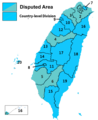 | 408 × 500 (162 KB) | 彭鹏 (talk | contribs) | +Country-level Division | |
| 10:55, 24 December 2017 |  | 408 × 500 (158 KB) | 彭鹏 (talk | contribs) | 更新 | |
| 12:05, 19 December 2017 | 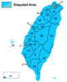 | 408 × 500 (170 KB) | Taiwania Justo (talk | contribs) | Transferred from zh.wikipedia |
You cannot overwrite this file.
File usage on Commons
The following page uses this file:
File usage on other wikis
The following other wikis use this file:
- Usage on ja.wikipedia.org
- Usage on vi.wikipedia.org
- Usage on zh-yue.wikipedia.org
- Usage on zh.wikipedia.org