File:South Asia non political, with rivers.jpg
Jump to navigation
Jump to search

Size of this preview: 648 × 600 pixels. Other resolutions: 259 × 240 pixels | 519 × 480 pixels | 830 × 768 pixels | 1,106 × 1,024 pixels | 2,324 × 2,151 pixels.
Original file (2,324 × 2,151 pixels, file size: 5.15 MB, MIME type: image/jpeg)
Captions
Captions
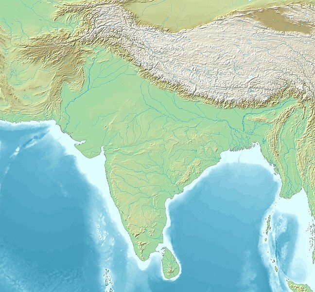
South Asia
Summary
[edit]Topographic map 90deg, North latitude: 0 - 90, East longitude: 60 - 150
[edit]Topographic map 90deg, North latitude: 0 - 90, East longitude: 60 - 150
|
| ||||||||||||||||||||||||


Map created from DEMIS Mapserver[dead link], which are public domain. Koba-chan
| Description |
English: South Asia non political, with rivers |
| Date | |
| Source | Map created from DEMIS Mapserver, which are public domain. |
| Author | DEMIS Mapserver, पाटलिपुत्र (talk) |
Licensing
[edit]

|
Permission is granted to copy, distribute and/or modify this document under the terms of the GNU Free Documentation License, Version 1.2 or any later version published by the Free Software Foundation; with no Invariant Sections, no Front-Cover Texts, and no Back-Cover Texts. A copy of the license is included in the section entitled GNU Free Documentation License. |
| This file is licensed under the Creative Commons Attribution-Share Alike 3.0 Unported license. | ||
| ||
| This licensing tag was added to this file as part of the GFDL licensing update. |
File history
Click on a date/time to view the file as it appeared at that time.
| Date/Time | Thumbnail | Dimensions | User | Comment | |
|---|---|---|---|---|---|
| current | 15:40, 11 February 2023 | | 2,324 × 2,151 (5.15 MB) | पाटलिपुत्र (talk | contribs) | Saturation -10% |
| 15:33, 11 February 2023 |  | 2,324 × 2,151 (5.12 MB) | पाटलिपुत्र (talk | contribs) | Reverted to version as of 13:45, 31 January 2023 (UTC) | |
| 15:32, 11 February 2023 |  | 2,324 × 2,151 (5.29 MB) | पाटलिपुत्र (talk | contribs) | colors | |
| 15:16, 11 February 2023 |  | 2,324 × 2,151 (5.31 MB) | पाटलिपुत्र (talk | contribs) | tweak | |
| 15:13, 11 February 2023 |  | 2,324 × 2,151 (5.03 MB) | पाटलिपुत्र (talk | contribs) | drab | |
| 13:45, 31 January 2023 |  | 2,324 × 2,151 (5.12 MB) | पाटलिपुत्र (talk | contribs) | Reverted to version as of 08:23, 6 February 2020 (UTC) | |
| 13:37, 31 January 2023 |  | 2,324 × 2,151 (6.33 MB) | पाटलिपुत्र (talk | contribs) | colors | |
| 13:27, 31 January 2023 |  | 2,324 × 2,151 (5.93 MB) | पाटलिपुत्र (talk | contribs) | light | |
| 13:24, 31 January 2023 |  | 2,324 × 2,151 (5.93 MB) | पाटलिपुत्र (talk | contribs) | contrast | |
| 10:55, 31 January 2023 |  | 2,324 × 2,151 (5.82 MB) | पाटलिपुत्र (talk | contribs) | Reverted to version as of 10:18, 31 January 2023 (UTC) |
You cannot overwrite this file.
File usage on Commons
The following 59 pages use this file:
- User talk:Avantiputra7
- File:Adil Shahis.png
- File:Bengal Basin.svg
- File:Hussain Shahis of Bengal.png
- File:Karkota Empire map.jpg
- File:Khaljis of Malwa.png
- File:Map of Paradan.png
- File:Map of Sind and Shri coinage circa 425 CE.png
- File:Map of Sindh (Rais).png
- File:Map of Sogdia.jpg
- File:Map of the Bahmani Sultanate.png
- File:Map of the Cahamanas.png
- File:Map of the Caliphal Province of Sind.png
- File:Map of the Candellas.png
- File:Map of the Chachas circa 650 CE.png
- File:Map of the Chalukyas.png
- File:Map of the Chaulukyas.png
- File:Map of the Early Kalachuris.png
- File:Map of the Eastern Gangas.png
- File:Map of the Gahadavalas.png
- File:Map of the Ghaznavid Empire.png
- File:Map of the Gupta Empire.png
- File:Map of the Gurjara-Pratiharas (circa 800-950 CE).png
- File:Map of the Habbarid Emirate.png
- File:Map of the Habbarid and Multan Emirates.png
- File:Map of the Hindu Shahis.png
- File:Map of the Hindu Shahis (Hindu Kush).png
- File:Map of the Indo-Greeks.png
- File:Map of the Indo-Parthians.png
- File:Map of the Indo-Scythians.png
- File:Map of the Kakatiyas.png
- File:Map of the Khaljis of Bengal.png
- File:Map of the Kushan Empire.png
- File:Map of the Langah Sultanate circa 1475 CE.png
- File:Map of the Later Guptas.jpg
- File:Map of the Later Kalacuris.png
- File:Map of the Lodi Sultanate.png
- File:Map of the Maha-Meghavahanas.png
- File:Map of the Maukharis.png
- File:Map of the Multan Emirate.png
- File:Map of the Northern Satraps (Northern Sakas).jpg
- File:Map of the Pala Empire.png
- File:Map of the Paramaras.png
- File:Map of the Pushyabhutis.png
- File:Map of the Rashtrakuta Empire.png
- File:Map of the Satavahanas.png
- File:Map of the Senas.png
- File:Map of the Shashankas.png
- File:Map of the Shungas.png
- File:Map of the Southern Hunas (territory).png
- File:Map of the Sur Empire.png
- File:Map of the Vakatakas.png
- File:Map of the Varmans.png
- File:Map of the Western Satraps.png
- File:Map of the Yadavas.png
- File:Maurya Empire diagram of networks.png
- File:Maurya Empire map of possible boundaries.png
- File:Pala Empire in 908 CE.png
- File:Sangamas of the Vijayanagara Empire.png
.png)
.png)
.png)
.jpg)
.png)
File usage on other wikis
The following other wikis use this file:
- Usage on ar.wikipedia.org
- Usage on ban.wikipedia.org
- Usage on bh.wikipedia.org
- Usage on bn.wikipedia.org
- কুয়াকাটা
- পাল সাম্রাজ্য
- শাহ আমানত আন্তর্জাতিক বিমানবন্দর
- মডিউল:অবস্থান মানচিত্র/উপাত্ত/দক্ষিণ এশিয়া
- মডিউল:অবস্থান মানচিত্র/উপাত্ত/দক্ষিণ এশিয়া/নথি
- কুমহালি ভাষা
- রক্তমৃত্তিকা মহাবিহার
- ২০২৪ সাফ ক্লাব চ্যাম্পিয়নশিপ
- কার্কোট রাজবংশ
- টেমপ্লেট:৮০০ খ্রিস্টাব্দে ভারতীয় উপমহাদেশ
- অহিচ্ছত্র
- শ্রীলঙ্কার কেন্দ্রীয় উচ্চভূমি
- খায়ের খানহ্
- অশোকের শিলালিপি
- টেমপ্লেট:Map of the Edicts of Ashoka
- Usage on de.wikipedia.org
- Usage on en.wikipedia.org
- Ashoka
- Ajanta Caves
- Harappa
- Kandahar
- Makran
- Mehrgarh
- Rajasthan
- Hoysala Kingdom
- Mohenjo-daro
- Gondwana (India)
- Lothal
- Menander I
- Tiruchirappalli
- Nalanda mahavihara
- Gupta Empire
- Samudragupta
- Sanchi
- First Battle of Panipat
- Middle kingdoms of India
- Delhi Sultanate
- Kandy
- Hephthalites
- Rawalpindi
- Kushan Empire
- Licchavis of Nepal
View more global usage of this file.