Category:Maps of South Asia
Jump to navigation
Jump to search
Wikimedia category | |||||
| Upload media | |||||
| Instance of | |||||
|---|---|---|---|---|---|
| Category combines topics | |||||
| |||||
Subcategories
This category has the following 13 subcategories, out of 13 total.
*
+
- Maps of Akhand Bharat (7 F)
.
- Maps of Southern South Asia (3 F)
F
- Flag maps of South Asia (2 F)
L
Media in category "Maps of South Asia"
The following 66 files are in this category, out of 66 total.
-
 Persian Plateau.png 717 × 430; 484 KB
-
 Reversed Map of South Asia.gif 2,000 × 2,156; 2.18 MB
-
 3 Regions Far East Southeast Asia Indian Subcontinent 2.PNG 370 × 304; 6 KB
-
-
 BBIN.png 1,024 × 1,024; 564 KB
-
 British India (orthographic projection).png 1,443 × 1,443; 531 KB
-
 British India (orthographic projection).svg 550 × 550; 2.8 MB
-
 Desi Muslims.jpg 516 × 674; 72 KB
-
 Desi Muslims.png 521 × 701; 21 KB
-
 Eastern World.PNG 1,903 × 837; 188 KB
-
 Eastern World.svg 2,560 × 1,314; 1.12 MB
-
 Eez pmn.jpg 435 × 369; 341 KB
-
 Electricity Regulators in South Asia.JPG 896 × 766; 47 KB
-
 Global sea levels and vegetation during the last Ice Age (South Asia).jpg 1,420 × 2,062; 1.71 MB
-
 Hindu Majority States and Provinces in South Asia.png 6,930 × 5,291; 1.16 MB
-
 India 78.40398E 20.74980N.jpg 1,280 × 958; 167 KB
-
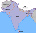
 India and its neighbours.jpg 1,632 × 1,845; 390 KB
-
 IST-CIA-TZ.png 429 × 459; 51 KB
-
 Karta indiska halvon.jpg 400 × 367; 14 KB
-
 Koppen-Geiger Map Southern Asia future.svg 1,400 × 850; 2.96 MB
-
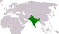
 LocationSouthAsia.PNG 1,357 × 628; 45 KB
-
 Map of Pakistan, Bangladesh, India and Sri Lanka.jpg 1,323 × 862; 312 KB
-
 Map of South Asia (SAARC country).jpg 518 × 500; 67 KB
-
 Map of South-India and Sri Lanka.png 237 × 259; 24 KB
-
 Marathe.jpg 400 × 411; 28 KB
-
 Mittlerer Osten Karte.png 681 × 393; 14 KB
-
 Monde indien langues.png 490 × 555; 110 KB
-
 Natural vegetation South Asia.png 746 × 429; 95 KB
-
 PAT - South Asia.gif 2,000 × 1,500; 777 KB
-
 PAT - South-Central Asia.gif 1,900 × 1,900; 945 KB
-
 Presentation1 1696666311.jpg 1,280 × 720; 143 KB
-
 SASEC South Asia Subregional Economic Cooperation.png 1,971 × 1,269; 43 KB
-
 Sher Shah's empire.png 424 × 555; 22 KB
-
 Sikkim and Bhutan 1910.jpg 4,958 × 3,638; 22.17 MB
-
 South Asia (definitions).png 6,460 × 3,613; 1.27 MB
-
 South Asia (ed)update.PNG 681 × 393; 180 KB
-
 South Asia (orthographic projection) with national boundaries.png 1,443 × 1,443; 530 KB
-
 South Asia - DPLA - 35c2f01ef7331b017d87818b1bf65d16.jpg 2,404 × 3,126; 4.18 MB
-
 South Asia Altitude.svg 800 × 730; 8.14 MB
-
 South Asia common definition.jpg 541 × 541; 64 KB
-
 South Asia countries.png 514 × 381; 49 KB
-
 South Asia non political (light).jpg 2,324 × 2,151; 4.68 MB
-
 South Asia non political stronger colors.jpg 2,324 × 2,151; 6.39 MB
-
 South Asia non political, with rivers.jpg 2,324 × 2,151; 5.15 MB
-
 South Asia non political.jpg 2,324 × 2,151; 5.04 MB
-
 South Asia political.jpg 2,324 × 2,151; 1.88 MB
-
 South Asia Soil.svg 705 × 757; 8.06 MB
-
 South Asia subdivisions flood hit between July 3 and August 15 2007.png 1,293 × 1,199; 66 KB
-
 South Asia UN.png 2,960 × 3,588; 1.63 MB
-
 South asia.jpg 425 × 533; 52 KB
-
 South Asian Language Families.jpg 637 × 695; 49 KB
-
 South Asian Language Families.png 1,000 × 1,201; 123 KB
-
 Southern Asia.png 536 × 800; 140 KB
-
 States of South Asia 1.png 725 × 684; 126 KB
-
 States of South Asia by language.png 798 × 752; 96 KB
-
 Südasien Sprachfamilien-nb.png 877 × 953; 42 KB
-
 Südasien Sprachfamilien.png 877 × 953; 20 KB
-
 Txu-oclc-10552568-nh46-12.jpg 5,000 × 3,800; 4.96 MB
-
 Txu-oclc-10552568-nh47-13.jpg 5,000 × 3,790; 4.28 MB
-
 Txu-oclc-10552568-nh47-9.jpg 5,000 × 3,794; 4.08 MB
-
 Txu-oclc-6654394-ng-47-6th-ed.jpg 5,000 × 4,723; 9.54 MB
-
 Txu-oclc-6654394-ni-44-3rd-ed.jpg 4,592 × 4,305; 6.06 MB
-
 Txu-oclc-6654394-nj-44-3rd-ed.jpg 4,904 × 5,343; 5.89 MB
-
 Zemljevid Indijska podcelina.png 400 × 367; 8 KB
-
 Ю.Азия.png 681 × 393; 22 KB
-
 خريطة كتاب سندباد عصري 1938.png 1,241 × 922; 2.18 MB


.png)
.svg)


.jpg)


.jpg)


.png)
update.PNG)
_with_national_boundaries.png)


.jpg)


