File:Samoa Islands 2002 mk.PNG
Jump to navigation
Jump to search
No higher resolution available.
Samoa_Islands_2002_mk.PNG (709 × 418 pixels, file size: 33 KB, MIME type: image/png)
Captions
Captions
Add a one-line explanation of what this file represents
Summary[edit]
| Description |
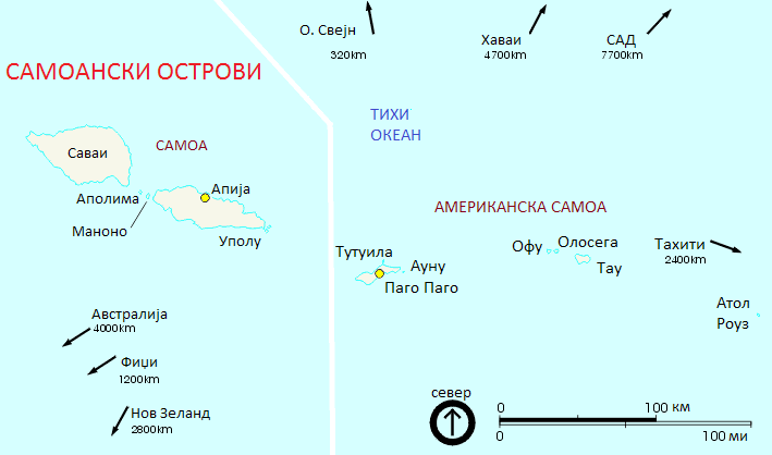
English: NPS map of Samoa Islands in Macedonian. Македонски: Карта на Самоанските Острови на македонски. |
| Date | circa 2002 |
| Source | http://www.lib.utexas.edu/maps/australia/samoa_islands_2002.gif, converted into .png |
| Author | NPS, converted by Telim tor, derivative:--Никола Стоіаноски 10:21, 22 October 2012 (UTC) |
| Other versions | Original .gif version, English version |
Licensing[edit]
| This image or media file contains material based on a work of a National Park Service employee, created as part of that person's official duties. As a work of the U.S. federal government, such work is in the public domain in the United States. See the NPS website and NPS copyright policy for more information. |
| This work was previously under Public Domain, or a Free License. It has been digitally enhanced and/or modified. This derivative work has been (or is hereby) released into the public domain by its author, Telim tor at the German Wikipedia project. This applies worldwide. In some countries this is not legally possible; if so:
|
File history
Click on a date/time to view the file as it appeared at that time.
| Date/Time | Thumbnail | Dimensions | User | Comment | |
|---|---|---|---|---|---|
| current | 10:20, 22 October 2012 | | 709 × 418 (33 KB) | MacedonianBoy (talk | contribs) | {{Information |Description ={{en|1=kkjkj}} |Source ={{own}} |Author =MacedonianBoy |Date = |Permission = |other_versions = }} |
You cannot overwrite this file.
File usage on Commons
There are no pages that use this file.