File:Pont Medieval de Besalú.jpg
Jump to navigation
Jump to search
Size of this preview: 800 × 532 pixels. Other resolutions: 320 × 213 pixels | 640 × 426 pixels | 1,024 × 681 pixels | 1,280 × 852 pixels | 1,936 × 1,288 pixels.
Original file (1,936 × 1,288 pixels, file size: 749 KB, MIME type: image/jpeg)
Captions
Captions
Add a one-line explanation of what this file represents
Summary[edit]
| Description |
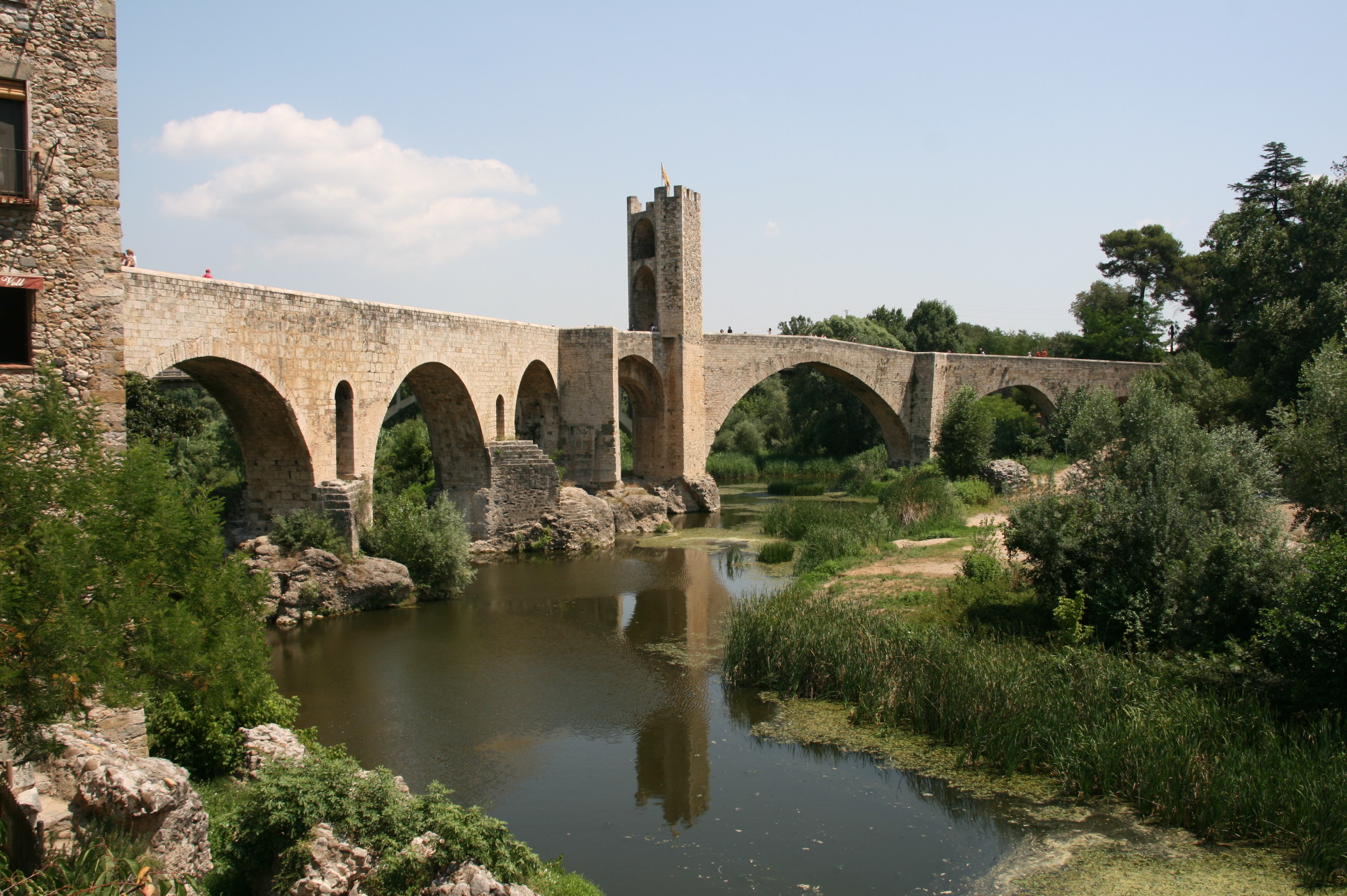
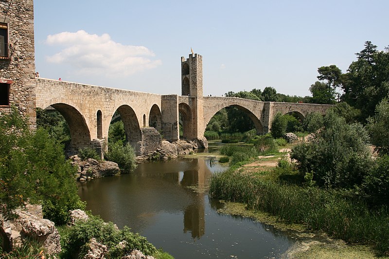
Català: Pont Medieval de Besalú
|
||
| Date | |||
| Source | Own work | ||
| Author | Arnaugir |
| Object location | | View this and other nearby images on: OpenStreetMap |
|---|
Licensing[edit]
I, the copyright holder of this work, hereby publish it under the following license:
This file is licensed under the Creative Commons Attribution-Share Alike 3.0 Unported license.
- You are free:
- to share – to copy, distribute and transmit the work
- to remix – to adapt the work
- Under the following conditions:
- attribution – You must give appropriate credit, provide a link to the license, and indicate if changes were made. You may do so in any reasonable manner, but not in any way that suggests the licensor endorses you or your use.
- share alike – If you remix, transform, or build upon the material, you must distribute your contributions under the same or compatible license as the original.

|
This image was uploaded as part of Wiki Loves Monuments 2011.
|
|
File history
Click on a date/time to view the file as it appeared at that time.
| Date/Time | Thumbnail | Dimensions | User | Comment | |
|---|---|---|---|---|---|
| current | 10:02, 1 September 2011 | | 1,936 × 1,288 (749 KB) | Arnaugir (talk | contribs) |
You cannot overwrite this file.
File usage on Commons
The following 2 pages use this file:
File usage on other wikis
The following other wikis use this file:
- Usage on arz.wikipedia.org
- Usage on ca.wikipedia.org
- Viquiprojecte:Monuments/Estadístiques/2011/01
- Llista d'espais naturals protegits de Catalunya
- Llista de topònims de Sant Jaume de Llierca
- Llista de topònims d'Argelaguer
- Llista de topònims de Besalú
- Llista de topònims de Castellfollit de la Roca
- Llista de topònims de Maià de Montcal
- Llista de topònims de Montagut i Oix
- Llista de topònims d'Olot
- Llista de topònims de les Preses
- Llista de topònims de Sant Ferriol
- Llista de topònims de Sant Joan les Fonts
- Llista de topònims de la Vall d'en Bas
- Llista de topònims de Crespià
- Llista de topònims d'Esponellà
- Llista de topònims de Serinyà
- Usage on ceb.wikipedia.org
- Usage on da.wikipedia.org
- Usage on en.wikipedia.org
- Usage on es.wikipedia.org
- Usage on eu.wikipedia.org
- Usage on fr.wikipedia.org
- Usage on la.wikipedia.org
- Usage on ro.wikipedia.org
- Usage on ty.wikipedia.org
- Usage on uk.wikipedia.org
- Usage on vi.wikipedia.org
- Usage on www.wikidata.org