File:Poke-O-Moonshine USGS map.png
Jump to navigation
Jump to search
No higher resolution available.
Poke-O-Moonshine_USGS_map.png (325 × 439 pixels, file size: 354 KB, MIME type: image/png)
Captions
Captions
Add a one-line explanation of what this file represents
| Description |
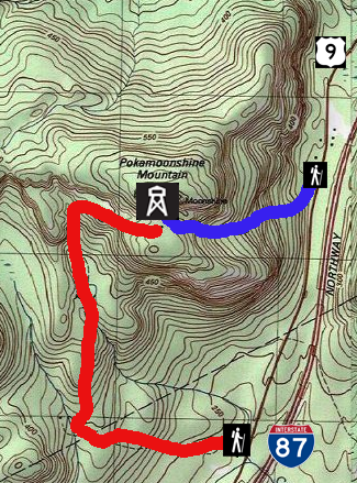
English: U.S. Geological Survey map of Poke-O-Moonshine Mountain (spelled as Pokamoonshine on map) with informational layers showing recreational facilities on mountain and nearby roads) |
|||
| Date | Original map unknown; later work 2013-02-04 | |||
| Source | USGS Au Sable Forks quadrangle, reproduced at ACME Mapper | |||
| Author | Unknown. Map symbol and trail route layers added by Daniel Case prior to upload | |||
| Permission (Reusing this file) |
|
|||
| Other versions | USGS Original |
File history
Click on a date/time to view the file as it appeared at that time.
| Date/Time | Thumbnail | Dimensions | User | Comment | |
|---|---|---|---|---|---|
| current | 06:59, 4 February 2013 | | 325 × 439 (354 KB) | Daniel Case (talk | contribs) | {{Information |Description ={{en|1=U.S. Geological Survey map of Poke-O-Moonshine Mountain (spelled as Pokamoonshine on map) with informational layers showing recreational facilit... |
You cannot overwrite this file.
File usage on Commons
There are no pages that use this file.
File usage on other wikis
The following other wikis use this file:
- Usage on en.wikipedia.org