File:Physical map of Tibet.png
Jump to navigation
Jump to search
Size of this preview: 800 × 471 pixels. Other resolutions: 320 × 188 pixels | 640 × 376 pixels | 833 × 490 pixels.
Original file (833 × 490 pixels, file size: 446 KB, MIME type: image/png)
Captions
Captions
Add a one-line explanation of what this file represents
Summary
[edit]
| Description |
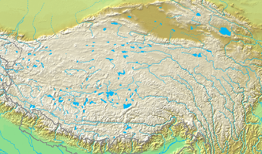
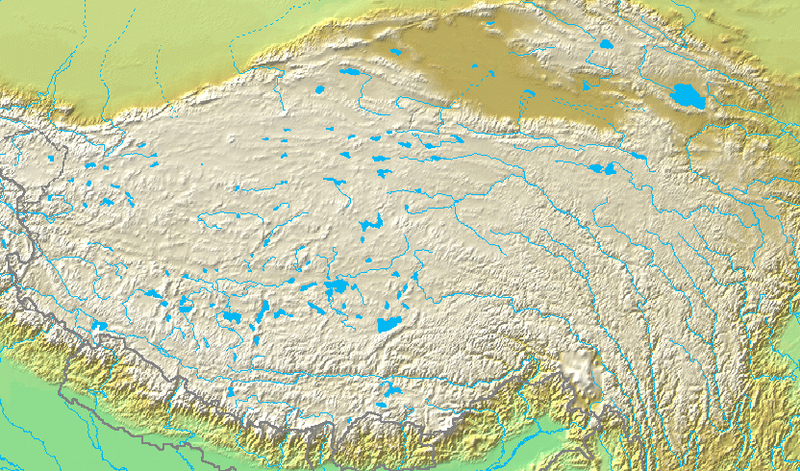
English: Topographic map of the Tibetan Plateau in Asia.
Français : Carte topographique du plateau tibetain.
|
||||
| Date | Unknown date | ||||
| Source | http://www.demis.nl/home/pages/Gallery/examples.htm via File:Topografic map of Tibetan Plateau.png | ||||
| Author | Unknown author. Cropped by User:Andrew Dalby | ||||
| Permission (Reusing this file) |
|
File history
Click on a date/time to view the file as it appeared at that time.
| Date/Time | Thumbnail | Dimensions | User | Comment | |
|---|---|---|---|---|---|
| current | 14:05, 15 July 2019 | | 833 × 490 (446 KB) | Andrew Dalby (talk | contribs) | {{information |Description= {{en|Topographic map of the '''{{C|Tibetan Plateau|Tibetan Plateau}}''' in {{C|Asia}}. ::*Bounding box West 66°, South 23°, East 108°, North 42°.}} {{fr|Carte topographique du '''{{C|Tibetan Plateau|plateau tibetain}}'''. ::*Cette carte est inscrite dans le rectangle : 66° ouest, 23° sud, 108° est, 42° nord.}} |Source= http://www.demis.nl/home/pages/Gallery/examples.htm via File:Topografic map of Tibetan Plateau.png |Date={{other date|?}} |Author={{unknown|A... |
You cannot overwrite this file.
File usage on Commons
The following 3 pages use this file:
File usage on other wikis
The following other wikis use this file:
- Usage on la.wikipedia.org