Category:Maps of the Indus River
Jump to navigation
Jump to search
Subcategories
This category has only the following subcategory.
W
Media in category "Maps of the Indus River"
The following 53 files are in this category, out of 53 total.
-

-
-
-

-
-
 1848 map of Central Asia by Heinrich Kiepert.jpg 11,845 × 14,157; 23.39 MB
-
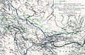
 Map of the Country of the Upper Oxus.jpg 3,789 × 2,543; 4.93 MB
-
 Map of the River Indus.jpg 2,497 × 5,331; 5.78 MB
-

-
 AncientRoad between Indus and AmuDarya.png 414 × 425; 409 KB
-
 Bassin de l'Indus.png 804 × 741; 441 KB
-

-
 Central Asian trade routes V2.jpg 1,280 × 836; 398 KB
-
 Central Asian trade routes.jpg 954 × 674; 206 KB
-
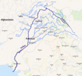
 Course and major tributaries of the Indus.jpg 2,409 × 2,497; 2.52 MB
-
 Flooding in pakistan-NASA satellite imagery.jpg 720 × 480; 169 KB
-
 FMIB 53152 Vallee sous-marine de l'Indus, d'apres M Thorpe.jpeg 322 × 498; 67 KB
-
 Indus (fleuve).png 515 × 461; 138 KB
-
 Indus Fan.jpg 487 × 542; 126 KB
-
 Indus flooding 2010 en.svg 856 × 726; 702 KB
-
 Indus River and Manchhar Lake.jpg 2,407 × 7,592; 3.23 MB
-
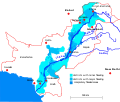
 Indus River basin map de.svg 603 × 472; 17.76 MB
-
 Indus River basin map.svg 603 × 472; 17.76 MB
-
 Indus river basin without boundaries of disputed regions.png 2,309 × 2,495; 599 KB
-
 Indus river basin.jpg 800 × 864; 328 KB
-
 Indus river mk.svg 2,309 × 2,495; 297 KB
-
 Indus river pl.svg 2,309 × 2,495; 172 KB
-
 Indus river-es.svg 2,309 × 2,495; 406 KB
-
 Indus river-hu.svg 2,309 × 2,495; 84 KB
-
 Indus river.svg 2,309 × 2,495; 172 KB
-
 Indus Sutlej River Basin.png 1,272 × 896; 1.61 MB
-
 Map India and Pakistan 1-250,000 Tile NI 43-12 Martselang.jpg 5,000 × 3,860; 4.16 MB
-

-
 Map of Asia, Mitchell's School Atlas LOC 2007633727-13 (cropped).jpg 3,117 × 2,378; 1.79 MB
-
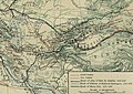
 Map of Central Asia with trade routes and movements, von Richthofen.png 2,034 × 1,227; 4.8 MB
-
 Map of Ladakh or Little Tibet (Klein Tubet) in 1858 Vorder-Asien (cropped).jpg 777 × 1,143; 473 KB
-
 Map of Tibet in 1831 from Ost-Indien Mit Den Inseln (cropped).jpg 1,898 × 981; 851 KB
-
 Mitchell's school atlas LOC 2007633727-13.jpg 3,402 × 2,814; 1.97 MB
-
 Mitchell's school atlas LOC 2007633727-13.tif 3,402 × 2,814; 27.39 MB
-
 Ost-Indien Mit Den Inseln.jpg 5,304 × 4,331; 7.17 MB
-
 Physical map of Tibet.png 833 × 490; 446 KB
-
 Pope1880Beluch2.jpg 930 × 1,200; 610 KB
-
 Punjab irrigation map, 1911.jpg 3,240 × 2,424; 1.09 MB
-
 Punjab rivers.jpg 1,000 × 965; 419 KB
-
 Relief-Inde.png 522 × 600; 189 KB
-
 Rivers and lakes topo map.png 1,000 × 1,138; 99 KB
-
 Sindh Samma Dynasty.jpg 676 × 804; 69 KB
-
 SourceFile of AncientRoad between Indus and AmuDarya.xcf 415 × 426; 2.57 MB
-

-

-
 TibetanPlateau.jpg 720 × 481; 329 KB
-
 Topografic map of Tibetan Plateau.png 1,365 × 732; 663 KB
-
 Txu-oclc-6654394-ni-44-3rd-ed.jpg 4,592 × 4,305; 6.06 MB
_(cropped).jpg)
.jpg)
.jpg)
%27_(11246944703).jpg)
,_map_of_Ladakh_(Petit_Thibet)_and_Map_of_Nepal_(Nepaul)_detail,_from-_Carte_des_sources_du_Gange,_de_l%27Indus_et_du_Broumapouter_au_nord_de_l%27Indoustan_et_au_Thibet_(34203873250)_(cropped).jpg)


.jpg)


.jpg)


.png)


_with_Lhasa_(Lassa)_capitol_and_India_(Hindoostan)_with_Calcutta_capitol_in_1839_from_Mitchell%27s_School_Atlas_LOC_2007633727-13_(cropped).jpg)
.jpg)

_in_1858_Vorder-Asien_(cropped).jpg)
.jpg)


_(14796674583).jpg)


