File:Perolles-See FR 01.jpg
Jump to navigation
Jump to search

Size of this preview: 800 × 533 pixels. Other resolutions: 320 × 213 pixels | 640 × 427 pixels | 1,024 × 683 pixels | 1,280 × 853 pixels | 2,560 × 1,707 pixels | 4,752 × 3,168 pixels.
Original file (4,752 × 3,168 pixels, file size: 3.06 MB, MIME type: image/jpeg)
Captions
Captions
Add a one-line explanation of what this file represents
Summary
[edit]| Description |
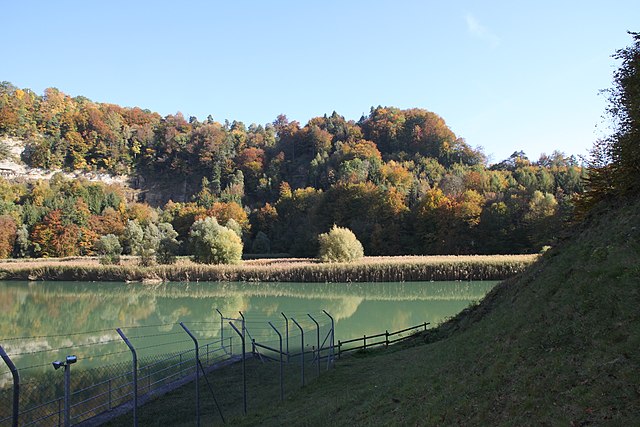
Deutsch: Blick auf den Perolles-See in der Magerau, Freiburg, Schweiz. Die Saane bildet ein bedeutendes Auengebiet, das sich von der Staumauer in der Magerau, wo sich der Perolles-See staut, bis unterhalb der Staumauer des Greyerzersees in Rossens erstreckt. Français : Vue sur le lac de Pérolles dans la Maigrauge, Fribourg, Suisse. La Sarine forme une importante zone alluviale qui s'étend du barrage de la Maigrauge, où s'accumule le lac de Pérolles, jusqu'en aval du barrage du lac de la Gruyère à Rossens. English: View of Lake Perolles in the Maigrauge, Fribourg, Switzerland. The Sarine forms an important alluvial zone stretching from the dam in the Maigrauge, where Lake Perolles is dammed, to below the dam of Lake Gruyère in Rossens. |
||
| Date | |||
| Source | Own work | ||
| Author | Martin Thurnherr | ||
| Permission (Reusing this file) |
|
||
| Protected |
|

| Object location | | View this and other nearby images on: OpenStreetMap |
|---|
Licensing
[edit]
I, the copyright holder of this work, hereby publish it under the following license:
This file is licensed under the Creative Commons Attribution-Share Alike 4.0 International license.
Attribution: Martin Thurnherr
- You are free:
- to share – to copy, distribute and transmit the work
- to remix – to adapt the work
- Under the following conditions:
- attribution – You must give appropriate credit, provide a link to the license, and indicate if changes were made. You may do so in any reasonable manner, but not in any way that suggests the licensor endorses you or your use.
- share alike – If you remix, transform, or build upon the material, you must distribute your contributions under the same or compatible license as the original.
File history
Click on a date/time to view the file as it appeared at that time.
| Date/Time | Thumbnail | Dimensions | User | Comment | |
|---|---|---|---|---|---|
| current | 20:34, 27 December 2022 | | 4,752 × 3,168 (3.06 MB) | Matutinho (talk | contribs) | {{Information |Description=Blick auf den Perolles-See |Source={{own}} |Date=2016-10-22 |Author= Martin Thurnherr |Permission={{User:Matutinho/Template:Credits}} |other_versions= |other fields = {{information field|name=Protected|value={{WDPA|148657}} }} }} Category:Lac de Pérolles Category:Alluvial sites of national importance (Switzerland) |
You cannot overwrite this file.
File usage on Commons
The following page uses this file:
File usage on other wikis
The following other wikis use this file:
- Usage on de.wikipedia.org