File:Péninsule ibérique en 1556.png
Jump to navigation
Jump to search

Size of this preview: 800 × 600 pixels. Other resolutions: 320 × 240 pixels | 640 × 480 pixels | 1,024 × 768 pixels | 1,280 × 960 pixels | 2,000 × 1,500 pixels.
Original file (2,000 × 1,500 pixels, file size: 974 KB, MIME type: image/png)
Captions
Captions
Add a one-line explanation of what this file represents
Summary[edit]
| Description |
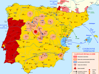
Français : Carte de la péninsule ibérique sous le règne de Charles Quint (1516-1556) |
| Date | |
| Source | Own work |
| Author | Elryck |
Licensing[edit]
I, the copyright holder of this work, hereby publish it under the following license:
This file is licensed under the Creative Commons Attribution-Share Alike 4.0 International license.
- You are free:
- to share – to copy, distribute and transmit the work
- to remix – to adapt the work
- Under the following conditions:
- attribution – You must give appropriate credit, provide a link to the license, and indicate if changes were made. You may do so in any reasonable manner, but not in any way that suggests the licensor endorses you or your use.
- share alike – If you remix, transform, or build upon the material, you must distribute your contributions under the same or compatible license as the original.
File history
Click on a date/time to view the file as it appeared at that time.
| Date/Time | Thumbnail | Dimensions | User | Comment | |
|---|---|---|---|---|---|
| current | 15:18, 27 August 2020 | | 2,000 × 1,500 (974 KB) | Elryck (talk | contribs) | Ajout des pogroms |
| 13:43, 24 August 2020 |  | 2,000 × 1,500 (936 KB) | Elryck (talk | contribs) | Uploaded own work with UploadWizard |
You cannot overwrite this file.
File usage on Commons
The following page uses this file:
File usage on other wikis
The following other wikis use this file:
- Usage on avk.wikipedia.org
- Usage on de.wikipedia.org
- Usage on fr.wikipedia.org
Metadata
Categories:
- French-language maps showing history of Europe
- Spain in the 16th century
- Maps of 16th-century Iberian Peninsula
- Maps of the history of Spain
- Territorial evolution of Spain
- Maps of the history of Portugal
- Revolt of the Comuneros
- Revolt of the Brotherhoods
- Charles V, Holy Roman Emperor
- Portugal in the 16th century