File:Ottoman Railway Company.png
Jump to navigation
Jump to search

Size of this preview: 800 × 293 pixels. Other resolutions: 320 × 117 pixels | 640 × 234 pixels | 1,024 × 375 pixels | 1,280 × 469 pixels | 3,248 × 1,190 pixels.
Original file (3,248 × 1,190 pixels, file size: 911 KB, MIME type: image/png)
Captions
Captions
Add a one-line explanation of what this file represents
Summary
[edit]
| Description |
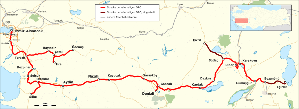
Deutsch: Karte der Ottoman Railway Company im Zustand von 2015 |
| Date | |
| Source |
Map was created by using
|
| Author |
|
| Permission (Reusing this file) |
Map data (c) OpenStreetMap (and) contributors, CC-BY-SA |
Licensing
[edit]
This file is licensed under the Creative Commons Attribution-Share Alike 2.0 Generic license.
- You are free:
- to share – to copy, distribute and transmit the work
- to remix – to adapt the work
- Under the following conditions:
- attribution – You must give appropriate credit, provide a link to the license, and indicate if changes were made. You may do so in any reasonable manner, but not in any way that suggests the licensor endorses you or your use.
- share alike – If you remix, transform, or build upon the material, you must distribute your contributions under the same or compatible license as the original.
| This work is licensed under the Open Database License (summary). |
File history
Click on a date/time to view the file as it appeared at that time.
| Date/Time | Thumbnail | Dimensions | User | Comment | |
|---|---|---|---|---|---|
| current | 20:27, 2 February 2016 | 3,248 × 1,190 (911 KB) | Pechristener (talk | contribs) | Stationspunkte bei Purdur und und Isparta | |
| 20:23, 2 February 2016 | 3,248 × 1,190 (911 KB) | Pechristener (talk | contribs) | fine tuning in der Legende | ||
| 02:09, 31 January 2016 | 3,248 × 1,190 (911 KB) | Pechristener (talk | contribs) | yellow background got lost in last edit | ||
| 02:05, 31 January 2016 | 3,248 × 1,190 (910 KB) | Pechristener (talk | contribs) | location map added | ||
| 13:41, 29 January 2016 | 3,248 × 1,190 (604 KB) | Kopiersperre (talk | contribs) | optipng | ||
| 20:35, 28 January 2016 | 3,248 × 1,190 (858 KB) | Pechristener (talk | contribs) | fine tuning | ||
| 20:29, 28 January 2016 | 3,248 × 1,190 (858 KB) | Pechristener (talk | contribs) | some erroneous station points removed | ||
| 20:21, 28 January 2016 | 3,248 × 1,190 (858 KB) | Pechristener (talk | contribs) | {{Information |Description={{de|1=Karte der Ottoman Railway Company im Zustand von 2015}} |Source = Map was created using [http://www.openstreetmap.org/ Open Street Map] Data |Author = * [[User:Pechriste... |
You cannot overwrite this file.
File usage on Commons
The following 9 pages use this file:
- User:Chumwa/OgreBot/Potential transport maps/2016 February 1-9
- User:Chumwa/OgreBot/Potential transport maps/2016 January 21-31
- User:Chumwa/OgreBot/Public transport information/2016 February 1-9
- User:Chumwa/OgreBot/Public transport information/2016 January 21-31
- User:Chumwa/OgreBot/Transport Maps/2016 February 1-9
- User:Chumwa/OgreBot/Transport Maps/2016 January 21-31
- User:Chumwa/OgreBot/Travel and communication maps/2016 February 1-9
- User:Chumwa/OgreBot/Travel and communication maps/2016 January 21-31
- Category:İzmir–Eğirdir railway
File usage on other wikis
The following other wikis use this file:
- Usage on de.wikipedia.org
- Usage on tr.wikipedia.org
- Usage on www.wikidata.org