File:NOAA 12281.pdf
Jump to navigation
Jump to search

Size of this JPG preview of this PDF file: 759 × 600 pixels. Other resolutions: 304 × 240 pixels | 608 × 480 pixels | 972 × 768 pixels | 1,280 × 1,011 pixels | 2,560 × 2,023 pixels | 6,106 × 4,825 pixels.
Original file (6,106 × 4,825 pixels, file size: 4.78 MB, MIME type: application/pdf)
Captions
Captions
Add a one-line explanation of what this file represents
Summary[edit]
| Description |
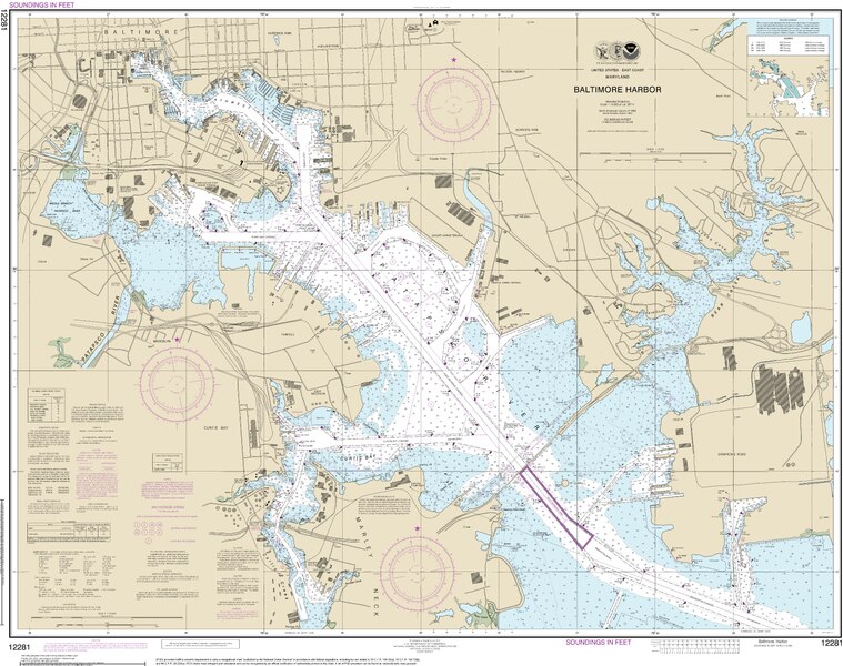
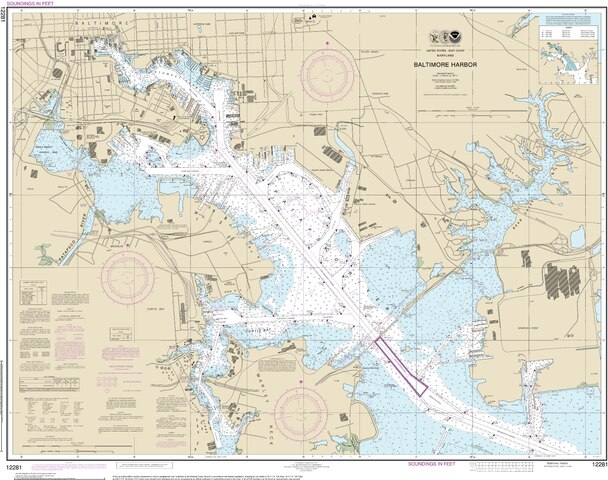
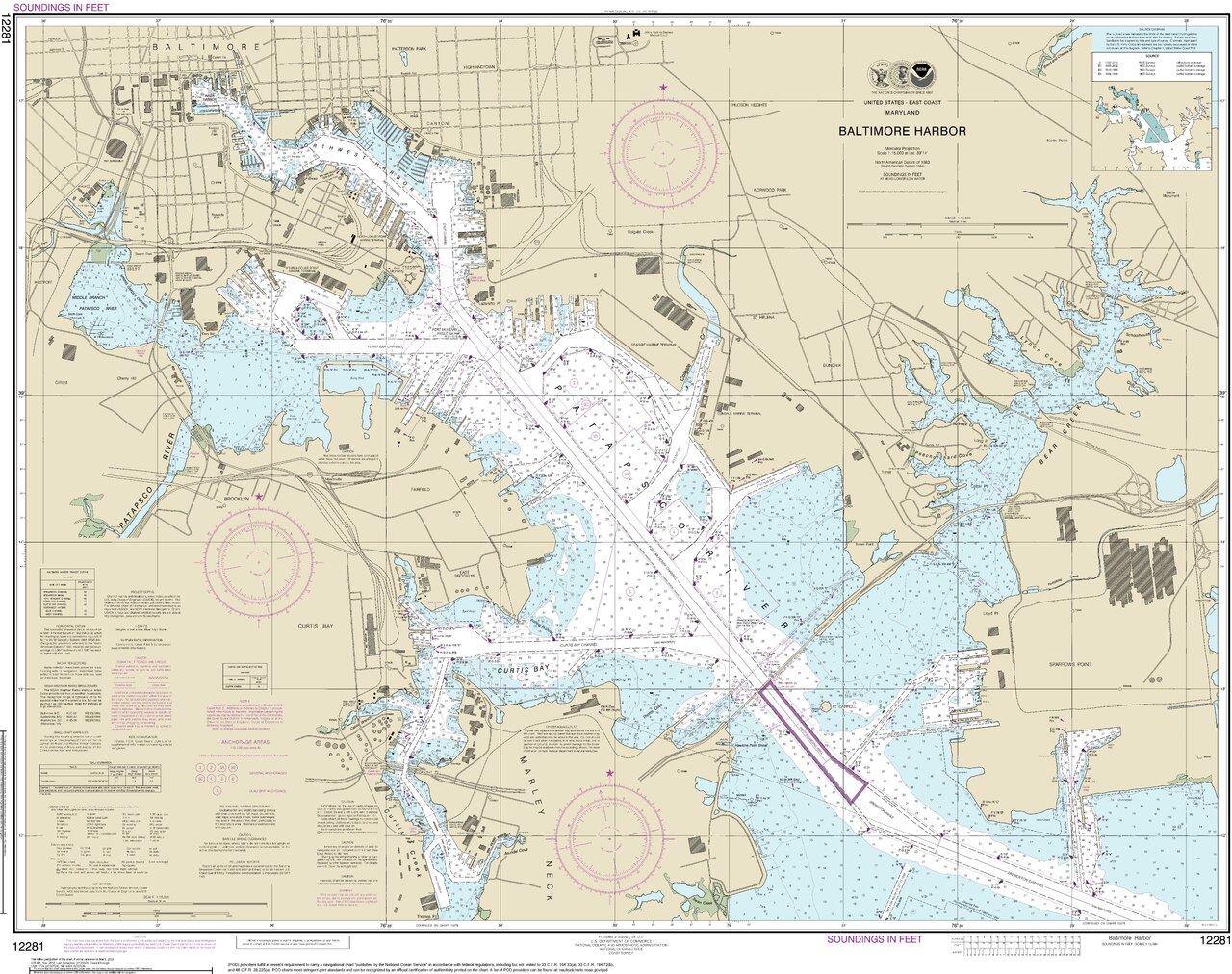
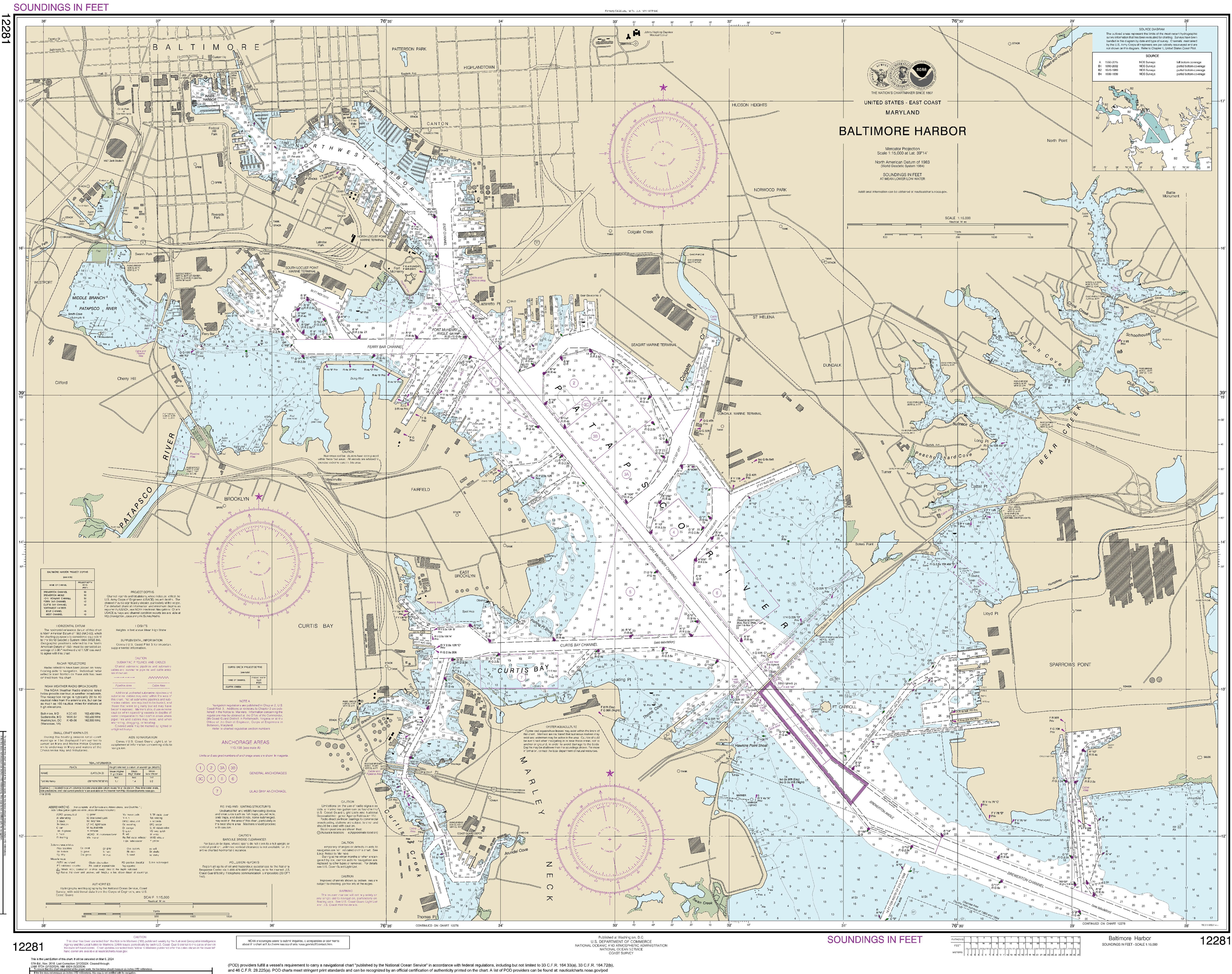
English: Navigational chart of Baltimore Harbor (Chart 12281, 57th Ed. Nov. 2018, last corrected 2024-02-12). |
|||
| Date | ||||
| Source | [1] | |||
| Author | National Oceanic and Atmospheric Administration. | |||
| Permission (Reusing this file) |
|
File history
Click on a date/time to view the file as it appeared at that time.
| Date/Time | Thumbnail | Dimensions | User | Comment | |
|---|---|---|---|---|---|
| current | 19:13, 30 March 2024 |  | 6,106 × 4,825 (4.78 MB) | Fvasconcellos (talk | contribs) | {{Information |description={{en|1=Navigational chart of Baltimore Harbor (Chart 12281, 57th Ed. Nov. 2018, last corrected 2024-02-12).}} |date=2024-02-12 |source=[https://www.charts.noaa.gov/PDFs/12281.pdf] |author={{w|National Oceanic and Atmospheric Administration}}. |permission={{PD-USGov-NOAA}} }} Category:Nautical charts of the United States |
You cannot overwrite this file.
File usage on Commons
There are no pages that use this file.