File:Map of the District of Columbia including the cities of Washington, Georgetown, and Alexandria, Virginia. LOC 88693472.tif
Jump to navigation
Jump to search

Size of this JPG preview of this TIF file: 800 × 517 pixels. Other resolutions: 320 × 207 pixels | 640 × 414 pixels | 1,024 × 662 pixels | 1,280 × 828 pixels | 2,560 × 1,656 pixels | 7,825 × 5,061 pixels.
Original file (7,825 × 5,061 pixels, file size: 113.3 MB, MIME type: image/tiff)
Captions
Captions
Add a one-line explanation of what this file represents
Summary[edit]
| Description |
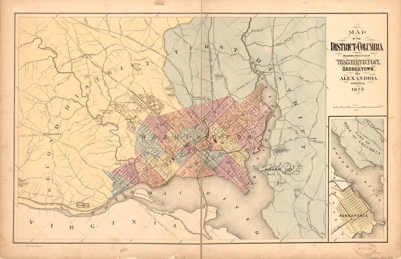
English: Shows wards and districts. Oriented with north toward the upper left. Includes ancillary map of Alexandria. LC copy 1 quartered, trimmed, has center section cut out, and mounted on cloth backing. Copy 2 fold-lined. Available also through the Library of Congress Web site as a raster image. DCP 2 copies |
||
| Title | Map of the District of Columbia including the cities of Washington, Georgetown, and Alexandria, Virginia. | ||
| Shelf ID | G3850 1873 .M3 | ||
| Date | |||
| Source | https://www.loc.gov/item/88693472/ | ||
| Author | Unknown author | ||
| Permission (Reusing this file) |
|
||
| Other versions |
|
||
| Location | Washington D.C. · Georgetown · Alexandria · Washington · Virginia · United States · District Of Columbia | ||
| Part of | American Memory · Cities And Towns · Catalog · Geography And Map Division | ||
| Subject | Washington (D.C.) · Alexandria · Georgetown · Washington · Virginia · United States · Maps · District Of Columbia · Georgetown (Washington, D.C.) · Alexandria (Va.) |


Licensing[edit]
|
This is a faithful photographic reproduction of a two-dimensional, public domain work of art. The work of art itself is in the public domain for the following reason:
The official position taken by the Wikimedia Foundation is that "faithful reproductions of two-dimensional public domain works of art are public domain".
This photographic reproduction is therefore also considered to be in the public domain in the United States. In other jurisdictions, re-use of this content may be restricted; see Reuse of PD-Art photographs for details. | ||||
File history
Click on a date/time to view the file as it appeared at that time.
| Date/Time | Thumbnail | Dimensions | User | Comment | |
|---|---|---|---|---|---|
| current | 23:04, 4 June 2018 |  | 7,825 × 5,061 (113.3 MB) | Fæ (talk | contribs) | LOC Maps https://www.loc.gov/item/88693472/ #5027 |
You cannot overwrite this file.
File usage on Commons
The following page uses this file: