File:Map of Suriname with Neighboring countries.png
Jump to navigation
Jump to search

Size of this preview: 800 × 522 pixels. Other resolutions: 320 × 209 pixels | 640 × 418 pixels | 1,024 × 668 pixels | 1,280 × 836 pixels | 2,560 × 1,671 pixels | 8,946 × 5,840 pixels.
Original file (8,946 × 5,840 pixels, file size: 1.01 MB, MIME type: image/png)
Captions
Captions
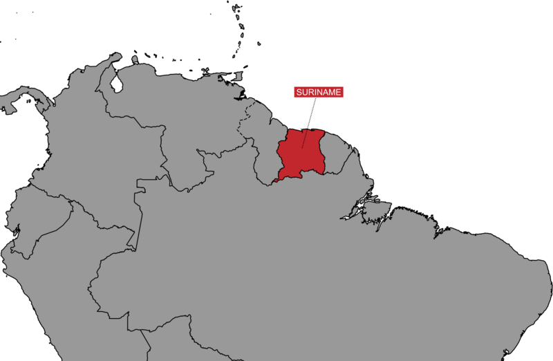
Map showing the location of Suriname on the continent of South America. you See Guyana to the west, Brazil to the south and French Guiana to the East.
Summary[edit]
| Description |
English: Map showing the location of Suriname on the continent of South America. you See Guyana to the west, Brazil to the south and French Guiana to the East. Map is shown from the Surinamese POV |
| Date | |
| Source | Own work |
| Author | SurinameCentral |
Licensing[edit]
I, the copyright holder of this work, hereby publish it under the following license:
This file is licensed under the Creative Commons Attribution-Share Alike 4.0 International license.
- You are free:
- to share – to copy, distribute and transmit the work
- to remix – to adapt the work
- Under the following conditions:
- attribution – You must give appropriate credit, provide a link to the license, and indicate if changes were made. You may do so in any reasonable manner, but not in any way that suggests the licensor endorses you or your use.
- share alike – If you remix, transform, or build upon the material, you must distribute your contributions under the same or compatible license as the original.
File history
Click on a date/time to view the file as it appeared at that time.
| Date/Time | Thumbnail | Dimensions | User | Comment | |
|---|---|---|---|---|---|
| current | 23:30, 12 January 2024 | | 8,946 × 5,840 (1.01 MB) | SurinameCentral (talk | contribs) | Label box Suriname text added, border corrections |
| 13:44, 11 December 2022 |  | 8,946 × 5,840 (892 KB) | SurinameCentral (talk | contribs) | Uploaded own work with UploadWizard |
You cannot overwrite this file.
File usage on Commons
The following page uses this file:
File usage on other wikis
The following other wikis use this file:
- Usage on nl.wikipedia.org