Category:Maps of Suriname (territory claimed by Suriname)
Jump to navigation
Jump to search
Media in category "Maps of Suriname (territory claimed by Suriname)"
The following 182 files are in this category, out of 182 total.
-
 134 bevolkingsmeerderheid per ressort.png 1,281 × 920; 39 KB
-
 2020 Surinamese general election - Most voted party by district.svg 1,181 × 1,205; 328 KB
-
 2020 Surinamese general election - Results.svg 512 × 473; 268 KB
-
 2020 Zetels in DNA.jpg 2,200 × 2,544; 352 KB
-
 All Districts.jpg 601 × 670; 74 KB
-
 Argentina Suriname Locator.svg 595 × 595; 752 KB
-
 Base Map of Suriname With Correct River Names.jpg 1,102 × 749; 299 KB
-
 Black Map shape Suriname with Flag.svg 1,062 × 1,085; 12 KB
-
 Borders of Suriname - Grenzen van Suriname.svg 842 × 1,032; 371 KB
-
 Brazil Suriname Locator with Correct Borders.png 768 × 712; 16 KB
-
 Brazil Suriname Locator.svg 595 × 595; 769 KB
-
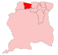
 Brokopondo resorts.svg 842 × 595; 301 KB
-
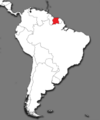
 Colombia Suriname Locator.svg 595 × 595; 732 KB
-
 Commewijne resorts.svg 842 × 595; 219 KB
-
 Correct map of Suriname With District Names.jpg 2,310 × 2,593; 334 KB
-
 District Sipaliwini in Suriname.svg 1,181 × 1,205; 262 KB
-
 Districten kaart van Suriname.svg 842 × 1,108; 1.42 MB
-
 Districts of Suriname.png 3,507 × 4,960; 220 KB
-
 Divisão Política do Suriname correcta.png 2,370 × 2,336; 464 KB
-
 Divisão Política do Suriname Corrected.png 2,271 × 2,241; 258 KB
-
 Ecuador Suriname Locator.svg 595 × 595; 720 KB
-
 Falkland Islands Suriname Locator.svg 595 × 595; 711 KB
-
 Flag Map of Dutch Suriname 1954 -1975.png 2,558 × 2,658; 188 KB
-
 Flag Map of Suriname.svg 827 × 791; 44 KB
-
 Flag-map of Suriname.png 529 × 484; 17 KB
-
 French Guiana Suriname Locator.svg 595 × 595; 709 KB
-
 Geologische kaart van Suriname.png 2,385 × 3,339; 1.57 MB
-
 Green Map of Suriname with Districts and Capitals per district.png 2,226 × 2,373; 235 KB
-
 Guyana Suriname Locator.svg 595 × 595; 715 KB
-
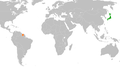 Japan Suriname Locator Corrected.png 1,958 × 1,096; 281 KB
-
 Kaart van Boven-Corantijn en Corantijn Rivier - Suriname.svg 842 × 1,032; 361 KB
-
 Kaart van Coeroeni Rivier - Suriname.svg 842 × 1,032; 345 KB
-
 Kaart van Coeroeni-Kutari-Sipaliwini Rivier - Suriname.svg 842 × 1,032; 293 KB
-
 Kaart van Commewijne - Cottica Rivier - Suriname.svg 842 × 1,032; 313 KB
-
 Kaart van Coppename-Linker- en Rechter Coppename Rivier - Suriname.svg 842 × 1,032; 329 KB
-
 Kaart van Kabalebo Rivier - Suriname.svg 842 × 1,032; 339 KB
-
 Kaart van Kutari Rivier - Suriname.svg 842 × 1,032; 343 KB
-
 Kaart van Litani Rivier - Suriname.svg 842 × 1,032; 298 KB
-
 Kaart van Lucie Rivier - Suriname.svg 842 × 1,032; 341 KB
-
 Kaart van Marowini - Lawa - Marowijne Rivier - Suriname.svg 842 × 1,032; 304 KB
-
 Kaart van Nickerie Rivier - Suriname.svg 842 × 1,032; 336 KB
-
 Kaart van Oelemarie Rivier - Suriname.svg 842 × 1,032; 296 KB
-
 Kaart van Oronoque Rivier - Suriname.svg 842 × 1,032; 351 KB
-
 Kaart van Palumeu Rivier - Suriname.svg 842 × 1,032; 292 KB
-
 Kaart van Saramacca en Kleine Saramacca Rivier - Suriname.svg 842 × 1,032; 322 KB
-
 Kaart van Sipaliwini Rivier - Suriname.svg 842 × 1,032; 343 KB
-
 Kaart van Suriname (Grenzen,Rivieren,Wegen,Plaatsen).png 5,952 × 6,632; 1.76 MB
-
 Kaart van Suriname - Map of Suriname.png 8,417 × 5,952; 1.9 MB
-
 Kaart van Suriname-Gran Rio- Pikin Rio en Van Blommensteinmeer - Suriname.svg 842 × 1,032; 317 KB
-
 Kaart van Suriname.png 300 × 300; 198 KB
-
 Kaart van Tapanahony Rivier - Suriname.svg 842 × 1,032; 290 KB
-
 Kaartsuriname 2.gif 487 × 481; 71 KB
-
 Koppen-Geiger Map SURINAME present.svg 512 × 371; 377 KB
-
 LGBT flag map of Suriname.png 2,558 × 2,658; 109 KB
-
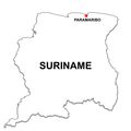
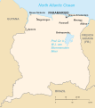
 Location Suriname.jpg 250 × 115; 9 KB
-
 Location Suriname.svg 1,000 × 500; 341 KB
-
 Location-Suriname.png 250 × 115; 7 KB
-
 Map of Suriname - Army Green.png 3,000 × 3,000; 181 KB
-
 Map of Suriname - Athletic Gold.png 3,000 × 3,000; 188 KB
-
 Map of Suriname - Black.png 3,000 × 3,000; 113 KB
-
 Map of Suriname - Blue.png 3,000 × 3,000; 177 KB
-
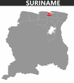
 Map of Suriname - Brokopondo Highlight.png 2,310 × 2,593; 206 KB
-
 Map of Suriname - Brown.png 3,000 × 3,000; 182 KB
-
 Map of Suriname - Burgundy.png 3,000 × 3,000; 183 KB
-
 Map of Suriname - Charcoal Grey.png 3,000 × 3,000; 189 KB
-
 Map of Suriname - Commewijne Highlight.png 2,310 × 2,593; 211 KB
-
 Map of Suriname - Coronie Highlight.png 2,310 × 2,593; 211 KB
-
 Map of Suriname - Corrected.jpg 640 × 320; 80 KB
-
 Map of Suriname - Forest Green.png 3,000 × 3,000; 179 KB
-
 Map of Suriname - Green.png 3,000 × 3,000; 175 KB
-
 Map of Suriname - Grey.png 3,000 × 3,000; 191 KB
-
 Map of Suriname - Hot Pink.png 3,000 × 3,000; 188 KB
-
 Map of Suriname - Marowijne Highlight.png 2,310 × 2,593; 212 KB
-
 Map of Suriname - Metallic Gold.png 3,000 × 3,000; 194 KB
-
 Map of Suriname - Metallic Silver.png 3,000 × 3,000; 196 KB
-
 Map of Suriname - Navy Blue.png 3,000 × 3,000; 177 KB
-
 Map of Suriname - Nickerie Highlight.png 2,310 × 2,593; 214 KB
-
 Map of Suriname - Orange.png 3,000 × 3,000; 176 KB
-
 Map of Suriname - Para Highlight.png 2,310 × 2,593; 210 KB
-
 Map of Suriname - Paramaribo Highlight.png 2,310 × 2,593; 216 KB
-
 Map of Suriname - Purple.png 3,000 × 3,000; 188 KB
-
 Map of Suriname - Red.png 3,000 × 3,000; 183 KB
-
 Map of Suriname - Reflex Blue.png 3,000 × 3,000; 179 KB
-
 Map of Suriname - Saramacca Highlight.png 2,310 × 2,593; 211 KB
-
 Map of Suriname - Sipaliwini Highlight.png 2,310 × 2,593; 192 KB
-
 Map of Suriname - Teal.png 3,000 × 3,000; 177 KB
-
 Map of Suriname - Wanica Highlight.png 2,310 × 2,593; 212 KB
-
 Map of Suriname - White.png 3,000 × 3,000; 188 KB
-
 Map of Suriname - Yellow.png 3,000 × 3,000; 181 KB
-
 Map of Suriname Black Fill and Golden District Borders.svg 842 × 1,190; 220 KB
-
 Map of Suriname Black Shadow.jpg 2,480 × 2,459; 191 KB
-
 Map of Suriname Blue Shadow.jpg 2,480 × 2,459; 343 KB
-
 Map of Suriname Green Shadow.jpg 2,480 × 2,459; 349 KB
-
 Map of Suriname Grey Shadow.jpg 2,480 × 2,459; 246 KB
-
 Map of Suriname Orange Shadow.jpg 2,480 × 2,459; 363 KB
-
 Map of Suriname Pink Shadow.jpg 2,480 × 2,459; 355 KB
-
 Map of Suriname Red Shadow.jpg 2,480 × 2,459; 351 KB
-
 Map of Suriname White Shadow.jpg 2,480 × 2,459; 255 KB
-
 Map of Suriname with Borders as claimed by Suriname and Venezuela.png 1,558 × 1,676; 563 KB
-
 Map of Suriname with Coat of Arms and Flag.svg 841 × 595; 390 KB
-
 Map of Suriname with Correct border Rivers and place names.png 1,603 × 1,744; 571 KB
-
 Map of Suriname with Neighboring countries.png 8,946 × 5,840; 1.01 MB
-
 Map of Suriname with Place Names.png 3,507 × 2,480; 574 KB
-
 Map of Suriname Yellow Shadow.jpg 2,480 × 2,459; 324 KB
-
 Map of the Guianas - Guyana, Suriname and French Guiana.png 2,400 × 1,800; 2.5 MB
-
 Map of the Guianas Neutral.svg 842 × 595; 213 KB
-
 Map of Tigri Area Suriname.png 2,523 × 1,785; 3.35 MB
-
 Marowijne resorts.svg 842 × 595; 336 KB
-
 Nickerie Resorts.svg 842 × 595; 374 KB
-
 Official borders of the Republic of Suriname 2.png 2,800 × 1,700; 456 KB
-
 Official borders of the Republic of Suriname.png 3,280 × 2,168; 573 KB
-
 Orthographic map of Suriname Showing the Correct Borders.png 2,292 × 2,292; 708 KB
-
 Orthographic suriname.jpg 547 × 539; 67 KB
-
 Overview map of Suriname.png 2,270 × 2,322; 233 KB
-
 Para resorts.svg 842 × 595; 275 KB
-
 Paraguay Suriname Locator.svg 595 × 595; 715 KB
-
 Paramaribo Suriname Ressorts 2023.png 1,056 × 816; 27 KB
-
 Peru Suriname Locator.svg 595 × 595; 730 KB
-
 Real - Correct Map of Suriname - White with Coat of Arms and Shadow.jpg 2,480 × 2,459; 837 KB
-
 Real - Correct Map of Suriname - White with Coat of Arms without Shadow.jpg 2,480 × 2,459; 806 KB
-
 Real - Correct Map of Suriname 50 % Transparency.jpg 2,480 × 2,459; 665 KB
-
 Real - Correct Map of Suriname Coat of arms and flag.jpg 2,480 × 2,459; 972 KB
-
 Real - Correct Map of Suriname Coat of Arms with Flag.jpg 2,480 × 2,459; 845 KB
-
 Real - Correct Map of Suriname Coat of Arms with Transparent Flag.jpg 2,480 × 2,459; 925 KB
-
 Real Flag-map of Suriname.svg 400 × 366; 95 KB
-
 Real Map of Suriname showing the Correct Borders.png 4,167 × 4,167; 275 KB
-
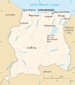
 Rivers of Suriname.png 4,000 × 4,332; 971 KB
-
 Saramacca Resorts.svg 842 × 595; 305 KB
-
 Sipaliwini Resorts.svg 842 × 595; 1.43 MB
-
 Surinaamse districten 1966-1985.jpg 4,128 × 3,096; 3.62 MB
-
 Flag Map of Suriname.png 481 × 479; 5 KB
-
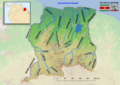
 Suriname - Location Map (2022) - SUR.png 800 × 800; 244 KB
-
 Suriname administrative divisions - ukr -.png 4,924 × 5,023; 1.11 MB
-
 Suriname administrative divisions with Correct River Names.png 4,924 × 5,023; 1.21 MB
-
 Suriname border rivers true names.png 5,656 × 4,000; 1.09 MB
-
 Suriname Border, River and Road Network.svg 992 × 850; 460 KB
-
 Suriname District Numbers.svg 595 × 612; 198 KB
-
 Suriname districts blank.svg 595 × 558; 154 KB
-
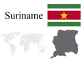 Suriname Flag, Map and Locator.png 4,000 × 3,000; 585 KB
-
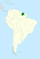
 Suriname Highlighted on Map of South America.png 3,905 × 4,697; 901 KB
-
 Suriname Highlighted on the Map of South America.png 4,921 × 7,217; 1.34 MB
-
 Suriname in South America Corrected.png 1,100 × 1,432; 37 KB
-

-
 Suriname Location Map with Flag.svg 949 × 842; 782 KB
-
 Suriname Location on World Map.png 7,560 × 3,571; 823 KB
-
 Suriname Locator - South America.png 4,167 × 4,167; 6.72 MB
-
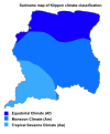 Suriname map of Köppen climate classification Correct.svg 3,000 × 3,604; 61 KB
-
 Suriname Map Shape Black and White.svg 1,814 × 1,100; 22 KB
-
 Suriname Map Shape with Capital Paramaribo.png 3,000 × 3,000; 359 KB
-
 Suriname Map With Flag.svg 850 × 850; 611 KB
-
 Suriname map.png 370 × 357; 31 KB
-
 Suriname Population Density 2012.svg 1,182 × 1,223; 228 KB
-
 Suriname Resorts Updated.svg 822 × 832; 324 KB
-
 Suriname River Map.png 6,000 × 4,242; 39.19 MB
-
 Suriname Shape with Blue Background.svg 567 × 567; 57 KB
-
 Suriname Simple Map 1.svg 842 × 947; 233 KB
-
 Suriname Simple Map 2.svg 842 × 947; 317 KB
-
 Suriname Switzerland Locator Corrected.png 1,464 × 1,216; 53 KB
-
 Suriname Territorial Integrity.png 2,000 × 1,333; 1.6 MB
-
 Suriname With Districts - Blanc.jpg 2,310 × 2,593; 318 KB
-
 Flag map of Greater Suriname.png 1,749 × 1,813; 54 KB
-
 Suriname-Brokopondo.svg 595 × 558; 154 KB
-
 Suriname-Commewijne.svg 595 × 558; 154 KB
-
 Suriname-Coronie.svg 595 × 558; 154 KB
-
 Suriname-Marowijne.svg 595 × 558; 154 KB
-
 Suriname-Nickerie.svg 595 × 558; 154 KB
-
 Suriname-Oppervlakte per district - Area per district in km2.svg 842 × 972; 441 KB
-
 Suriname-Para.svg 595 × 558; 154 KB
-
 Suriname-Paramaribo.svg 595 × 558; 154 KB
-
 Suriname-Saramacca.svg 595 × 558; 154 KB
-
 Suriname-Sipaliwini.svg 595 × 558; 154 KB
-
 Suriname-Wanica.svg 595 × 558; 154 KB
-
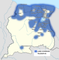 Telesur Suriname 4G Coverage Map 2021.png 1,181 × 1,205; 577 KB
-
 The 10 Districts of Suriname - De 10 districten van Suriname.svg 595 × 612; 304 KB
-
 Topografisch Kaart van Suriname.jpg 800 × 855; 764 KB
-
 Topographic Border Map Suriname.jpg 2,480 × 2,580; 4.36 MB
-
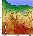
 Topographic Map of Suriname.png 910 × 927; 1.59 MB
-
 Tribal communities Suriname.png 1,886 × 1,628; 1.35 MB
-
 Uruguay Suriname Locator.svg 595 × 595; 709 KB
-
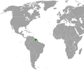
 Venezuela Suriname Locator.svg 595 × 595; 730 KB
-
 Wanica resorts.png 955 × 654; 14 KB
-
 Welcome to Suriname Card.png 1,840 × 2,436; 92 KB


.png)


_-_SUR.png)


