File:Map new zealand volcanoes.gif
Jump to navigation
Jump to search

Size of this preview: 367 × 600 pixels. Other resolutions: 147 × 240 pixels | 294 × 480 pixels | 727 × 1,188 pixels.
Original file (727 × 1,188 pixels, file size: 82 KB, MIME type: image/gif, 0.1 s)
Captions
Captions
Add a one-line explanation of what this file represents
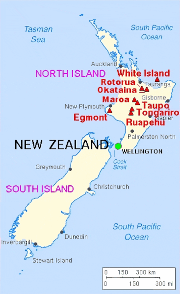
| Description | Major Volcanoes of New Zealand. | |||
| Date | ||||
| Source | Archived source link | |||
| Author | Lyn Topinka, USGS; base map from CIA, 1997; volcanoes from Simkin and Siebert, 1994 | |||
| Permission (Reusing this file) |
|
File history
Click on a date/time to view the file as it appeared at that time.
| Date/Time | Thumbnail | Dimensions | User | Comment | |
|---|---|---|---|---|---|
| current | 05:13, 11 April 2024 | | 727 × 1,188 (82 KB) | Hike395 (talk | contribs) | high resolution |
| 13:32, 16 February 2014 |  | 363 × 594 (13 KB) | Hike395 (talk | contribs) | Crop title, logo, border, credit line | |
| 09:44, 19 January 2005 |  | 377 × 722 (19 KB) | GarciaB~commonswiki (talk | contribs) | Map of Newzeeland volcanoes |
You cannot overwrite this file.
File usage on Commons
The following 2 pages use this file:
File usage on other wikis
The following other wikis use this file:
- Usage on el.wikipedia.org
- Usage on en.wikipedia.org
- Usage on es.wikipedia.org
- Usage on fi.wikipedia.org
- Usage on id.wikipedia.org
- Usage on ja.wikipedia.org
- Usage on nn.wikipedia.org
- Usage on pl.wikipedia.org
- Usage on sl.wikipedia.org
- Usage on sv.wikipedia.org
- Usage on tr.wikipedia.org