Category:Maps of volcanoes in New Zealand
Jump to navigation
Jump to search
Subcategories
This category has the following 16 subcategories, out of 16 total.
Media in category "Maps of volcanoes in New Zealand"
The following 20 files are in this category, out of 20 total.
-
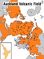 Auckland Volcanic Field.jpg 1,536 × 2,048; 585 KB
-
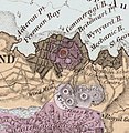 AucklandMapHochstetter1859 - Albert Park and Grafton Volcanoes crop.jpg 892 × 916; 267 KB
-
 Cartographic reliefs of Tongariro National Park.jpg 4,086 × 3,041; 9.5 MB
-
 Champagne Pool Map.jpg 829 × 692; 161 KB
-
 CurtisM.png 700 × 530; 194 KB
-
 Geology map of Karioi, Pirongia, Kakepuku and Te Kawa.jpg 886 × 596; 394 KB
-
 Kermadec Arc.jpg 585 × 897; 172 KB
-
 Map and Cross Section of Taranaki Basin.jpg 500 × 791; 44 KB
-
 Map new zealand volcanoes.gif 727 × 1,188; 82 KB
-
 Mayor Island dive map.png 3,000 × 2,684; 792 KB
-
 Mount Wellington, or Maunga Rei, near Auckland (circa 1860).jpg 778 × 609; 187 KB
-
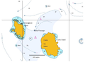
 NZ-Auckland Rangitoto map.png 378 × 423; 28 KB
-
 NZ-OneTreeHill.png 589 × 701; 104 KB
-
 Ohakuri.Rotorua.Paired.Eruptions.Rift.Zone.North.Island.NZ.jpg 1,302 × 1,506; 558 KB
-
 PSM V25 D513 Hot springs near bay of plenty new zealand.jpg 1,200 × 1,959; 264 KB
-
 Rotorua.Caldera.Mount.Tarawera.JPG 1,280 × 948; 399 KB
-
 Taupo.Volcanic.Zone.North.Island.NZ.JPG 616 × 864; 104 KB
-
 Transactions and proceedings of the New Zealand Institute (1913) (14767127214).jpg 1,758 × 2,822; 878 KB
-
-
 White Island (Whakari) Map.jpg 664 × 513; 116 KB


.jpg)


.jpg)
_Map.jpg)
_(14767127214).jpg)