File:Map-of-Summit-Co.-Ohio-1856-Library-of-Congress.pdf
Jump to navigation
Jump to search

Size of this JPG preview of this PDF file: 463 × 599 pixels. Other resolutions: 185 × 240 pixels | 371 × 480 pixels | 593 × 768 pixels | 1,275 × 1,650 pixels.
Original file (1,275 × 1,650 pixels, file size: 24.64 MB, MIME type: application/pdf)
Captions
Captions
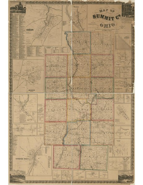
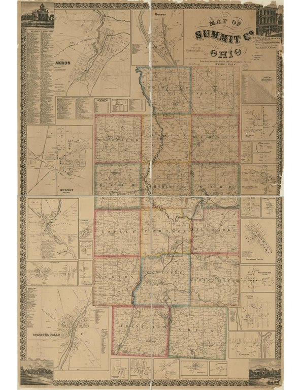
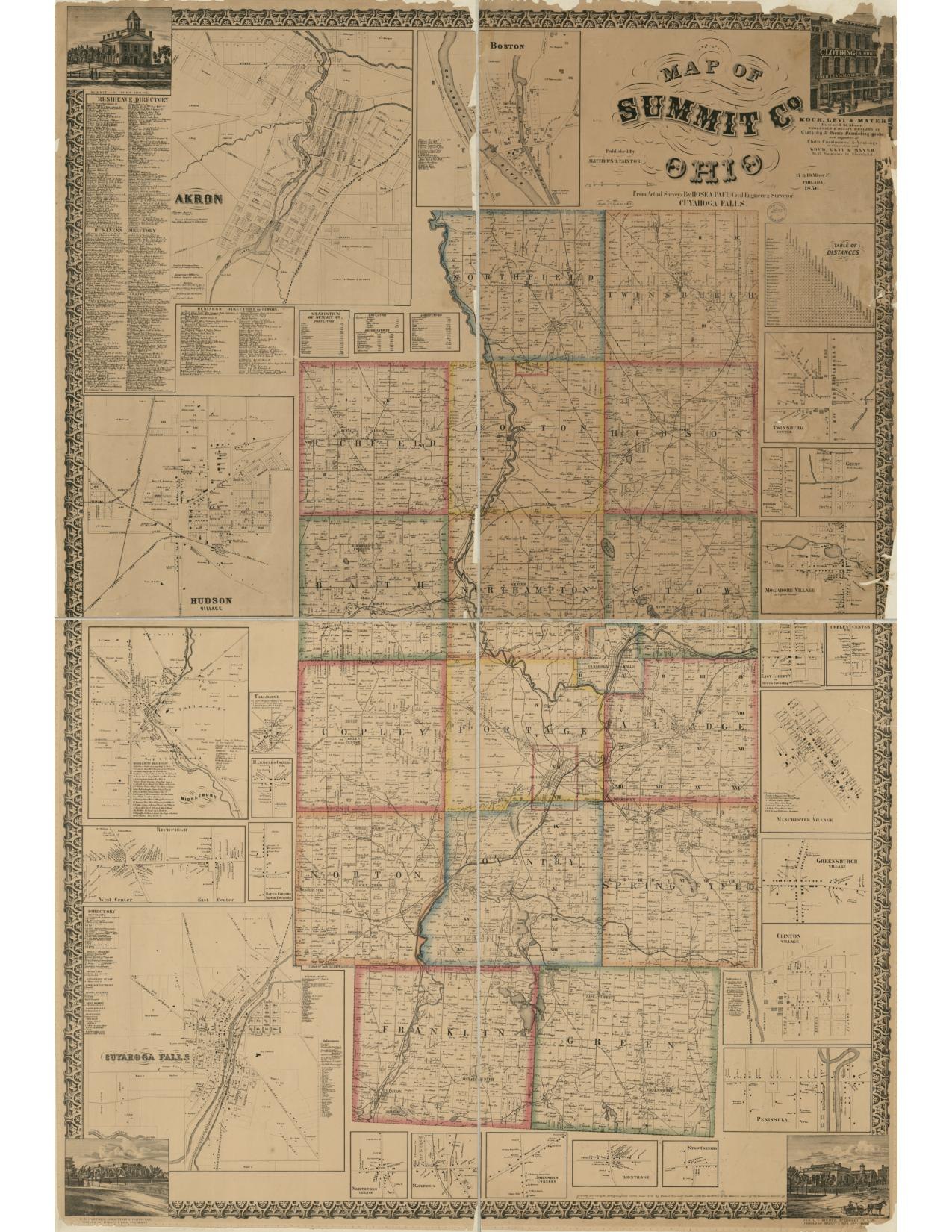
Summit County, Ohio 1856 showing Townships, Villages, Towns, & Cities.
Summary[edit]
| Description |
English: Akron, Bath Township, Boston, Copley, Coventry, Cuyahoga Falls, Franklln, Green Township, Hudson, North Field, North Hampton, Norton, Portage Township, Richfield, Stow, Springfield Township, Tallmadge, Twinsburg |
| Date | |
| Source | https://www.loc.gov/item/2012592394/ |
| Author |
Library of Congress, Summit County, Ohio, Housa Paul, Civil Engineer & Surveyor, Cuyahoga Falls, Ohio |
Licensing[edit]
This work is in the public domain in the United States because it is a work prepared by an officer or employee of the United States Government as part of that person’s official duties under the terms of Title 17, Chapter 1, Section 105 of the US Code.
Note: This only applies to original works of the Federal Government and not to the work of any individual U.S. state, territory, commonwealth, county, municipality, or any other subdivision. This template also does not apply to postage stamp designs published by the United States Postal Service since 1978. (See § 313.6(C)(1) of Compendium of U.S. Copyright Office Practices). It also does not apply to certain US coins; see The US Mint Terms of Use.
|
 | |
| This file has been identified as being free of known restrictions under copyright law, including all related and neighboring rights. | ||
File history
Click on a date/time to view the file as it appeared at that time.
| Date/Time | Thumbnail | Dimensions | User | Comment | |
|---|---|---|---|---|---|
| current | 19:38, 7 September 2022 |  | 1,275 × 1,650 (24.64 MB) | McKnight Buchanan (talk | contribs) | Uploaded a work by Library of Congress, Summit County, Ohio, Housa Paul, Civil Engineer & Surveyor, Cuyahoga Falls, Ohio from https://www.loc.gov/item/2012592394/ with UploadWizard |
You cannot overwrite this file.
File usage on Commons
The following page uses this file: