File:Mangareva 1974 nautical chart.jpg
Jump to navigation
Jump to search

Size of this preview: 800 × 549 pixels. Other resolutions: 320 × 220 pixels | 640 × 439 pixels | 1,024 × 703 pixels | 1,280 × 878 pixels | 2,560 × 1,757 pixels | 8,766 × 6,016 pixels.
Original file (8,766 × 6,016 pixels, file size: 8.65 MB, MIME type: image/jpeg)
Captions
Captions
Add a one-line explanation of what this file represents
| Warning | The original file is very high-resolution. It might not load properly or could cause your browser to freeze when opened at full size. |
|---|
Summary[edit]
| Description |
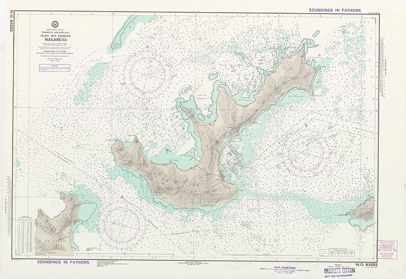
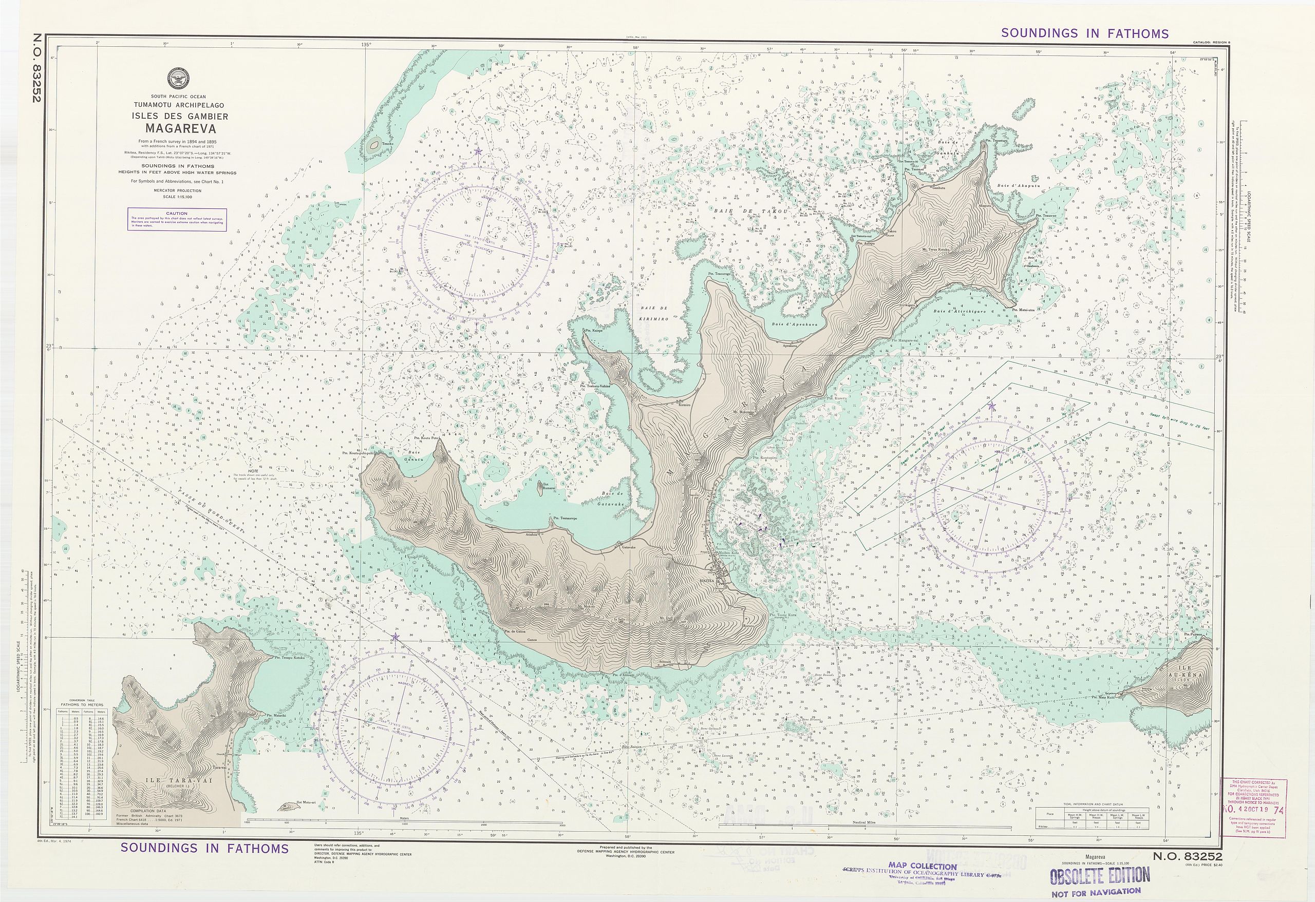
English: nautical chart of Mangareva, Gambier Islands, French Polynesia, South Pacific Ocean |
| Date | |
| Source |
http://library.ucsd.edu/dc/object/bb0035313c/zoom/0 https://tools.wmflabs.org/zoomable-images/zoomify.php?path=http://library.ucsd.edu/zoomify/bb/00/bb0035313c/&zoom=6 |
| Author | Defense Mapping Agency, Hydrographic Center (Washington D.C., U.S.A.) |
Licensing[edit]
| This work is from the Library of Congress. According to the library, there are no known copyright restrictions on the use of this work. |  |
File history
Click on a date/time to view the file as it appeared at that time.
| Date/Time | Thumbnail | Dimensions | User | Comment | |
|---|---|---|---|---|---|
| current | 12:43, 10 October 2016 | | 8,766 × 6,016 (8.65 MB) | Ratzer (talk | contribs) | Cropped 6 % horizontally and 10 % vertically using CropTool with lossless mode. |
| 12:39, 10 October 2016 |  | 9,321 × 6,662 (9.03 MB) | Ratzer (talk | contribs) | Cropped 43 % horizontally and 19 % vertically using CropTool with lossless mode. | |
| 11:29, 10 October 2016 |  | 16,384 × 8,192 (10.91 MB) | Ratzer (talk | contribs) | User created page with UploadWizard |
You cannot overwrite this file.
File usage on Commons
There are no pages that use this file.
File usage on other wikis
The following other wikis use this file:
- Usage on de.wikipedia.org
- Usage on frr.wikipedia.org