File:MH370 flight path with English labels.png
Jump to navigation
Jump to search

Size of this preview: 730 × 600 pixels. Other resolutions: 292 × 240 pixels | 584 × 480 pixels | 935 × 768 pixels | 1,246 × 1,024 pixels | 1,934 × 1,589 pixels.
Original file (1,934 × 1,589 pixels, file size: 654 KB, MIME type: image/png)
Captions
Captions
Extreme flight patterns cannot be explained.
Summary[edit]
| Description |
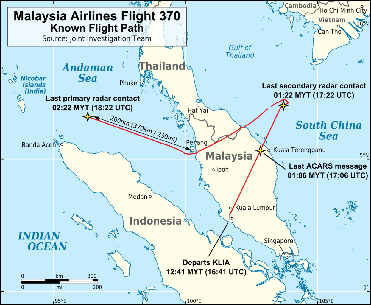
English: Map of the flight path of Malaysia Airlines Flight 370. |
|||
| Date | ||||
| Source |
Own work Flight path traced from a map ("Figure 2: MH370 flight path derived from primary and secondary radar data") on page 3 of the report MH 370 – Definition of Underwater Search Areas published by the Australian Transport Safety Bureau. The source map is in simple cylindrical projection (from Google Earth) and was gereferenced and distorted into a flat Mercator projection before being traced for this map. The data in the source image (ie. the flight path) that was traced to generate this map is the location of Flight 370. The position of an object is a fact; facts cannot be copyrighted. Background is the "Simplified World Polygons (LSIB) - March 2013" dataset available from the US Department of State - Office of the Geographer (public domain). Map boundaries: 93°E-107°E & 0.5°S-11°N. |
|||
| Author | AHeneen | |||
| Permission (Reusing this file) |
I, the copyright holder of this work, hereby publish it under the following license: This file is licensed under the Creative Commons Attribution 3.0 Unported license.
|
|||
| Other versions |
|


File history
Click on a date/time to view the file as it appeared at that time.
| Date/Time | Thumbnail | Dimensions | User | Comment | |
|---|---|---|---|---|---|
| current | 23:45, 12 December 2014 | | 1,934 × 1,589 (654 KB) | AHeneen (talk | contribs) | Larger font size for the four event labels & change size of scale |
| 23:16, 12 December 2014 |  | 1,934 × 1,589 (643 KB) | AHeneen (talk | contribs) | User created page with UploadWizard |
You cannot overwrite this file.
File usage on Commons
The following 7 pages use this file:
- Malaysia Airlines Flight 370
- Commons:Graphic Lab/Map workshop/Archive/2015
- Commons:WikiProject Aviation/recent uploads/2014 December 12
- File:MH370 flight path blank.png
- File:MH370 flight path with labels.svg
- File:MH370 flight path with numbers.svg
- File:Malaysia Airlines Flight 370 Known Flight Path de.svg
File usage on other wikis
The following other wikis use this file:
- Usage on el.wikipedia.org
- Usage on en.wikipedia.org
- Usage on hak.wikipedia.org
- Usage on hy.wikipedia.org
- Usage on it.wikipedia.org
- Usage on ja.wikipedia.org
- Usage on lt.wikipedia.org
- Usage on nn.wikipedia.org
- Usage on pl.wikipedia.org
- Usage on ru.wikipedia.org
- Usage on tr.wikipedia.org