File:Münchner Schotterebene.png
Jump to navigation
Jump to search
Size of this preview: 736 × 600 pixels. Other resolutions: 295 × 240 pixels | 589 × 480 pixels | 942 × 768 pixels | 1,256 × 1,024 pixels | 1,877 × 1,530 pixels.
Original file (1,877 × 1,530 pixels, file size: 825 KB, MIME type: image/png)
Captions
Captions
Add a one-line explanation of what this file represents
Summary
[edit]
| Description |
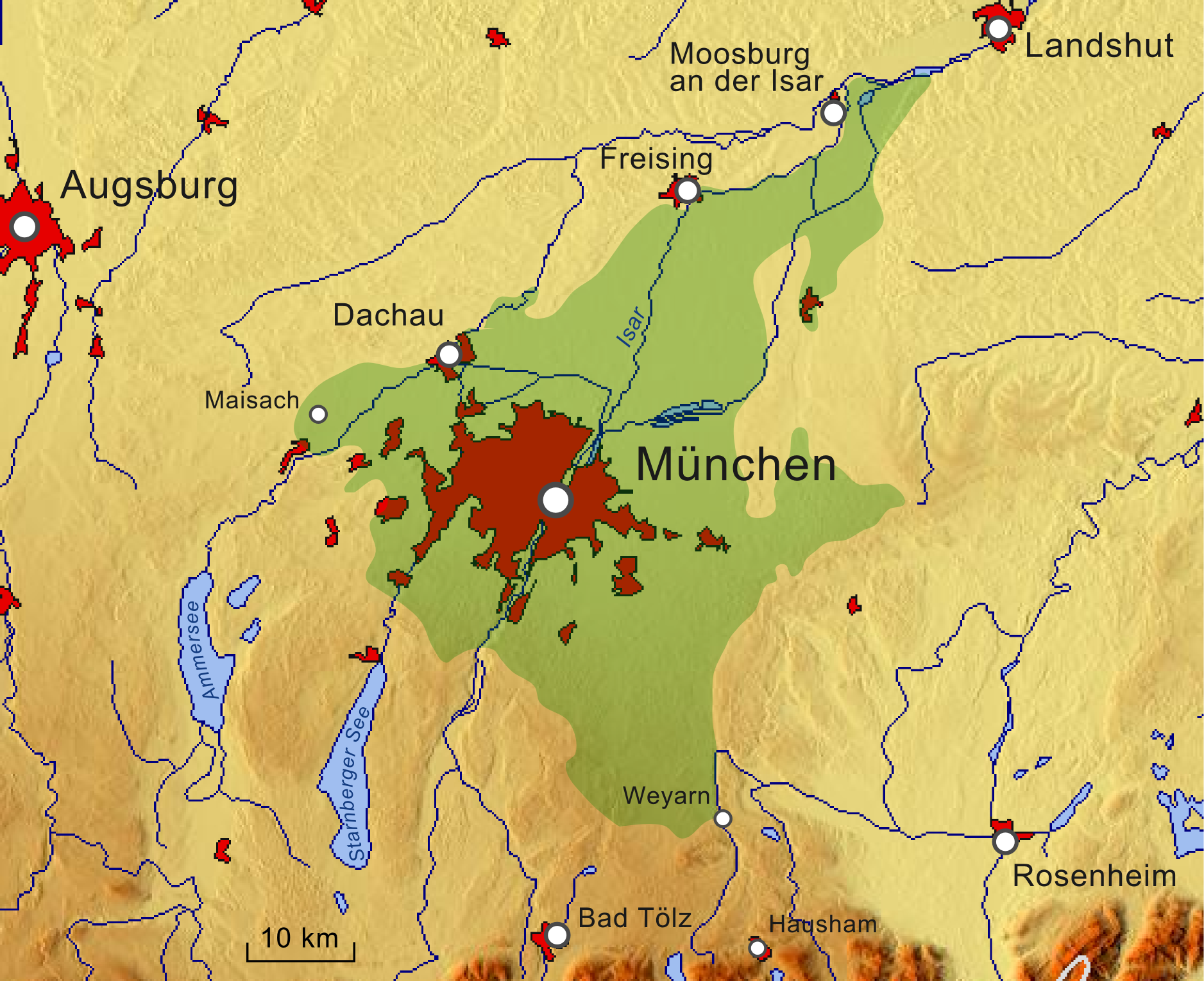
Deutsch: Münchner Schotterebene in Grün auf einer Reliefkarte. |
| Date | |
| Source |
|
| Creator |
|
| Georeferencing | If inappropriate please set warp_status = skip to hide. |
| This work is licensed under the Open Database License (summary). |

|
Permission is granted to copy, distribute and/or modify this document under the terms of the GNU Free Documentation License, Version 1.2 or any later version published by the Free Software Foundation; with no Invariant Sections, no Front-Cover Texts, and no Back-Cover Texts. A copy of the license is included in the section entitled GNU Free Documentation License. |
File history
Click on a date/time to view the file as it appeared at that time.
| Date/Time | Thumbnail | Dimensions | User | Comment | |
|---|---|---|---|---|---|
| current | 20:51, 21 October 2018 | | 1,877 × 1,530 (825 KB) | Pechristener (talk | contribs) | eine farbigere Version mit mehr Relief |
| 20:34, 21 October 2018 |  | 1,877 × 1,530 (934 KB) | Pechristener (talk | contribs) | {{Map |description={{de|{{w|Münchner Schotterebene||de}} in Grün auf einer Reliefkarte.}} |date=2018-10-21 |source= * Background: [http://www.maps-for-free.com maps-for-free.com] |author= * Background: [http://www.maps-for-free.com maps-for-free.com] * Rendering: {{u|Pechristener}} |permission= |other versions= }} {{ODbL}} {{GFDL}} Category:Maps-for-free images Category:Munich gravel plain Category:Files by User:Pechristener/Karten |
You cannot overwrite this file.
File usage on Commons
There are no pages that use this file.
File usage on other wikis
The following other wikis use this file:
- Usage on de.wikipedia.org
- Usage on en.wikipedia.org
- Usage on vi.wikipedia.org