File:Leicestershire-lockdown-boundary-map.jpg
Jump to navigation
Jump to search
Size of this preview: 610 × 600 pixels. Other resolutions: 244 × 240 pixels | 488 × 480 pixels | 781 × 768 pixels | 1,106 × 1,087 pixels.
Original file (1,106 × 1,087 pixels, file size: 1.18 MB, MIME type: image/jpeg)
Captions
Captions
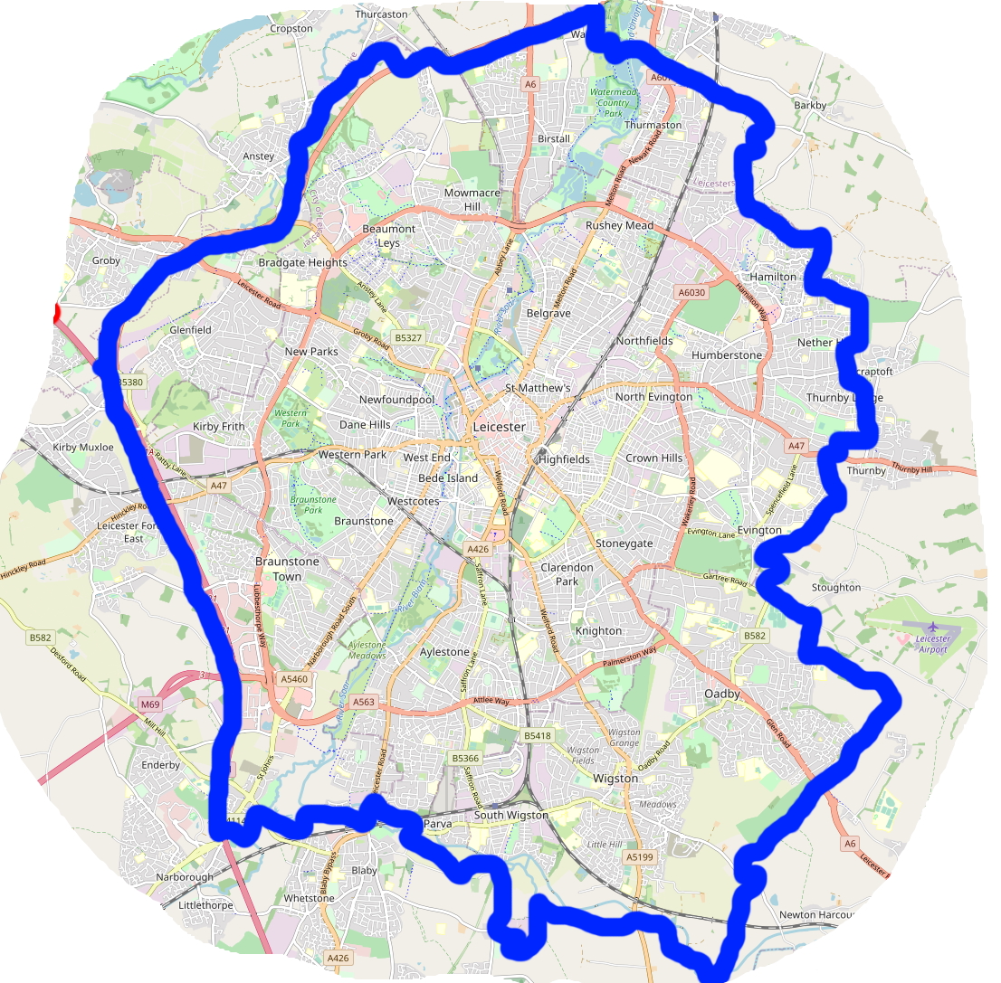
Area of Leicester subject to the COVID-19 lockdown measures of 30th June 2020
Summary[edit]
| Description |
English: Leicester was made subject to the UK's first 'local lockdown' on 30th June 2020. I made this map courtesy of OpenStreetMap, superimposing publicly available UK government data[1]. It shows the boundary of the local lockdown measures as at that date. |
| Date | |
| Source | Own work |
| Author | Crep171166 |
Licensing[edit]
| This work contains information from OpenStreetMap, which is made available under the Open Database License (ODbL).
The ODbL does not require any particular license for maps produced from ODbL data. Prior to 1 August 2020, map tiles produced by the OpenStreetMap Foundation were licensed under the CC-BY-SA-2.0 license. Maps produced by other people may be subject to other licences. |
I, the copyright holder of this work, hereby publish it under the following license:
This file is licensed under the Creative Commons Attribution-Share Alike 4.0 International license.
- You are free:
- to share – to copy, distribute and transmit the work
- to remix – to adapt the work
- Under the following conditions:
- attribution – You must give appropriate credit, provide a link to the license, and indicate if changes were made. You may do so in any reasonable manner, but not in any way that suggests the licensor endorses you or your use.
- share alike – If you remix, transform, or build upon the material, you must distribute your contributions under the same or compatible license as the original.
- ↑ Department of Health and Social Care (30 June 2020). Leicestershire coronavirus lockdown: areas and changes. Gov.uk Coronavirus (COVID-19) Guidance and support. Retrieved on 1 July 2020.
File history
Click on a date/time to view the file as it appeared at that time.
| Date/Time | Thumbnail | Dimensions | User | Comment | |
|---|---|---|---|---|---|
| current | 18:33, 1 July 2020 | | 1,106 × 1,087 (1.18 MB) | FotoFree (talk | contribs) | Uploaded own work with UploadWizard |
You cannot overwrite this file.
File usage on Commons
There are no pages that use this file.
File usage on other wikis
The following other wikis use this file: