File:Karte des Isartals zwischen Landau und Landshut.pdf
Jump to navigation
Jump to search

Size of this JPG preview of this PDF file: 800 × 207 pixels. Other resolutions: 320 × 83 pixels | 640 × 166 pixels | 1,024 × 265 pixels | 1,280 × 331 pixels | 2,560 × 663 pixels | 20,793 × 5,385 pixels.
Original file (20,793 × 5,385 pixels, file size: 117.84 MB, MIME type: application/pdf)
Captions
Captions
Add a one-line explanation of what this file represents
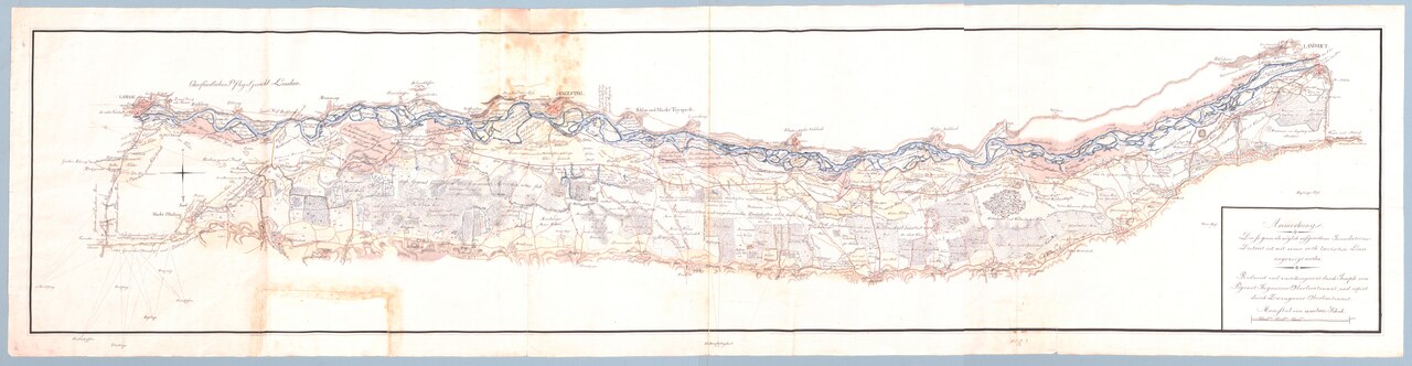
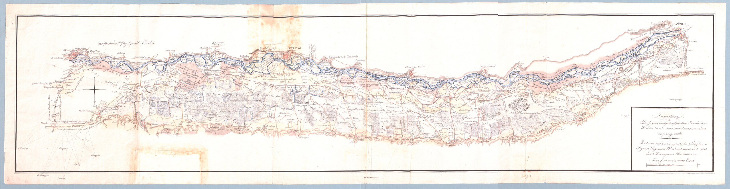
Summary[edit]
| Author |
Joseph von Pigenot |
| Description |
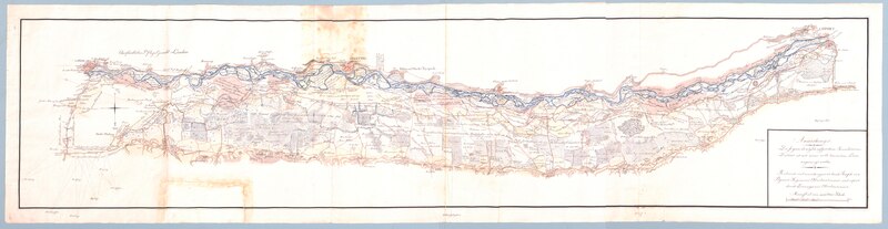
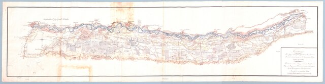
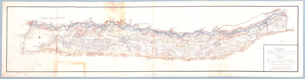
Deutsch: Gesüdete Karte des Isartals zwischen Landau und Landshut. Original des Stadtarchiv Dingolfing o.Sig., als Leihgabe im Heimatmuseum Dingolfing (Stand 07. März 2024). Der oft auf der Karte eingezeichnete Einfang bedeutet eingezäunte Nutzfläche, die von der Freiweide ausgenommen ist.[1] |
| Date | ca. 1800 |
| Inscriptions |
Kartenunterschrift: Anmerkung |
| Source/Photographer | Stadtarchiv Dingolfing |
| Other versions |
  from Landshut to Dingolfing only |
Licensing[edit]
|
This work is in the public domain in its country of origin and other countries and areas where the copyright term is the author's life plus 100 years or fewer. | |
| This file has been identified as being free of known restrictions under copyright law, including all related and neighboring rights. | |
File history
Click on a date/time to view the file as it appeared at that time.
| Date/Time | Thumbnail | Dimensions | User | Comment | |
|---|---|---|---|---|---|
| current | 13:16, 7 March 2024 | 20,793 × 5,385 (117.84 MB) | Ratzer (talk | contribs) | Uploaded a work by Joseph von Pigenot from Stadtarchiv Dingolfing (offline) with UploadWizard |
You cannot overwrite this file.
File usage on Commons
The following 4 pages use this file:
File usage on other wikis
The following other wikis use this file:
- Usage on de.wikipedia.org