File:Karte Dachsteingebirge.png
Jump to navigation
Jump to search
Size of this preview: 800 × 443 pixels. Other resolutions: 320 × 177 pixels | 640 × 355 pixels | 1,024 × 568 pixels | 1,280 × 709 pixels | 2,560 × 1,419 pixels | 3,744 × 2,075 pixels.
Original file (3,744 × 2,075 pixels, file size: 1.64 MB, MIME type: image/png)
Captions
Captions
Add a one-line explanation of what this file represents
Summary[edit]
| Description |
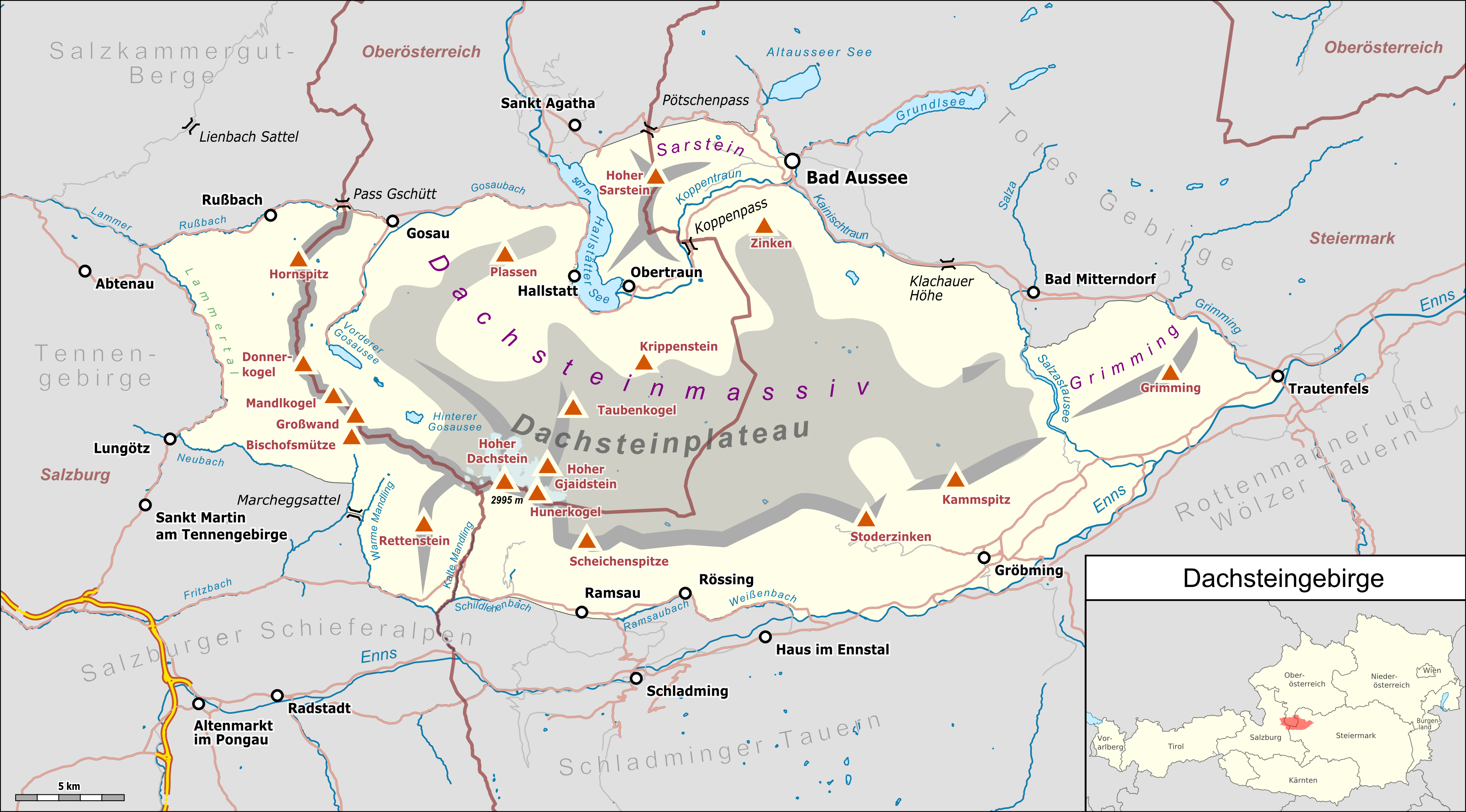
Deutsch: Übersichtskarte des Dachsteingebirges. |
|||||||||
| Date | ||||||||||
| Source |
Own work Map was created using:
|
|||||||||
| Creator |
|
|||||||||
| Permission (Reusing this file) |
Map data (c) OpenStreetMap (and) contributors, CC-BY-SA | |||||||||
| Geotemporal data | ||||||||||
| Bounding box |
|
|||||||||
| Georeferencing | ||||||||||
| This work is licensed under the Open Database License (summary). |
File history
Click on a date/time to view the file as it appeared at that time.
| Date/Time | Thumbnail | Dimensions | User | Comment | |
|---|---|---|---|---|---|
| current | 10:03, 23 February 2019 | | 3,744 × 2,075 (1.64 MB) | Pechristener (talk | contribs) | kleine Korrekturen |
| 10:13, 26 January 2019 |  | 3,744 × 2,075 (1.63 MB) | Pechristener (talk | contribs) | some peaks added | |
| 21:48, 22 January 2019 |  | 3,744 × 2,075 (1.62 MB) | Pechristener (talk | contribs) | == {{int:filedesc}} == {{Map |Description={{de|1=Übersichtskarte des {{w|Dachsteingebirge|Dachsteingebirges|de}}. }} |Source ={{own}} Map was created using: *[http://www.openstreetmap.org/ Open Street Map] Data *{{f|Austria, administrative divisions - de-.svg}} for location map |Author = *Hauptkarte: Pechristener *{{f|Austria, administrative divisions - de-.svg}} : TUBS |Date =2019-01-22 |Permission =Map data (c) OpenStree... |
You cannot overwrite this file.
File usage on Commons
The following 7 pages use this file:
File usage on other wikis
The following other wikis use this file:
- Usage on arz.wikipedia.org
- Usage on de.wikipedia.org
- Usage on eo.wikipedia.org
- Usage on hu.wikipedia.org
- Usage on it.wikipedia.org
- Usage on nl.wikipedia.org
- Usage on pl.wikipedia.org
- Usage on www.wikidata.org