File:Gorj Province, Romania - PIA23677.tiff
Jump to navigation
Jump to search

Size of this JPG preview of this TIF file: 800 × 519 pixels. Other resolutions: 320 × 207 pixels | 640 × 415 pixels | 1,024 × 664 pixels | 1,280 × 830 pixels | 2,560 × 1,660 pixels | 3,318 × 2,151 pixels.
Original file (3,318 × 2,151 pixels, file size: 20.43 MB, MIME type: image/tiff)
Captions
Captions
Add a one-line explanation of what this file represents
Summary[edit]
| Description |
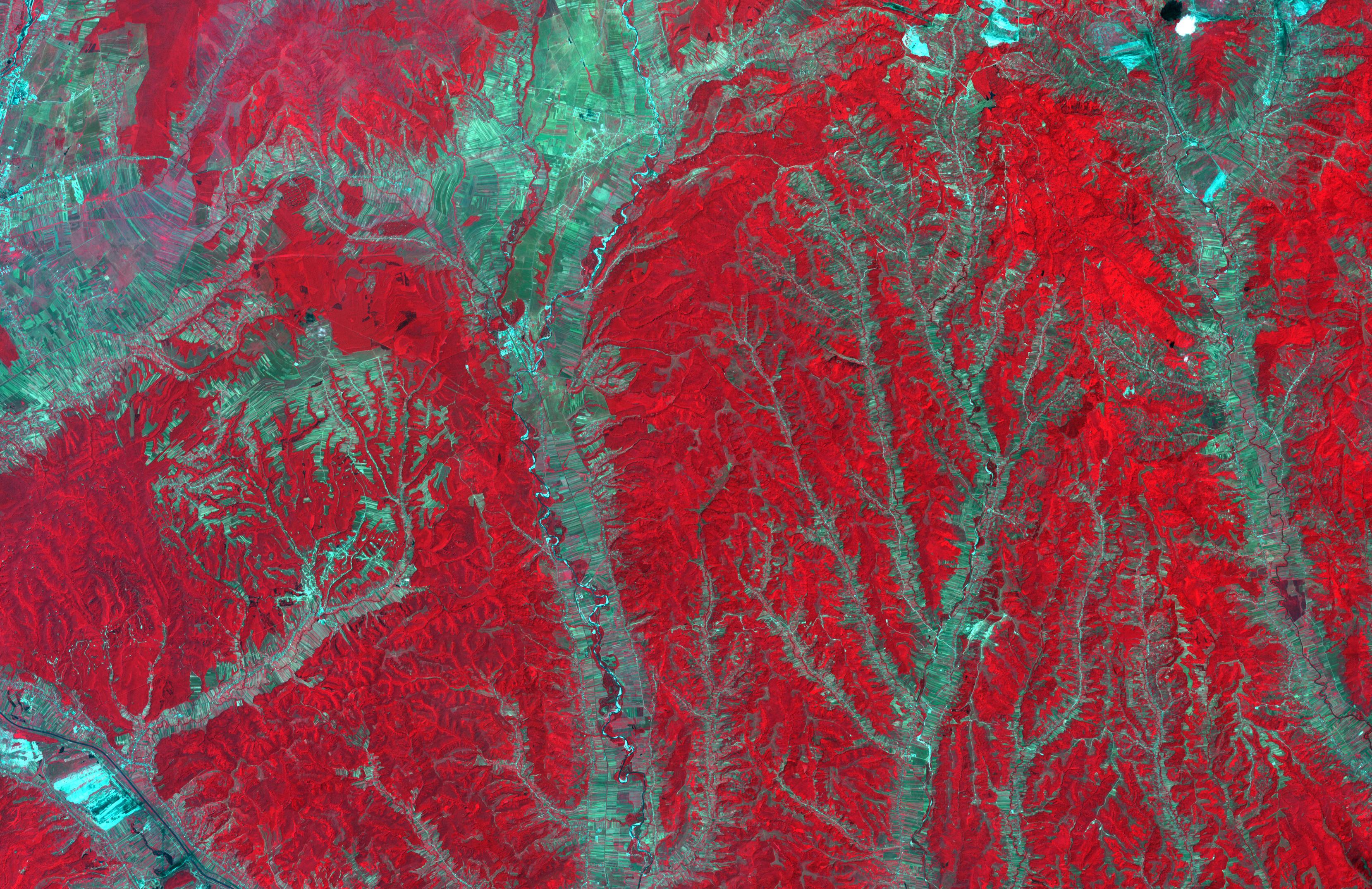
In southwest Romania, the rivers draining the Transylvanian Alps have incised the rough topography of the foothills. Only the river channels can be utilized for agriculture; the inter-stream land is rugged and forested. Agricultural fields are extremely long and narrow, oriented perpendicular to the streams and rivers. The image was acquired July 4, 2008, covers an area of 36.9 by 51.8 kilometers, and is located at 44.8 degrees north, 23.6 degrees east. With its 14 spectral bands from the visible to the thermal infrared wavelength region and its high spatial resolution of about 50 to 300 feet (15 to 90 meters), ASTER images Earth to map and monitor the changing surface of our planet. ASTER is one of five Earth-observing instruments launched Dec. 18, 1999, on Terra. The instrument was built by Japan's Ministry of Economy, Trade and Industry. A joint U.S./Japan science team is responsible for validation and calibration of the instrument and data products. |
| Date | (published 2020-2-3) |
| Source | Catalog page · Full-res (JPEG · TIFF) |
| Author | NASA/METI/AIST/Japan Space Systems, and U.S./Japan ASTER Science Team |
| Camera location | | View this and other nearby images on: OpenStreetMap |
|---|
This image or video was catalogued by Jet Propulsion Laboratory of the United States National Aeronautics and Space Administration (NASA) under Photo ID: PIA23677. This tag does not indicate the copyright status of the attached work. A normal copyright tag is still required. See Commons:Licensing. Other languages:
|
| This media is a product of the Terra mission Credit and attribution belongs to the Advanced Spaceborne Thermal Emission and Reflection Radiometer (ASTER) team, NASA/METI/AIST/Japan Space Systems |
Licensing[edit]
| This file is in the public domain in the United States because it was solely created by NASA. NASA copyright policy states that "NASA material is not protected by copyright unless noted". (See Template:PD-USGov, NASA copyright policy page or JPL Image Use Policy.) | ||
 |
Warnings:
|
File history
Click on a date/time to view the file as it appeared at that time.
| Date/Time | Thumbnail | Dimensions | User | Comment | |
|---|---|---|---|---|---|
| current | 08:40, 29 February 2020 |  | 3,318 × 2,151 (20.43 MB) | Junior Jumper (talk | contribs) | {{NASA Photojournal |catalog=PIA23677 |image=yes |caption=In southwest Romania, the rivers draining the Transylvanian Alps have incised the rough topography of the foothills. Only the river channels can be utilized for agriculture; the inter-stream land is rugged and forested. Agricultural fields are extremely long and narrow, oriented perpendicular to the streams and rivers. The image was acquired July 4, 2008, covers an area of 36.9 by 51.8 kilometers, and is located at 44.8 degrees north,... |
You cannot overwrite this file.
File usage on Commons
The following page uses this file: