File:Epirus across Greece and Albania el.svg
Jump to navigation
Jump to search

Size of this PNG preview of this SVG file: 424 × 600 pixels. Other resolutions: 170 × 240 pixels | 339 × 480 pixels | 543 × 768 pixels | 724 × 1,024 pixels | 1,448 × 2,048 pixels | 744 × 1,052 pixels.
Original file (SVG file, nominally 744 × 1,052 pixels, file size: 159 KB)
Captions
Captions
Add a one-line explanation of what this file represents
| Description |
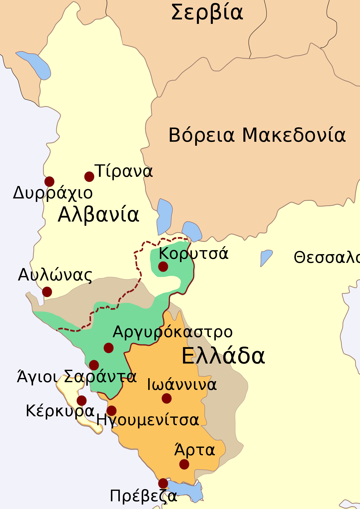
English: Draft map of the region of Epirus, stretching across modern Greece and Albania.
Legend
Ελληνικά: Η Ήπειρος μεταξύ Ελλάδας και Αλβανίας
Υπόμνημα
|
| Date | |
| Source | |
| Author | Future Perfect at Sunrise, modified by: Alexikoua |
| Permission (Reusing this file) |
CC-BY-SA-3.0; Released under the GNU Free Documentation License |
Licensing[edit]
I, the copyright holder of this work, hereby publish it under the following licenses:
This file is licensed under the Creative Commons Attribution-Share Alike 3.0 Unported license.
- You are free:
- to share – to copy, distribute and transmit the work
- to remix – to adapt the work
- Under the following conditions:
- attribution – You must give appropriate credit, provide a link to the license, and indicate if changes were made. You may do so in any reasonable manner, but not in any way that suggests the licensor endorses you or your use.
- share alike – If you remix, transform, or build upon the material, you must distribute your contributions under the same or compatible license as the original.

|
Permission is granted to copy, distribute and/or modify this document under the terms of the GNU Free Documentation License, Version 1.2 or any later version published by the Free Software Foundation; with no Invariant Sections, no Front-Cover Texts, and no Back-Cover Texts. A copy of the license is included in the section entitled GNU Free Documentation License. |
You may select the license of your choice.
Original upload log[edit]
Transferred from el.wikipedia to Commons by MARKELLOS using CommonsHelper.
The original description page was here. All following user names refer to el.wikipedia.
- 2009-05-06 21:01 Alexikoua 744×1052× (162164 bytes) {{Πληροφορίες εικόνας {{Πληροφορίες εικόνας |Περιγραφή=Η Ήπειρος μεταξύ Ελλάδας και Αλβανίας |Πηγή=http://en.wikipedia.org/wiki/File:Epirus_across_Greece_and_Albania.svg, χ�
- 2009-03-27 17:56 Alexikoua 330×420× (488407 bytes) {{Πληροφορίες εικόνας |Περιγραφή=Η Ήπειρος μεταξύ Ελλάδας και Αλβανίας |Πηγή=http://en.wikipedia.org/wiki/File:Epirus_across_Greece_and_Albania.svg, χρήστη en:Future Perfect at Sunrise |
- 2009-03-27 17:51 Alexikoua 330×420× (488260 bytes) {{Πληροφορίες εικόνας |Περιγραφή=Η Ήπειρος μεταξύ Ελλάδας και Αλβανίας |Πηγή=http://en.wikipedia.org/wiki/File:Epirus_across_Greece_and_Albania.svg, χρήστη en:Future Perfect at Sunrise |
File history
Click on a date/time to view the file as it appeared at that time.
| Date/Time | Thumbnail | Dimensions | User | Comment | |
|---|---|---|---|---|---|
| current | 13:59, 6 September 2020 | | 744 × 1,052 (159 KB) | Εὐθυμένης (talk | contribs) | state name update |
| 15:33, 11 April 2010 |  | 744 × 1,052 (158 KB) | File Upload Bot (Magnus Manske) (talk | contribs) | {{BotMoveToCommons|el.wikipedia|year={{subst:CURRENTYEAR}}|month={{subst:CURRENTMONTHNAME}}|day={{subst:CURRENTDAY}}}} {{Information |Description={{el|Η Ήπειρος μεταξύ Ελλάδας και Αλβανίας<br/> == Άδεια χρήσης = |
You cannot overwrite this file.
File usage on Commons
The following page uses this file:
File usage on other wikis
The following other wikis use this file: