File:Dschanub Kurdufan district map overview.svg
Jump to navigation
Jump to search

Size of this PNG preview of this SVG file: 424 × 600 pixels. Other resolutions: 170 × 240 pixels | 339 × 480 pixels | 543 × 768 pixels | 724 × 1,024 pixels | 1,448 × 2,048 pixels | 744 × 1,052 pixels.
Original file (SVG file, nominally 744 × 1,052 pixels, file size: 72 KB)
Captions
Captions
Add a one-line explanation of what this file represents
| Description |
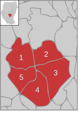
English: Locator map of smaller pre-2005 North Kurdufan state, in the Kurdufan region — in pre-2011 Sudan.
|
||
| Date | |||
| Source | own work, based on Image:Sudan district map.svg | ||
| Author | de:user:Sven-steffen arndt | ||
| Permission (Reusing this file) |
|
File history
Click on a date/time to view the file as it appeared at that time.
| Date/Time | Thumbnail | Dimensions | User | Comment | |
|---|---|---|---|---|---|
| current | 02:04, 18 September 2013 | | 744 × 1,052 (72 KB) | Spesh531 (talk | contribs) | Reverted to version as of 23:38, 27 December 2006 west kurdufan is back |
| 00:19, 18 January 2011 |  | 744 × 1,052 (100 KB) | Lasunncty (talk | contribs) | update | |
| 23:38, 27 December 2006 |  | 744 × 1,052 (72 KB) | Sven-steffen arndt (talk | contribs) | {{Information |Description=Map of Kordofan state in Sudan with district overview |Source=own work, based on Image:Sudan district map.svg |Date=27. December 2006 |Author=de:user:Sven-steffen arndt |Permission={{PD-self}} |other_versions= }} [[Ca |
You cannot overwrite this file.
File usage on Commons
The following page uses this file:
File usage on other wikis
The following other wikis use this file:
- Usage on ar.wikipedia.org
- Usage on bn.wikipedia.org
- Usage on ca.wikipedia.org
- Usage on de.wikipedia.org
- Usage on en.wikipedia.org
- Usage on eo.wikipedia.org
- Usage on fa.wikipedia.org
- Usage on hy.wikipedia.org
- Usage on it.wikipedia.org
- Usage on pt.wikipedia.org
- Usage on ro.wikipedia.org
- Usage on ru.wikipedia.org
- Usage on sv.wikipedia.org
- Usage on uk.wikipedia.org
- Usage on zu.wikipedia.org