File:Die Deutschen und Britischen Schutzgebiete und Interessenspharen in Aequatorial-Ost-Afrika - nach den Vereinbarungen vom Juni 1890 LOC 2011594799.tif
Jump to navigation
Jump to search

Size of this JPG preview of this TIF file: 737 × 599 pixels. Other resolutions: 295 × 240 pixels | 590 × 480 pixels | 944 × 768 pixels | 1,259 × 1,024 pixels | 2,518 × 2,048 pixels | 12,338 × 10,036 pixels.
Original file (12,338 × 10,036 pixels, file size: 354.26 MB, MIME type: image/tiff)
Captions
Captions
Add a one-line explanation of what this file represents
Summary
[edit]| Warning | The original file is very high-resolution. It might not load properly or could cause your browser to freeze when opened at full size. |
|---|
| Description |
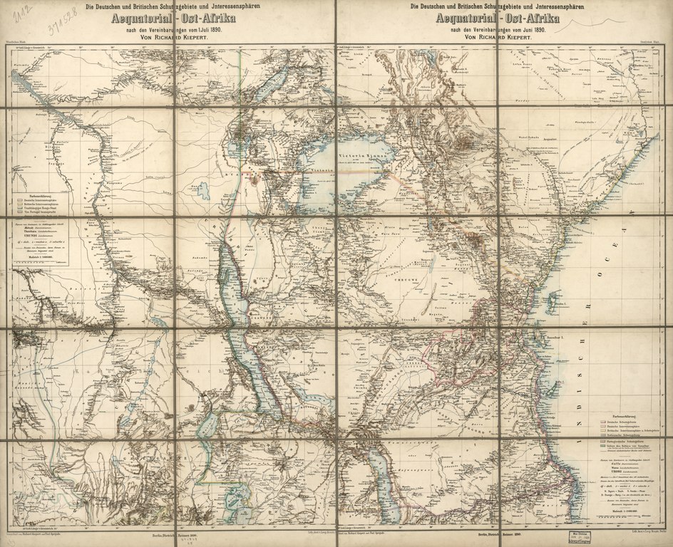
English: Covers Tanzania, Ruanda, and Burundi and portions of Somalia, Kenya, Uganda, Democratic Republic of the Congo, Zambia, and Malawi. Relief shown by shading and spot heights. In upper left margin: Westliches Blatt. In upper right margin: Oestliches Blatt. Title printed in the top margin of the western sheet and the eastern sheet. Available also through the Library of Congress Web site as a raster image. Sectioned into 20 pieces, mounted on cloth. On label mounted on verso: Hermann Peters, Verlags-, Sortiments-, und Landkarten-Handlung ... |
||
| Title | Die Deutschen und Britischen Schutzgebiete und Interessenspharen in Aequatorial-Ost-Afrika : nach den Vereinbarungen vom Juni 1890 | ||
| Shelf ID | G8440 1890 .K5 | ||
| Date | |||
| Source | https://www.loc.gov/item/2011594799/ | ||
| Author | Kiepert, Richard; Sprigade, Paul; Kraatz, Leopold; Dietrich Reimer Verlag (Berlin, Germany) | ||
| Permission (Reusing this file) |
|
||
| Other versions |
|
||
| Location | Tanzania · Africa · Rwanda · Germany · Burundi · German East Africa | ||
| Part of | American Memory · General Maps · Catalog · Geography And Map Division | ||
| Subject | Tanzania · Africa · Maps · Rwanda · Germany · Burundi · Colonies · German East Africa |


Licensing
[edit]|
This is a faithful photographic reproduction of a two-dimensional, public domain work of art. The work of art itself is in the public domain for the following reason:
The official position taken by the Wikimedia Foundation is that "faithful reproductions of two-dimensional public domain works of art are public domain".
This photographic reproduction is therefore also considered to be in the public domain in the United States. In other jurisdictions, re-use of this content may be restricted; see Reuse of PD-Art photographs for details. | ||||
File history
Click on a date/time to view the file as it appeared at that time.
| Date/Time | Thumbnail | Dimensions | User | Comment | |
|---|---|---|---|---|---|
| current | 00:04, 18 June 2018 |  | 12,338 × 10,036 (354.26 MB) | Fæ (talk | contribs) | LOC Maps https://www.loc.gov/item/2011594799/ #19193 |
You cannot overwrite this file.
File usage on Commons
The following page uses this file: