File:Diamond Notch Falls, Spruceton, NY.jpg
Jump to navigation
Jump to search

Size of this preview: 800 × 587 pixels. Other resolutions: 320 × 235 pixels | 640 × 470 pixels | 1,024 × 751 pixels | 1,280 × 939 pixels | 2,560 × 1,878 pixels | 5,496 × 4,032 pixels.
Original file (5,496 × 4,032 pixels, file size: 22.32 MB, MIME type: image/jpeg)
Captions
Captions
Add a one-line explanation of what this file represents
| Description |
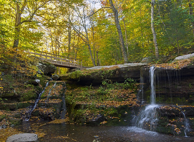
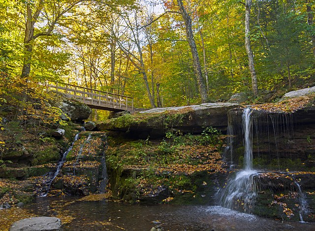
English: Diamond Notch Falls, along the West Kill in the West Kill Wilderness Area of New York's Catskill Park, in autumn. Since there had been a drought during the preceding months, the falls are not as dramatic as they could be. The bridge carries the Diamond Notch Trail and the Devil's Path, a rare trail duplex in the Catskills, one that ends just off the bridge as the latter trail (one of whose plastic markers is visible on a tree) forks off to climb West Kill Mountain while the Diamond Notch Trail continues to that feature. |
||
| Date | Taken on 10 October 2016 | ||
| Source | Own work | ||
| Author | Daniel Case | ||
| Permission (Reusing this file) |
I, the copyright holder of this work, hereby publish it under the following licenses:
This file is licensed under the Creative Commons Attribution-Share Alike 3.0 Unported license.
You may select the license of your choice. |

| Camera location | | View this and other nearby images on: OpenStreetMap |
|---|
The geographical information in this file was retrospectively estimated.
The location may therefore be somewhat imprecise. Verifying and refining these coordinates is strongly encouraged. |
File history
Click on a date/time to view the file as it appeared at that time.
| Date/Time | Thumbnail | Dimensions | User | Comment | |
|---|---|---|---|---|---|
| current | 01:34, 4 January 2018 | | 5,496 × 4,032 (22.32 MB) | Daniel Case (talk | contribs) | {{Information |Description ={{en|1={{w|Diamond Notch Falls}}, along the {{w|West Kill}} in the {{w|West Kill Wilderness Area}} of New York's {{w|Catskill Park}}, in autumn. Since there had been a drought during the preceding months, the falls are no... |
You cannot overwrite this file.
File usage on Commons
There are no pages that use this file.
File usage on other wikis
The following other wikis use this file:
- Usage on en.wikipedia.org