File:Crooked Creek landscape, Ivvavik National Park, YT.jpg
Original file (5,460 × 3,240 pixels, file size: 18.3 MB, MIME type: image/jpeg)
Captions
DescriptionCrooked Creek landscape, Ivvavik National Park, YT.jpg |
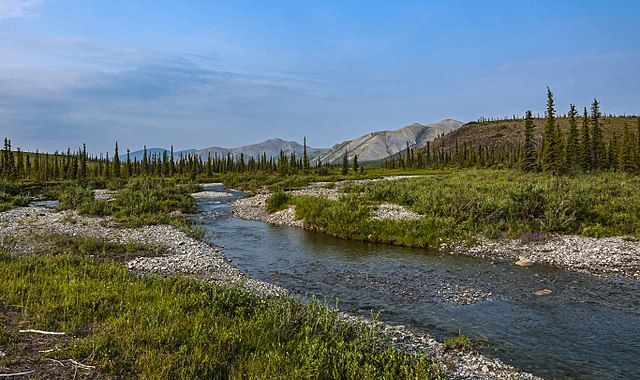
English: Crooked Creek, just above where it flows into the Firth River in Canada's Ivvavik National Park |
||
Date | |||
Source | Own work | ||
Author | Daniel Case | ||
Permission (Reusing this file) |
I, the copyright holder of this work, hereby publish it under the following licenses:
This file is licensed under the Creative Commons Attribution-Share Alike 2.0 Generic license.
You may select the license of your choice. |
Camera location | 68° 54′ 11.63″ N, 140° 23′ 50.57″ W | View this and other nearby images on: OpenStreetMap | 68.903230; -140.397380 |
---|
The geographical information in this file was retrospectively estimated.
The location may therefore be somewhat imprecise. Verifying and refining these coordinates is strongly encouraged. |
This image has been assessed using the Quality image guidelines and is considered a Quality image.
العربية ∙ جازايرية ∙ беларуская ∙ беларуская (тарашкевіца) ∙ български ∙ বাংলা ∙ català ∙ čeština ∙ Cymraeg ∙ Deutsch ∙ Schweizer Hochdeutsch ∙ Zazaki ∙ Ελληνικά ∙ English ∙ Esperanto ∙ español ∙ eesti ∙ euskara ∙ فارسی ∙ suomi ∙ français ∙ galego ∙ עברית ∙ हिन्दी ∙ hrvatski ∙ magyar ∙ հայերեն ∙ Bahasa Indonesia ∙ italiano ∙ 日本語 ∙ Jawa ∙ ქართული ∙ 한국어 ∙ kurdî ∙ Lëtzebuergesch ∙ lietuvių ∙ македонски ∙ മലയാളം ∙ मराठी ∙ Bahasa Melayu ∙ Nederlands ∙ Norfuk / Pitkern ∙ polski ∙ português ∙ português do Brasil ∙ rumantsch ∙ română ∙ русский ∙ sicilianu ∙ slovenčina ∙ slovenščina ∙ shqip ∙ српски / srpski ∙ svenska ∙ தமிழ் ∙ తెలుగు ∙ ไทย ∙ Tagalog ∙ Türkçe ∙ toki pona ∙ українська ∙ vèneto ∙ Tiếng Việt ∙ 中文 ∙ 中文(简体) ∙ 中文(繁體) ∙ +/− |
Annotations InfoField | This image is annotated: View the annotations at Commons |
Artefacts
File history
Click on a date/time to view the file as it appeared at that time.
Date/Time | Thumbnail | Dimensions | User | Comment | |
---|---|---|---|---|---|
current | 17:27, 2 July 2017 | 5,460 × 3,240 (18.3 MB) | Daniel Case (talk | contribs) | Went back to two versions ago and then resharpened a different way. | |
07:13, 2 July 2017 | 5,460 × 3,240 (17.62 MB) | Daniel Case (talk | contribs) | sharpened some more | ||
06:26, 2 July 2017 | 5,460 × 3,240 (14.55 MB) | Daniel Case (talk | contribs) | get rid of some more dust spots per FPC | ||
00:44, 21 December 2016 | 5,460 × 3,240 (14.55 MB) | Daniel Case (talk | contribs) | Clean up dust | ||
02:33, 2 September 2016 | 5,460 × 3,240 (14.49 MB) | Daniel Case (talk | contribs) | {{Information |Description ={{en|1=Crooked Creek, just above where it flows into the Firth River in Canada's Ivvavik National Park}} |Source ={{own}} |Author =[[User:Daniel Case|Daniel Ca... |
You cannot overwrite this file.
File usage on Commons
The following 6 pages use this file:
- Canadian tundra
- User talk:Daniel Case
- Commons:Featured picture candidates/File:Crooked Creek landscape, Ivvavik National Park, YT.jpg
- Commons:Featured picture candidates/Log/July 2017
- Commons:Quality images/Subject/Places/Mixed/Panorama/Archive 2016
- Commons:Quality images candidates/Archives December 24 2016
File usage on other wikis
The following other wikis use this file:
- Usage on it.wikipedia.org
- Usage on pt.wikipedia.org
- Usage on sv.wikipedia.org
Metadata
This file contains additional information such as Exif metadata which may have been added by the digital camera, scanner, or software program used to create or digitize it. If the file has been modified from its original state, some details such as the timestamp may not fully reflect those of the original file. The timestamp is only as accurate as the clock in the camera, and it may be completely wrong.
Camera manufacturer | NIKON CORPORATION |
---|---|
Camera model | NIKON D3X |
Exposure time | 1/60 sec (0.016666666666667) |
F-number | f/16 |
ISO speed rating | 100 |
Date and time of data generation | 11:01, 3 July 2015 |
Lens focal length | 28 mm |
Width | 5,460 px |
Height | 3,240 px |
Bits per component |
|
Pixel composition | RGB |
Orientation | Normal |
Number of components | 3 |
Horizontal resolution | 300 dpi |
Vertical resolution | 300 dpi |
Software used | Adobe Photoshop CC 2017 (Windows) |
File change date and time | 13:23, 2 July 2017 |
Exposure Program | Normal program |
Exif version | 2.21 |
Date and time of digitizing | 11:01, 3 July 2015 |
APEX shutter speed | 5.906891 |
APEX aperture | 8 |
APEX exposure bias | −0.5 |
Maximum land aperture | 3.6 APEX (f/3.48) |
Metering mode | Pattern |
Light source | Fine weather |
Flash | Flash did not fire |
DateTime subseconds | 24 |
DateTimeOriginal subseconds | 24 |
DateTimeDigitized subseconds | 24 |
Color space | Uncalibrated |
Sensing method | One-chip color area sensor |
File source | Digital still camera |
Scene type | A directly photographed image |
Custom image processing | Normal process |
Exposure mode | Auto exposure |
White balance | Manual white balance |
Digital zoom ratio | 1 |
Focal length in 35 mm film | 28 mm |
Scene capture type | Standard |
Scene control | None |
Contrast | Normal |
Saturation | Normal |
Sharpness | Normal |
Subject distance range | Unknown |
Serial number of camera | 5028808 |
Lens used | 28.0-300.0 mm f/3.5-5.6 |
Rating (out of 5) | 0 |
Date metadata was last modified | 09:23, 2 July 2017 |
Unique ID of original document | 86F61211B45CB74C64B1D88332F4D16E |
Structured data
Items portrayed in this file
depicts
3 July 2015
68°54'11.63"N, 140°23'50.57"W
image/jpeg
38b3528347b86ad96e3eea3063e7c180a99d8a4c
19,189,913 byte
3,240 pixel
5,460 pixel
- License migration not eligible
- GFDL
- CC-BY-SA-2.0
- Self-published work
- Files with coordinates missing SDC location of creation
- Media with estimated locations
- Quality images of Yukon
- Quality images of rivers in Canada
- Quality images
- Quality images missing SDC depicts
- Images with annotations
- Canada photographs taken on 2015-07-03
- Pages with maps